


<< Text Pages >> Eastlow Hill - Artificial Mound in England in Suffolk
Submitted by Andy B on Friday, 07 June 2024 Page Views: 677
Roman, Greek and ClassicalSite Name: Eastlow HillCountry: England
NOTE: This site is 3.6 km away from the location you searched for.
County: Suffolk Type: Artificial Mound
Nearest Village: Rushbrooke
Map Ref: TL89956175
Latitude: 52.221197N Longitude: 0.779408E
Condition:
| 5 | Perfect |
| 4 | Almost Perfect |
| 3 | Reasonable but with some damage |
| 2 | Ruined but still recognisable as an ancient site |
| 1 | Pretty much destroyed, possibly visible as crop marks |
| 0 | No data. |
| -1 | Completely destroyed |
| 5 | Superb |
| 4 | Good |
| 3 | Ordinary |
| 2 | Not Good |
| 1 | Awful |
| 0 | No data. |
| 5 | Can be driven to, probably with disabled access |
| 4 | Short walk on a footpath |
| 3 | Requiring a bit more of a walk |
| 2 | A long walk |
| 1 | In the middle of nowhere, a nightmare to find |
| 0 | No data. |
| 5 | co-ordinates taken by GPS or official recorded co-ordinates |
| 4 | co-ordinates scaled from a detailed map |
| 3 | co-ordinates scaled from a bad map |
| 2 | co-ordinates of the nearest village |
| 1 | co-ordinates of the nearest town |
| 0 | no data |
Be the first person to rate this site - see the 'Contribute!' box in the right hand menu.
Internal Links:
External Links:
I have visited· I would like to visit
Andy B has visited here
Eastlow Hill is a scheduled monument still existing just north-east of Rushbrooke. It was actually excavated as far back as 1844 and found to contain a Roman burial chamber, complete with skeleton in a lead coffin. It and three others (later destroyed, which held Roman cremations) formed a group known as the Four Hills, and are believed to be the graves of a family that lived in a known villa nearby.
So, not only was the purpose of both mounds known in Rudge's day, but so was their age, showing that they couldn't have been raised as part of any supposedly-prehistoric trackway. The fact that no puddingstones were known at either should have ruled them out in any case.
Source: www.hiddenea.com/Suffolk%20PTD.htm
You may be viewing yesterday's version of this page. To see the most up to date information please register for a free account.
Do not use the above information on other web sites or publications without permission of the contributor.
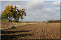
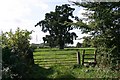
Nearby Images from Geograph Britain and Ireland:

©2009(licence)

©2022(licence)
©2009(licence)
©2006(licence)

©2024(licence)
The above images may not be of the site on this page, they are loaded from Geograph.
Please Submit an Image of this site or go out and take one for us!
Click here to see more info for this site
Nearby sites
Key: Red: member's photo, Blue: 3rd party photo, Yellow: other image, Green: no photo - please go there and take one, Grey: site destroyed
Download sites to:
KML (Google Earth)
GPX (GPS waypoints)
CSV (Garmin/Navman)
CSV (Excel)
To unlock full downloads you need to sign up as a Contributory Member. Otherwise downloads are limited to 50 sites.
Turn off the page maps and other distractions
Nearby sites listing. In the following links * = Image available
2.0km SSE 158° Hall Farm, Bradfeld St George Artificial Mound (TL908599)
3.9km NNW 340° Cattishall Tumulus Artificial Mound (TL88476541)
5.3km N 351° St. John's Well (Suffolk)* Holy Well or Sacred Spring (TL889669)
5.3km WNW 302° Moyse's Hall Museum Museum (TL8530264367)
5.3km NNW 329° Plum Pudding Covert Artificial Mound (TL870662)
6.5km NNW 329° Hall Farm Puddingstone Marker Stone (TL864672)
7.5km E 86° Woolpit Cross* Ancient Cross (TL974625)
7.7km E 85° Lady Well, Woolpit* Holy Well or Sacred Spring (TL9763362676)
8.0km NW 315° Fornham All Saints A Cursus Cursus (TL841672)
8.1km NNE 32° Pakenham Cursus Cursus (TL940688)
8.5km WSW 244° Baal Stone* Natural Stone / Erratic / Other Natural Feature (TL82375776)
8.6km NNW 333° Timworth Puddingstone* Marker Stone (TL8580969281)
8.6km NW 315° Fornham All Saints C Cursus Cursus (TL83636765)
9.0km NW 315° Fornham All Saints B Cursus Cursus (TL83346794)
10.0km NW 317° Fornham All Saints A Cursus Cursus (TL829688)
10.1km NNW 336° Ingham Puddingstone* Marker Stone (TL8556770828)
11.4km NNW 329° The Hill of Health* Round Barrow(s) (TL8365171319)
12.0km NW 313° Flempton Cursus Cursus (TL808695)
12.3km N 1° Troston Mount* Round Barrow(s) (TL896741)
12.5km NNW 345° Seven hills, Rymer* Barrow Cemetery (TL8630073700)
12.5km N 356° Black Hill-Suffolk* Round Barrow(s) (TL886742)
12.7km SE 137° Cross Green Puddingstone Natural Stone / Erratic / Other Natural Feature (TL990528)
13.0km NW 318° West Stow* Ancient Village or Settlement (TL808710)
13.1km NE 42° Artificial Mound near Wrenshall Farm Artificial Mound (TL9836071843)
13.3km N 2° Honington Barrows Round Barrow(s) (TL899751)
View more nearby sites and additional images


 We would like to know more about this location. Please feel free to add a brief description and any relevant information in your own language.
 Wir möchten mehr über diese Stätte erfahren. Bitte zögern Sie nicht, eine kurze Beschreibung und relevante Informationen in Deutsch hinzuzufügen.
 Nous aimerions en savoir encore un peu sur les lieux. S'il vous plaît n'hesitez pas à ajouter une courte description et tous les renseignements pertinents dans votre propre langue.
 Quisieramos informarnos un poco más de las lugares. No dude en añadir una breve descripción y otros datos relevantes en su propio idioma.