


<< Our Photo Pages >> Sedgeford Iron Age Settlement - Ancient Village or Settlement in England in Norfolk
Submitted by bec-zog on Wednesday, 18 July 2012 Page Views: 27712
Iron Age and Later PrehistorySite Name: Sedgeford Iron Age SettlementCountry: England
NOTE: This site is 22.8 km away from the location you searched for.
County: Norfolk Type: Ancient Village or Settlement
Nearest Village: Sedgeford
Map Ref: TF705360
Latitude: 52.894408N Longitude: 0.533116E
Condition:
| 5 | Perfect |
| 4 | Almost Perfect |
| 3 | Reasonable but with some damage |
| 2 | Ruined but still recognisable as an ancient site |
| 1 | Pretty much destroyed, possibly visible as crop marks |
| 0 | No data. |
| -1 | Completely destroyed |
| 5 | Superb |
| 4 | Good |
| 3 | Ordinary |
| 2 | Not Good |
| 1 | Awful |
| 0 | No data. |
| 5 | Can be driven to, probably with disabled access |
| 4 | Short walk on a footpath |
| 3 | Requiring a bit more of a walk |
| 2 | A long walk |
| 1 | In the middle of nowhere, a nightmare to find |
| 0 | No data. |
| 5 | co-ordinates taken by GPS or official recorded co-ordinates |
| 4 | co-ordinates scaled from a detailed map |
| 3 | co-ordinates scaled from a bad map |
| 2 | co-ordinates of the nearest village |
| 1 | co-ordinates of the nearest town |
| 0 | no data |
Internal Links:
External Links:
I have visited· I would like to visit
meandering_morleys visited on 24th Jul 2011 - their rating: Cond: 3 Amb: 4 Access: 5 I attended one of the excellent Human Remains courses here this year and would thoroughly recommend any of the courses on offer.
Andy B have visited here
")
They grew spelt wheat in fields. They used both handmade and wheel-thrown pottery. They used and deposited rich assemblages of metal objects, including the coins of the Sedgeford hoard and the Sedgeford torc. They were connected to the wider world of north-west Norfolk by prehistoric tracks and a small river that passed through the valley.
More on the work of SHARP here and see past news items we have featured on Sedgeford.
IMPORTANT NOTE: Grid Ref given is very approximate. If you know the correct location please leave a comment to let us know.
Note: Rare Iron Age inhumation find in Norfolk confirmed by carbon dating - open day for this year's dig on Sunday 29th July
You may be viewing yesterday's version of this page. To see the most up to date information please register for a free account.
")
")
")
")
Do not use the above information on other web sites or publications without permission of the contributor.
Nearby Images from Geograph Britain and Ireland:
©2021(licence)
©2011(licence)
©2011(licence)
©2021(licence)
©2017(licence)
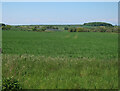
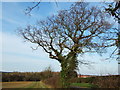
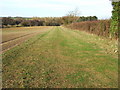
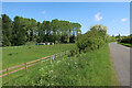
The above images may not be of the site on this page, they are loaded from Geograph.
Please Submit an Image of this site or go out and take one for us!
Click here to see more info for this site
Nearby sites
Key: Red: member's photo, Blue: 3rd party photo, Yellow: other image, Green: no photo - please go there and take one, Grey: site destroyed
Download sites to:
KML (Google Earth)
GPX (GPS waypoints)
CSV (Garmin/Navman)
CSV (Excel)
To unlock full downloads you need to sign up as a Contributory Member. Otherwise downloads are limited to 50 sites.
Turn off the page maps and other distractions
Nearby sites listing. In the following links * = Image available
6.9km NNE 19° Beacon Hill (Norfolk) Ancient Village or Settlement (TF72534255)
8.8km SE 130° Bircham Common Barrows* Barrow Cemetery (TF775306)
8.8km SSE 148° Harpley Common Barrow Cemetery* Barrow Cemetery (TF7550028700)
9.3km N 7° Holme IIb (Provisional) Timber Circle (TF7123545244)
9.3km N 7° Holme II* Timber Circle (TF7123445246)
9.3km N 6° Seahenge* Timber Circle (TF71124527)
11.1km NE 46° Branodunum Stone Fort or Dun (TF78214402)
12.9km NE 52° Burnham Deepdale* Early Christian Sculptured Stone (TF804443)
13.5km ENE 65° Burnham Market* Round Barrow(s) (TF826421)
14.0km ESE 114° Coxford Heath Barrow Round Barrow(s) (TF83493070)
14.3km E 95° South Creake* Hillfort (TF848352)
14.3km S 176° St. Botolph's Springs Holy Well or Sacred Spring (TF7210021800)
14.4km ESE 113° Wicken Covert Barrow Round Barrow(s) (TF83973081)
14.9km SE 137° West Rudham Cursus Cursus (TF810254)
15.0km SE 137° West Rudham North* Long Barrow (TF8104325337)
15.1km SE 138° West Rudham South* Long Barrow (TF8094125116)
15.7km SE 137° West Rudham* Round Barrow(s) (TF81652495)
16.1km ENE 67° Leath House Roman Barrow* Barrow Cemetery (TF852427)
16.4km SE 130° Fox Covert Bowl Barrows (West Rudham)* Round Barrow(s) (TF8339525782)
18.0km SSW 210° Kings Lynn Museum* Museum (TF62022005)
19.0km ENE 65° Holkham Camp* Hillfort (TF87454468)
20.1km SSW 195° Middleton Mount Artificial Mound (TF66121639)
21.9km SE 140° Weasenham Plantation* Barrow Cemetery (TF853198)
22.3km SE 137° Litcham Heath* Round Barrow(s) (TF863202)
23.0km E 90° Our Lady of Walsingham Holy Well* Holy Well or Sacred Spring (TF9355136894)
View more nearby sites and additional images


 We would like to know more about this location. Please feel free to add a brief description and any relevant information in your own language.
 Wir möchten mehr über diese Stätte erfahren. Bitte zögern Sie nicht, eine kurze Beschreibung und relevante Informationen in Deutsch hinzuzufügen.
 Nous aimerions en savoir encore un peu sur les lieux. S'il vous plaît n'hesitez pas à ajouter une courte description et tous les renseignements pertinents dans votre propre langue.
 Quisieramos informarnos un poco más de las lugares. No dude en añadir una breve descripción y otros datos relevantes en su propio idioma.