


<< Other Photo Pages >> Trelowth Common Round - Ancient Village or Settlement in England in Cornwall
Submitted by Bladup on Thursday, 21 August 2025 Page Views: 253
Multi-periodSite Name: Trelowth Common RoundCountry: England
NOTE: This site is 0.9 km away from the location you searched for.
County: Cornwall Type: Ancient Village or Settlement
Map Ref: SW98605033
Latitude: 50.318417N Longitude: 4.830425W
Condition:
| 5 | Perfect |
| 4 | Almost Perfect |
| 3 | Reasonable but with some damage |
| 2 | Ruined but still recognisable as an ancient site |
| 1 | Pretty much destroyed, possibly visible as crop marks |
| 0 | No data. |
| -1 | Completely destroyed |
| 5 | Superb |
| 4 | Good |
| 3 | Ordinary |
| 2 | Not Good |
| 1 | Awful |
| 0 | No data. |
| 5 | Can be driven to, probably with disabled access |
| 4 | Short walk on a footpath |
| 3 | Requiring a bit more of a walk |
| 2 | A long walk |
| 1 | In the middle of nowhere, a nightmare to find |
| 0 | No data. |
| 5 | co-ordinates taken by GPS or official recorded co-ordinates |
| 4 | co-ordinates scaled from a detailed map |
| 3 | co-ordinates scaled from a bad map |
| 2 | co-ordinates of the nearest village |
| 1 | co-ordinates of the nearest town |
| 0 | no data |
Internal Links:
External Links:
")
Thomas mentioned a small entrenchment concentric to the inner and about 30m away; this is barely visible today and is detectable by the fact that hedgerows follow the line suggested by Thomas. The inner banks are scheduled, and the site has been described by Beagrie. Although it was ploughed, no occupation debris was visible at the time of the OS visit and the site is now largely under grassland. The Schedule was revised in March 1992 to include the whole of the monument, including the outer bank, and the eastern end of the hollow way leading into the site from the west. The site is visible on aerial photographs and was plotted as part of the NMP.
You may be viewing yesterday's version of this page. To see the most up to date information please register for a free account.
Do not use the above information on other web sites or publications without permission of the contributor.
Nearby Images from Geograph Britain and Ireland:
©2018(licence)
©2023(licence)
©2006(licence)
©2008(licence)
©2008(licence)
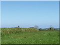
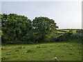
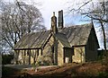
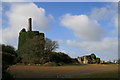
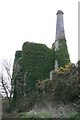
The above images may not be of the site on this page, they are loaded from Geograph.
Please Submit an Image of this site or go out and take one for us!
Click here to see more info for this site
Nearby sites
Key: Red: member's photo, Blue: 3rd party photo, Yellow: other image, Green: no photo - please go there and take one, Grey: site destroyed
Download sites to:
KML (Google Earth)
GPX (GPS waypoints)
CSV (Garmin/Navman)
CSV (Excel)
To unlock full downloads you need to sign up as a Contributory Member. Otherwise downloads are limited to 50 sites.
Turn off the page maps and other distractions
Nearby sites listing. In the following links * = Image available
1.8km NNE 28° St Mewan's Well* Holy Well or Sacred Spring (SW995519)
1.8km NW 307° Trethullan Castle* Ancient Village or Settlement (SW97175148)
2.2km ESE 112° Levalsa Meor Neolithic Tin Mine Ancient Mine, Quarry or other Industry (SX0060549413)
3.2km NW 317° Langerth Round* Ancient Village or Settlement (SW96515277)
3.2km ESE 114° Towan* Holy Well or Sacred Spring (SX015489)
3.5km NE 51° The Mengu Stone* Marker Stone (SX014524)
3.9km NE 39° Menacuddle* Holy Well or Sacred Spring (SX0118753260)
4.2km E 98° Castle Gotha* Ancient Village or Settlement (SX027496)
4.5km SSW 206° Pencoose Castle Round Ancient Village or Settlement (SW96474637)
4.6km W 276° Resugga Castle* Ancient Village or Settlement (SW940510)
4.7km ENE 65° Gwallon Longstone* Standing Stone (Menhir) (SX02965212)
4.9km WSW 255° St Naunter's Holy Well Remnant.* Holy Well or Sacred Spring (SW938492)
5.0km NW 325° St Stephens Beacon* Hillfort (SW959545)
5.2km W 261° Ladock Earthworks Promontory Fort / Cliff Castle (SW93384971)
5.8km ESE 112° Black Head* Promontory Fort / Cliff Castle (SX039480)
6.0km N 357° Cocksbarrow Timber Circle (SW985563)
6.4km NE 47° Menear* Standing Stone (Menhir) (SX0345154469)
6.7km NE 42° Carn Grey* Rock Outcrop (SX033551)
6.7km NNE 24° Caerloggas Down Circle* Modern Stone Circle etc (SX01635635)
6.9km NNE 24° Caerloggas Barrow I Timber Circle (SX017565)
6.9km NNE 24° Caerloggas Barrow III Timber Circle (SX017565)
6.9km NNE 25° Caerloggas Down longstone* Modern Stone Circle etc (SX0174756485)
7.0km WSW 238° Golden Camp* Hillfort (SW92454685)
7.1km WSW 251° Carvossa* Ancient Village or Settlement (SW918483)
7.3km N 6° Hensbarrow* Round Barrow(s) (SW99685754)
View more nearby sites and additional images


 We would like to know more about this location. Please feel free to add a brief description and any relevant information in your own language.
 Wir möchten mehr über diese Stätte erfahren. Bitte zögern Sie nicht, eine kurze Beschreibung und relevante Informationen in Deutsch hinzuzufügen.
 Nous aimerions en savoir encore un peu sur les lieux. S'il vous plaît n'hesitez pas à ajouter une courte description et tous les renseignements pertinents dans votre propre langue.
 Quisieramos informarnos un poco más de las lugares. No dude en añadir una breve descripción y otros datos relevantes en su propio idioma.