


<< Text Pages >> Gallows Hill, Wiltshire - Round Barrow(s) in England in Wiltshire
Submitted by coldrum on Monday, 31 October 2011 Page Views: 5028
Neolithic and Bronze AgeSite Name: Gallows Hill, WiltshireCountry: England
NOTE: This site is 2.1 km away from the location you searched for.
County: Wiltshire Type: Round Barrow(s)
Map Ref: ST95542411
Latitude: 51.016349N Longitude: 2.064956W
Condition:
| 5 | Perfect |
| 4 | Almost Perfect |
| 3 | Reasonable but with some damage |
| 2 | Ruined but still recognisable as an ancient site |
| 1 | Pretty much destroyed, possibly visible as crop marks |
| 0 | No data. |
| -1 | Completely destroyed |
| 5 | Superb |
| 4 | Good |
| 3 | Ordinary |
| 2 | Not Good |
| 1 | Awful |
| 0 | No data. |
| 5 | Can be driven to, probably with disabled access |
| 4 | Short walk on a footpath |
| 3 | Requiring a bit more of a walk |
| 2 | A long walk |
| 1 | In the middle of nowhere, a nightmare to find |
| 0 | No data. |
| 5 | co-ordinates taken by GPS or official recorded co-ordinates |
| 4 | co-ordinates scaled from a detailed map |
| 3 | co-ordinates scaled from a bad map |
| 2 | co-ordinates of the nearest village |
| 1 | co-ordinates of the nearest town |
| 0 | no data |
Be the first person to rate this site - see the 'Contribute!' box in the right hand menu.
Internal Links:
External Links:
Round Barrow in Wiltshire
A disc barrow was identified on Gallow's Hill Alvediston, By Clay, and comprised a mound 18 feet in diameter and 3 feet high with an external bank 1 foot high and outer ditch 15 inches deep (2) Grinsell describes it as a bowl barrow surrounded by a tree ring (1). Excavation by Clay about 1924-5, showed that the mound had been disturbed by man and rabbits. A few pieces of burnt bone and possibly Bronze Age sherds were found with many recent glass and pottery fragments. An ill-defined cist was found at the centre of the mound. The most northerly of the Scotts pines growing in the ditch was probably used as the gallows which gave the site its name. It has footholds cut in it and marks of chains or ropes. About 1875 a skeleton was found in making a dew-pond to the south of the trees and was probably the burial of an executed criminal.
The mound is 5.8m in diameter and 0.6m high and is surrounded by an outer ditch, 17.5m diameter and 0.1 to 0.3m deep, with vague indications of a bank on the inside. It is under grass with no evidence now of excavation. The finds made when it was excavated and its present appearance are consistent with it being abowl barrow enclosed by a tree-ring. No further information on the gallows was obtained but one of the trees has indentations visible upon it.
As described by F1, the outer ditch to the mound has been destroyed by ploughing on the west side and the rest of the work overgrown by rough grass and scrub. A tree stump at ST 9554 2419 on the N side of the mound could be the site of the gallows."
Source: Pastscape.
You may be viewing yesterday's version of this page. To see the most up to date information please register for a free account.
Do not use the above information on other web sites or publications without permission of the contributor.
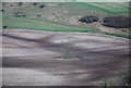
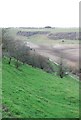
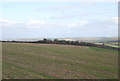
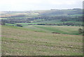
Nearby Images from Geograph Britain and Ireland:
©2007(licence)
©2007(licence)
©2007(licence)
©2007(licence)
©2007(licence)
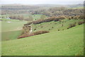
The above images may not be of the site on this page, they are loaded from Geograph.
Please Submit an Image of this site or go out and take one for us!
Click here to see more info for this site
Nearby sites
Key: Red: member's photo, Blue: 3rd party photo, Yellow: other image, Green: no photo - please go there and take one, Grey: site destroyed
Download sites to:
KML (Google Earth)
GPX (GPS waypoints)
CSV (Garmin/Navman)
CSV (Excel)
To unlock full downloads you need to sign up as a Contributory Member. Otherwise downloads are limited to 50 sites.
Turn off the page maps and other distractions
Nearby sites listing. In the following links * = Image available
1.3km W 273° White Sheet Hill Long Barrow (ST94242419)
2.3km S 188° Winklebury Camp (Wiltshire) Hillfort (ST952218)
3.6km NE 50° Sutton Down long barrow* Long Barrow (ST983264)
3.7km SE 134° South Down Ox Drove Tumuli* Round Barrow(s) (ST982215)
4.0km NE 46° Buxbury Hill* Round Barrow(s) (ST984269)
4.3km N 10° Castle Ditches (Wiltshire)* Hillfort (ST963283)
5.6km WSW 247° Chapel Well (Donhead St Mary) Holy Well or Sacred Spring (ST90372196)
5.8km N 356° Tisbury Circle* Stone Circle (ST951299)
6.1km SE 139° Mistlebury* Hillfort (ST99581948)
6.4km SSE 165° Scrubbity Barrows* Barrow Cemetery (ST97201789)
6.6km ESE 103° Marleycombe Hill, earthworks* Misc. Earthwork (SU020226)
6.7km W 278° Castle Rings* Hillfort (ST889251)
7.1km SE 126° Bokerley Dyke Misc. Earthwork (SU01241990)
7.4km ENE 57° Chiselbury* Hillfort (SU018281)
8.4km ESE 111° Vernditch Chase (North)* Long Barrow (SU03402113)
8.8km ESE 115° Vernditch Chase (South)* Long Barrow (SU035204)
8.9km SE 140° Wor Barrow* Long Barrow (SU01241729)
8.9km SSW 197° Caesar's Camp (Dorset)* Hillfort (ST930156)
8.9km NNE 22° Teffont Magna - St. Edwards Church* Ancient Cross (ST98923237)
9.2km SW 231° Fontmell Down* Misc. Earthwork (ST884183)
9.2km SE 137° Oakley Down Barrows* Barrow Cemetery (SU01821731)
9.3km NNE 19° Spring Head Holy Well or Sacred Spring (ST9855732867)
9.4km ESE 123° Bokerley Dyke* Misc. Earthwork (SU035190)
9.5km ESE 119° Pentridge 3* Long Barrow (SU039195)
9.7km ESE 115° Martin Down Enclosure* Ancient Village or Settlement (SU043200)
View more nearby sites and additional images


 We would like to know more about this location. Please feel free to add a brief description and any relevant information in your own language.
 Wir möchten mehr über diese Stätte erfahren. Bitte zögern Sie nicht, eine kurze Beschreibung und relevante Informationen in Deutsch hinzuzufügen.
 Nous aimerions en savoir encore un peu sur les lieux. S'il vous plaît n'hesitez pas à ajouter une courte description et tous les renseignements pertinents dans votre propre langue.
 Quisieramos informarnos un poco más de las lugares. No dude en añadir una breve descripción y otros datos relevantes en su propio idioma.