


<< Text Pages >> South Ingleby Tumulus - Misc. Earthwork in England in Lincolnshire
Submitted by attlebax on Wednesday, 06 June 2012 Page Views: 4475
Multi-periodSite Name: South Ingleby TumulusCountry: England
NOTE: This site is 8.462 km away from the location you searched for.
County: Lincolnshire Type: Misc. Earthwork
Nearest Town: Lincoln Nearest Village: Ingleby
Map Ref: SK8946576860
Latitude: 53.281177N Longitude: 0.659629W
Condition:
| 5 | Perfect |
| 4 | Almost Perfect |
| 3 | Reasonable but with some damage |
| 2 | Ruined but still recognisable as an ancient site |
| 1 | Pretty much destroyed, possibly visible as crop marks |
| 0 | No data. |
| -1 | Completely destroyed |
| 5 | Superb |
| 4 | Good |
| 3 | Ordinary |
| 2 | Not Good |
| 1 | Awful |
| 0 | No data. |
| 5 | Can be driven to, probably with disabled access |
| 4 | Short walk on a footpath |
| 3 | Requiring a bit more of a walk |
| 2 | A long walk |
| 1 | In the middle of nowhere, a nightmare to find |
| 0 | No data. |
| 5 | co-ordinates taken by GPS or official recorded co-ordinates |
| 4 | co-ordinates scaled from a detailed map |
| 3 | co-ordinates scaled from a bad map |
| 2 | co-ordinates of the nearest village |
| 1 | co-ordinates of the nearest town |
| 0 | no data |
Internal Links:
External Links:
This is shown on the earliest Lincolnshire Ordnance Survey map around 1890. It is clearly marked as a tumulus. It is not shown on the current O/S map although I believe it still appears on the high resolution map of 1955.
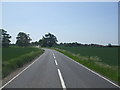
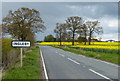
The location is just to the East of the B1241 on the Saxilby to Ingleby Road. The site of the Medieval Ingleby village (everyone killed in the plague) is about 400 metres North of this.
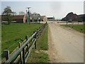
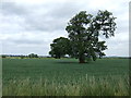
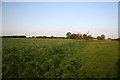
The site is now a ploughed field but there are some trees located nearby so that may be the actual site. A rough location of the site was mentioned to me around 30 years ago.
You may be viewing yesterday's version of this page. To see the most up to date information please register for a free account.
Do not use the above information on other web sites or publications without permission of the contributor.
Nearby Images from Geograph Britain and Ireland:
©2010(licence)
©2010(licence)
©2013(licence)
©2016(licence)
©2006(licence)
The above images may not be of the site on this page, they are loaded from Geograph.
Please Submit an Image of this site or go out and take one for us!
Click here to see more info for this site
Nearby sites
Key: Red: member's photo, Blue: 3rd party photo, Yellow: other image, Green: no photo - please go there and take one, Grey: site destroyed
Download sites to:
KML (Google Earth)
GPX (GPS waypoints)
CSV (Garmin/Navman)
CSV (Excel)
To unlock full downloads you need to sign up as a Contributory Member. Otherwise downloads are limited to 50 sites.
Turn off the page maps and other distractions
Nearby sites listing. In the following links * = Image available
6.1km ENE 76° St Pancras Well* Holy Well or Sacred Spring (SK954785)
8.7km E 95° Riseholme Barrow* Round Barrow(s) (SK98177624)
9.5km ESE 122° Roman Lincoln Ancient Village or Settlement (SK976720)
9.8km SE 124° Lincoln Museum* Museum (SK9771471547)
10.4km SE 141° Lincoln stone circle* Modern Stone Circle etc (SK962689)
12.3km ESE 119° Lincoln Greetwell Henge/disc barrow* Barrow Cemetery (TF00407110)
13.4km WSW 257° Kingshaugh* Hillfort (SK765735)
13.8km ESE 117° Washingborough Ancient Settlement* Ancient Village or Settlement (TF019709)
14.4km NNE 26° Aisthorpe springs Holy Well or Sacred Spring (SK956899)
14.5km SSW 210° Besthorpe Ancient Village or Settlement (SK825641)
14.6km W 275° Lady well (Headon)* Holy Well or Sacred Spring (SK7483877954)
14.7km NNE 16° St. Helen's Well (Hemswell)* Holy Well or Sacred Spring (SK932911)
15.5km NE 35° Newell's Well (Glentham) Holy Well or Sacred Spring (SK981897)
15.8km WNW 285° Castle Hill (Nottinghamshire) Hillfort (SK741806)
15.9km WSW 251° Holy well (Tuxford) Holy Well or Sacred Spring (SK745714)
16.4km ESE 110° Fiskerton Iron Age causeway* Ancient Village or Settlement (TF05007159)
17.8km WSW 248° Holy well ( Tuxford ) Holy Well or Sacred Spring (SK7370)
17.9km WNW 290° St John's Well (Welham) Holy Well or Sacred Spring (SK72558280)
19.4km SSW 199° Langford, Brough and Glebe Farm sites on the A46* Ancient Village or Settlement (SK833584)
19.7km E 101° Barlings Well* Holy Well or Sacred Spring (TF08937347)
19.8km WSW 240° The Duck's Mouth* Holy Well or Sacred Spring (SK724667)
20.8km ENE 73° Wickenby Ancient Village or Settlement (TF0928883432)
22.0km NNE 12° Ashwell* Holy Well or Sacred Spring (SK936985)
26.1km SSW 204° Farndon Fields* Natural Stone / Erratic / Other Natural Feature (SK794528)
27.4km NNW 338° Holy Well (Lower Burnham)* Holy Well or Sacred Spring (SE78520205)
View more nearby sites and additional images


 We would like to know more about this location. Please feel free to add a brief description and any relevant information in your own language.
 Wir möchten mehr über diese Stätte erfahren. Bitte zögern Sie nicht, eine kurze Beschreibung und relevante Informationen in Deutsch hinzuzufügen.
 Nous aimerions en savoir encore un peu sur les lieux. S'il vous plaît n'hesitez pas à ajouter une courte description et tous les renseignements pertinents dans votre propre langue.
 Quisieramos informarnos un poco más de las lugares. No dude en añadir una breve descripción y otros datos relevantes en su propio idioma.