

<< Our Photo Pages >> Lincoln Greetwell Henge/disc barrow - Barrow Cemetery in England in Lincolnshire
Submitted by Catrinm on Monday, 29 January 2018 Page Views: 6003
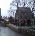
Neolithic and Bronze AgeSite Name: Lincoln Greetwell Henge/disc barrow Alternative Name: Lincoln bypass site north of WithamCountry: England County: Lincolnshire Type: Barrow Cemetery
Nearest Town: Lincoln
Map Ref: TF00407110
Latitude: 53.227464N Longitude: 0.497495W
Condition:
| 5 | Perfect |
| 4 | Almost Perfect |
| 3 | Reasonable but with some damage |
| 2 | Ruined but still recognisable as an ancient site |
| 1 | Pretty much destroyed, possibly visible as crop marks |
| 0 | No data. |
| -1 | Completely destroyed |
| 5 | Superb |
| 4 | Good |
| 3 | Ordinary |
| 2 | Not Good |
| 1 | Awful |
| 0 | No data. |
| 5 | Can be driven to, probably with disabled access |
| 4 | Short walk on a footpath |
| 3 | Requiring a bit more of a walk |
| 2 | A long walk |
| 1 | In the middle of nowhere, a nightmare to find |
| 0 | No data. |
| 5 | co-ordinates taken by GPS or official recorded co-ordinates |
| 4 | co-ordinates scaled from a detailed map |
| 3 | co-ordinates scaled from a bad map |
| 2 | co-ordinates of the nearest village |
| 1 | co-ordinates of the nearest town |
| 0 | no data |
Internal Links:
External Links:
I have visited· I would like to visit
Catrinm visited on 18th Apr 2020 - their rating: Cond: 1 Amb: 2 Access: 3 Quite hard to get to the remaining barrows now - where is Network archeology's report? Part of their o0cntract was to keep the public informed.
Catrinm visited on 26th Dec 2017 - their rating: Cond: 2 Amb: 4 Access: 4 Hard to photograph but definitely there- has the third one actually gone now?
Catrinm have visited here
Average ratings for this site from all visit loggers: Condition: 1.5 Ambience: 3 Access: 3.5
")
Two Bronze Age cremation burials found inside circle, so may span millennium 2000-3000 BC .
Can be viewed by coming off the footpath (Viking way) and going round edge of excavation site (carefully keeping outside of barriers in place, obviously).
Have a look at Bladup's comment on the photo page.
Note: Lots more news from the Lincolnshire Bypass (or prehistoric landscape to give it a better name) - Cremation Urn, Axe head, human skeletons, Bronze earring, more in the comments on our page and follow the links for excellent reporting from Lincolnshire Live. ...lots of barrows, but is there a henge too?
You may be viewing yesterday's version of this page. To see the most up to date information please register for a free account.
")
")
")
")
")
")
")
")
")
")
")
")
")
Do not use the above information on other web sites or publications without permission of the contributor.
Click here to see more info for this site
Nearby sites
Key: Red: member's photo, Blue: 3rd party photo, Yellow: other image, Green: no photo - please go there and take one, Grey: site destroyed
Download sites to:
KML (Google Earth)
GPX (GPS waypoints)
CSV (Garmin/Navman)
CSV (Excel)
To unlock full downloads you need to sign up as a Contributory Member. Otherwise downloads are limited to 50 sites.
Turn off the page maps and other distractions
Nearby sites listing. In the following links * = Image available
1.5km E 99° Washingborough Ancient Settlement* Ancient Village or Settlement (TF019709)
2.7km W 281° The Collection, Lincoln* Museum (SK9771471547)
4.6km E 85° Fiskerton Iron Age causeway* Ancient Village or Settlement (TF05007159)
4.7km WSW 244° Lincoln stone circle* Modern Stone Circle etc (SK962689)
8.9km NNW 327° St Pancras Well* Holy Well or Sacred Spring (SK954785)
12.3km WNW 299° South Ingleby Tumulus Misc. Earthwork (SK8946576860)
15.2km NE 37° Wickenby Ancient Village or Settlement (TF0928883432)
18.7km N 354° Newell's Well (Glentham) Holy Well or Sacred Spring (SK981897)
19.2km WSW 250° Besthorpe Ancient Village or Settlement (SK825641)
19.4km NNW 347° Aisthorpe springs Holy Well or Sacred Spring (SK956899)
21.2km NNW 341° St. Helen's Well (Hemswell)* Holy Well or Sacred Spring (SK932911)
21.3km SW 235° Langford, Brough and Glebe Farm sites on the A46* Ancient Village or Settlement (SK833584)
21.7km E 85° Baumber Cursus* Cursus (TF22067350)
23.2km SSE 153° Anwick Drake Stones* Natural Stone / Erratic / Other Natural Feature (TF114506)
23.9km W 277° Kingshaugh* Hillfort (SK765735)
24.7km ENE 60° Burgh Top* Round Barrow(s) (TF21458406)
24.9km E 90° West Ashby Henge (TF25347168)
25.0km ENE 58° Burgh on Bain* Long Barrow (TF21298497)
25.1km NNE 33° Walesby All Saints church carvings* Sculptured Stone (TF1382892388)
25.8km W 272° Holy well (Tuxford) Holy Well or Sacred Spring (SK745714)
26.4km WNW 286° Lady well (Headon)* Holy Well or Sacred Spring (SK7483877954)
27.0km NE 40° Bully Hill (Tealby)* Round Barrow(s) (TF17279227)
27.3km W 269° Holy well ( Tuxford ) Holy Well or Sacred Spring (SK7370)
27.7km ENE 56° Grims Mound* Round Barrow(s) (TF23258693)
27.8km SW 230° Farndon Fields* Natural Stone / Erratic / Other Natural Feature (SK794528)
View more nearby sites and additional images


 We would like to know more about this location. Please feel free to add a brief description and any relevant information in your own language.
 Wir möchten mehr über diese Stätte erfahren. Bitte zögern Sie nicht, eine kurze Beschreibung und relevante Informationen in Deutsch hinzuzufügen.
 Nous aimerions en savoir encore un peu sur les lieux. S'il vous plaît n'hesitez pas à ajouter une courte description et tous les renseignements pertinents dans votre propre langue.
 Quisieramos informarnos un poco más de las lugares. No dude en añadir una breve descripción y otros datos relevantes en su propio idioma.