


<< Our Photo Pages >> Burr Tor - Hillfort in England in Derbyshire
Submitted by vicky on Wednesday, 18 September 2002 Page Views: 10907
Iron Age and Later PrehistorySite Name: Burr TorCountry: England
NOTE: This site is 0.8 km away from the location you searched for.
County: Derbyshire Type: Hillfort
Nearest Town: Bakewell Nearest Village: Great Hucklow
Map Ref: SK179782 Landranger Map Number: 119
Latitude: 53.300453N Longitude: 1.732875W
Condition:
| 5 | Perfect |
| 4 | Almost Perfect |
| 3 | Reasonable but with some damage |
| 2 | Ruined but still recognisable as an ancient site |
| 1 | Pretty much destroyed, possibly visible as crop marks |
| 0 | No data. |
| -1 | Completely destroyed |
| 5 | Superb |
| 4 | Good |
| 3 | Ordinary |
| 2 | Not Good |
| 1 | Awful |
| 0 | No data. |
| 5 | Can be driven to, probably with disabled access |
| 4 | Short walk on a footpath |
| 3 | Requiring a bit more of a walk |
| 2 | A long walk |
| 1 | In the middle of nowhere, a nightmare to find |
| 0 | No data. |
| 5 | co-ordinates taken by GPS or official recorded co-ordinates |
| 4 | co-ordinates scaled from a detailed map |
| 3 | co-ordinates scaled from a bad map |
| 2 | co-ordinates of the nearest village |
| 1 | co-ordinates of the nearest town |
| 0 | no data |
Internal Links:
External Links:
")
Overlooking the limestone plateau between Eyam and Hazelbridge, Burr Tor stands at 396m (1300ft) above sea level and is also one of the region’s larger hillforts. The name may derive from the Old English term burh, meaning a fortification. It was recognised as a hillfort as early as 1792
In 1954, when Preston investigated the site, which is known as Camphill, it was ‘the landing ground of the Derbyshire and Lancashire Gliding Club’. This did (and still does) have its benefits, however, as a number of aerial photographs taken by members of the club provided a birds-eye view of the defences.
You may be viewing yesterday's version of this page. To see the most up to date information please register for a free account.
Do not use the above information on other web sites or publications without permission of the contributor.
coldrum has found this location on Google Street View:
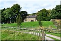
Nearby Images from Geograph Britain and Ireland:
©2014(licence)
©2012(licence)
©2019(licence)
©2011(licence)
©2012(licence)
The above images may not be of the site on this page, they are loaded from Geograph.
Please Submit an Image of this site or go out and take one for us!
Click here to see more info for this site
Nearby sites
Key: Red: member's photo, Blue: 3rd party photo, Yellow: other image, Green: no photo - please go there and take one, Grey: site destroyed
Download sites to:
KML (Google Earth)
GPX (GPS waypoints)
CSV (Garmin/Navman)
CSV (Excel)
To unlock full downloads you need to sign up as a Contributory Member. Otherwise downloads are limited to 50 sites.
Turn off the page maps and other distractions
Nearby sites listing. In the following links * = Image available
668m NNE 23° Crow Chin cairns* Cairn (SK1815578818)
1.4km NW 315° Stan Low* Round Barrow(s) (SK169792)
1.6km NW 306° Cop Low* Round Barrow(s) (SK16627912)
1.8km NNW 339° Hazlebadge Round Barrow 2* Round Barrow(s) (SK17257991)
2.2km NNW 344° Hazlebadge Round Barrow 1* Round Barrow(s) (SK17268034)
2.6km NW 325° Fissure Cave Cave or Rock Shelter (SK164803)
2.6km E 91° Derwic Well* Holy Well or Sacred Spring (SK2054978171)
2.8km NNE 32° Burton Bole* Round Barrow(s) (SK194806)
2.9km W 264° Tideslow* Chambered Cairn (SK150779)
3.0km S 190° Peter's Stone* Natural Stone / Erratic / Other Natural Feature (SK17387525)
3.0km N 6° The Grey Ditch* Misc. Earthwork (SK182812)
3.1km NE 48° Abney Moor I* Stone Circle (SK202803)
3.2km NE 48° Smelting Hill* Stone Circle (SK203804)
3.6km E 82° Stanage* Cairn (SK215787)
3.8km N 353° Bath Spring Holy Well or Sacred Spring (SK174820)
3.9km SSE 151° White Rake* Long Barrow (SK198748)
4.0km ESE 112° Eyam Museum* Museum (SK2159176729)
4.0km WSW 245° The Dor Well* Holy Well or Sacred Spring (SK143765)
4.0km NE 54° Offerton Moor West* Ring Cairn (SK2115580550)
4.1km ENE 62° Highlow Bank* Standing Stone (Menhir) (SK215801)
4.1km NE 56° Offerton Moor East* Stone Circle (SK213805)
4.2km WSW 248° Ebbing and Flowing well* Holy Well or Sacred Spring (SK140766)
4.2km S 181° Wardlow Hay Cop* Round Barrow(s) (SK17857397)
4.3km ESE 121° Eyam Delf* Cave or Rock Shelter (SK21577598)
4.3km ESE 115° St Lawrence (Eyam)* Ancient Cross (SK218764)
View more nearby sites and additional images


 We would like to know more about this location. Please feel free to add a brief description and any relevant information in your own language.
 Wir möchten mehr über diese Stätte erfahren. Bitte zögern Sie nicht, eine kurze Beschreibung und relevante Informationen in Deutsch hinzuzufügen.
 Nous aimerions en savoir encore un peu sur les lieux. S'il vous plaît n'hesitez pas à ajouter une courte description et tous les renseignements pertinents dans votre propre langue.
 Quisieramos informarnos un poco más de las lugares. No dude en añadir una breve descripción y otros datos relevantes en su propio idioma.