


<< Our Photo Pages >> Cremlyn 2 - Standing Stone (Menhir) in Wales in Anglesey (Sir Ynys Mon)
Submitted by TimPrevett on Tuesday, 24 September 2002 Page Views: 7358
Neolithic and Bronze AgeSite Name: Cremlyn 2Country: Wales
NOTE: This site is 1.0 km away from the location you searched for.
County: Anglesey (Sir Ynys Mon) Type: Standing Stone (Menhir)
Map Ref: SH573774 Landranger Map Number: 114
Latitude: 53.274326N Longitude: 4.141474W
Condition:
| 5 | Perfect |
| 4 | Almost Perfect |
| 3 | Reasonable but with some damage |
| 2 | Ruined but still recognisable as an ancient site |
| 1 | Pretty much destroyed, possibly visible as crop marks |
| 0 | No data. |
| -1 | Completely destroyed |
| 5 | Superb |
| 4 | Good |
| 3 | Ordinary |
| 2 | Not Good |
| 1 | Awful |
| 0 | No data. |
| 5 | Can be driven to, probably with disabled access |
| 4 | Short walk on a footpath |
| 3 | Requiring a bit more of a walk |
| 2 | A long walk |
| 1 | In the middle of nowhere, a nightmare to find |
| 0 | No data. |
| 5 | co-ordinates taken by GPS or official recorded co-ordinates |
| 4 | co-ordinates scaled from a detailed map |
| 3 | co-ordinates scaled from a bad map |
| 2 | co-ordinates of the nearest village |
| 1 | co-ordinates of the nearest town |
| 0 | no data |
Internal Links:
External Links:
I have visited· I would like to visit
TimPrevett has visited here
")
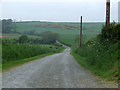
Access: Down a long, long dusty track off the B5109 from Beaumaris to Pentraeth. We parked in farm yard; walking, a little way up the track to the right, I asked a man in tractor if it were OK to visit the stones, which he said was fine. My wife was also asked by someone from the farm while I was off megaraking.
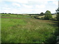
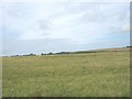
The stones are each in a separate field, to the left of the track The stones: I visited the top stone first of all, which is down the field, right in the middle. I estimate 9 to 10 feet tall. It was very light coloured, though wa covered with lichen, lots of bird poo, and wool lower down. From there I went to the hedge splitting the fields, through a gate, to the lower stone, visible at the brough of the hill in the centre of the field. This stone I estimated 5'9" tall, covered in lichen, and much broader than the other stone, being almost round. With commanding views of Snowdonia, and a beautiful June day, these two stones had the ideal situation for a visit. Lovely.
You may be viewing yesterday's version of this page. To see the most up to date information please register for a free account.
")
")
")
Do not use the above information on other web sites or publications without permission of the contributor.
Nearby Images from Geograph Britain and Ireland:

©2007(licence)

©2007(licence)
©2006(licence)
©2008(licence)
©2008(licence)
The above images may not be of the site on this page, they are loaded from Geograph.
Please Submit an Image of this site or go out and take one for us!
Click here to see more info for this site
Nearby sites
Key: Red: member's photo, Blue: 3rd party photo, Yellow: other image, Green: no photo - please go there and take one, Grey: site destroyed
Download sites to:
KML (Google Earth)
GPX (GPS waypoints)
CSV (Garmin/Navman)
CSV (Excel)
To unlock full downloads you need to sign up as a Contributory Member. Otherwise downloads are limited to 50 sites.
Turn off the page maps and other distractions
Nearby sites listing. In the following links * = Image available
223m NNW 332° Cremlyn 1* Standing Stone (Menhir) (SH572776)
2.2km W 266° Hendrefor* Chambered Tomb (SH551773)
2.3km NNW 345° Llanddona* Standing Stone (Menhir) (SH5675879673)
3.6km SSW 193° Pen-Y-Maen* Standing Stone (Menhir) (SH564739)
3.6km ESE 109° Anglesey Eisteddfod Circle* Modern Stone Circle etc (SH607761)
3.7km WNW 286° Mynydd Llwydiarth Hillfort (SH5378978520)
4.0km SSW 208° Ty-Gwyn* Standing Stone (Menhir) (SH5536273949)
4.3km NNE 16° Din Sylwy* Hillfort (SH586815)
4.6km W 281° The Three Leaps* Stone Row / Alignment (SH5283878407)
4.6km WNW 301° Traeth Coch Pentraeth Standing Stone* Marker Stone (SH534799)
4.7km S 172° Gorsedd Stones, Bangor* Modern Stone Circle etc (SH5785272766)
5.9km ENE 59° Penmon Park Settlement Ancient Village or Settlement (SH6241280315)
6.1km ENE 63° Tan-Y-Fron* Ancient Village or Settlement (SH6284479994)
6.1km SSW 195° Menai Bridge Gorsedd Circle* Modern Stone Circle etc (SH55517153)
6.2km WSW 242° St Gredifael's Holy Well (Penmynydd) Holy Well or Sacred Spring (SH51677465)
6.3km SSW 211° Ty Mawr Tomb* Passage Grave (SH5388672144)
6.5km W 278° Llanddyfynan Barrows* Chambered Tomb (SH5088278462)
6.5km NE 55° Tyddyn Rheinallt Settlement Ancient Village or Settlement (SH6275580995)
6.6km ENE 58° Penmon Priory and Church* Ancient Cross (SH630807)
6.7km ENE 58° St Seiriol's Well* Holy Well or Sacred Spring (SH631808)
6.7km NE 55° Penmon Deer Park Settlement Ancient Village or Settlement (SH6290981114)
6.7km SSE 160° Llandegai Henge Complex* Henge (SH59407100)
6.7km SSE 160° Llandegai Cursus* Cursus (SH594710)
6.8km SSE 158° Llandegai Cursus Cursus (SH597710)
6.9km SSE 155° Llandegai Bronze Age Settlement* Ancient Village or Settlement (SH600710)
View more nearby sites and additional images


 We would like to know more about this location. Please feel free to add a brief description and any relevant information in your own language.
 Wir möchten mehr über diese Stätte erfahren. Bitte zögern Sie nicht, eine kurze Beschreibung und relevante Informationen in Deutsch hinzuzufügen.
 Nous aimerions en savoir encore un peu sur les lieux. S'il vous plaît n'hesitez pas à ajouter une courte description et tous les renseignements pertinents dans votre propre langue.
 Quisieramos informarnos un poco más de las lugares. No dude en añadir una breve descripción y otros datos relevantes en su propio idioma.