


Carlungie
Submitted by Nick on Sunday, 09 March 2003 Page Views: 11379
Iron Age and Later PrehistorySite Name: CarlungieCountry: Scotland County: Angus Type: Souterrain (Fogou, Earth House)
Nearest Town: Dundee Nearest Village: Newbigging
Map Ref: NO51123597 Landranger Map Number: 54
Latitude: 56.513229N Longitude: 2.795886W
Condition:
| 5 | Perfect |
| 4 | Almost Perfect |
| 3 | Reasonable but with some damage |
| 2 | Ruined but still recognisable as an ancient site |
| 1 | Pretty much destroyed, possibly visible as crop marks |
| 0 | No data. |
| -1 | Completely destroyed |
| 5 | Superb |
| 4 | Good |
| 3 | Ordinary |
| 2 | Not Good |
| 1 | Awful |
| 0 | No data. |
| 5 | Can be driven to, probably with disabled access |
| 4 | Short walk on a footpath |
| 3 | Requiring a bit more of a walk |
| 2 | A long walk |
| 1 | In the middle of nowhere, a nightmare to find |
| 0 | No data. |
| 5 | co-ordinates taken by GPS or official recorded co-ordinates |
| 4 | co-ordinates scaled from a detailed map |
| 3 | co-ordinates scaled from a bad map |
| 2 | co-ordinates of the nearest village |
| 1 | co-ordinates of the nearest town |
| 0 | no data |
23 photos by 7 photographers
Internal Links:


External Links:


I have visited· I would like to visit
coin would like to visit
markj99 visited on 18th Nov 2019 Carlungie Souterrain is easily visited via the A92. I found the site to be over-restored and lacking in atmosphere.
SandyG visited on 16th Aug 2014
jeffrep visited on 13th May 2013
DrewParsons hamish have visited here
Log in or create a free account to see how our visitors rate this site for condition, ambience and access, and to record your own visits.
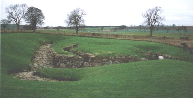
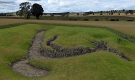
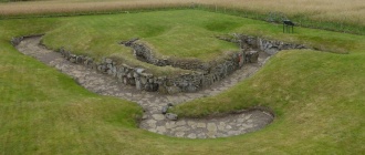
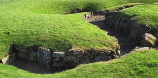
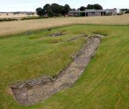
Take the A92 east from Dundee, turn north onto the B962, and then east onto a local road at Templehall. The souterrain is past the quarry. A lane runs south towards Carnlugie farm and 100 metres down this you can park on the verge and follow the track across to the site, which is situated a little way out in a field. There is an information board at the site.
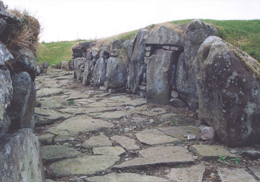
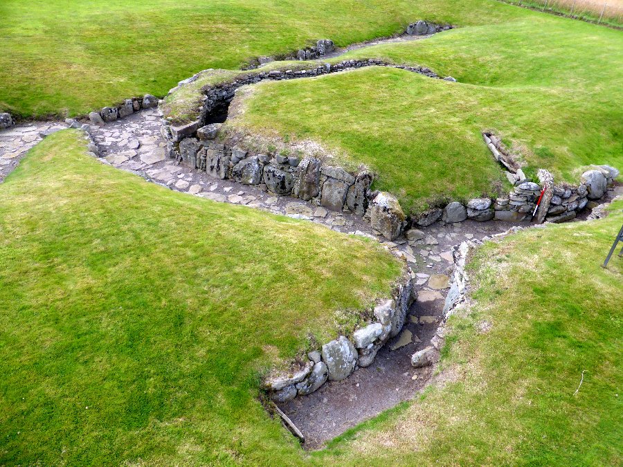
Additional information submitted by Drew Parsons in September 2012: The site was excavated in 1951-2 and finds included Roman amphora and a brooch from France dated to between 100 to 200 AD. There were 7 huts set around a courtyard outside of the souterrain with a further hut nearby.
You may be viewing yesterday's version of this page. To see the most up to date information please register for a free account.







These are just the first 25 photos of Carlungie. If you log in with a free user account you will be able to see our entire collection.
Do not use the above information on other web sites or publications without permission of the contributor.
Click here to see more info for this site
Log in or create a free account to see nearby ancient sites our visitors rate highly
All Nearby sites
 Click here to view sites on an interactive OS map
Download sites to:
KML (Google Earth)
GPX (GPS waypoints)
CSV (Garmin/Navman)
CSV (Excel)
To unlock full downloads you need to sign up as a Society Member. Otherwise downloads are limited to 50 sites.
Turn off the page maps and other distractions
Nearby sites listing. In the following links * = Image available
1.4km SSE 159° Barry Cursus Cursus (NO51603465)
1.8km SSW 210° Ardestie* Souterrain (Fogou, Earth House) (NO5019434441)
1.9km SSE 152° Woodhill House* Rock Art (NO520343)
2.1km NNE 21° Camus Cross (Angus)* Ancient Cross (NO519379)
2.2km WSW 240° Drumsturdy Hill* Broch or Nuraghe (NO492349)
4.5km E 99° Carnoustie Neolithic Halls, Bronze Age roundhouses and Hoard* Ancient Village or Settlement (NO5553135246)
5.0km WSW 243° Linlathen Class I Pictish Symbol Stone (NO46623376)
5.1km SW 229° Balmossie Den (Broughty Ferry)* Holy Well or Sacred Spring (NO4721732714)
5.5km ESE 107° The Singing Stone (Summstein) Modern Stone Circle etc (NO56353431)
6.9km NW 305° Carrot Hill* Rock Art (NO45454000)
8.2km NNE 24° Carmyllie Hill (Greystone) Cairn (NO545434)
10.1km WNW 281° Tealing* Souterrain (Fogou, Earth House) (NO412381)
10.2km WNW 291° Tealing Stones* Standing Stones (NO4165139785)
10.5km WNW 290° Huntingfaulds* Rock Art (NO41303974)
12.1km NW 323° Mill Of Invereighty Ancient Village or Settlement (NO439457)
12.2km WSW 242° McManus Galleries* Museum (NO40253047)
12.4km WNW 291° Gallow Hill B* Rock Art (NO39584066)
12.6km NNE 18° Dumbarrow Hill Stone Fort or Dun (NO55154791)
12.6km WNW 286° Prieston* Rock Art (NO39023960)
12.8km WNW 289° Gallow Hill A* Rock Art (NO39054033)
13.1km W 280° Balkemback* Stone Circle (NO382384)
13.3km W 266° Strathmartine 3 Class II Pictish Symbol Stone (NO378352)
13.6km N 1° Dunnichen* Class I Pictish Symbol Stone (NO516496)
13.7km W 276° Balluderon* Class II Pictish Symbol Stone (NO37483758)
13.9km N 6° Girdle Stane of Dunnichen* Rock Art (NO5280849737)
View more nearby sites and additional images

 We would like to know more about this location. Please feel free to add a brief description and any relevant information in your own language.
 Wir möchten mehr über diese Stätte erfahren. Bitte zögern Sie nicht, eine kurze Beschreibung und relevante Informationen in Deutsch hinzuzufügen.
 Nous aimerions en savoir encore un peu sur les lieux. S'il vous plaît n'hesitez pas à ajouter une courte description et tous les renseignements pertinents dans votre propre langue.
 Quisieramos informarnos un poco más de las lugares. No dude en añadir una breve descripción y otros datos relevantes en su propio idioma.