<< Our Photo Pages >> Vinstra Helleristninger - Rock Art in Norway in Oppland
Submitted by kenntha88 on Wednesday, 25 September 2019 Page Views: 758
Rock ArtSite Name: Vinstra HelleristningerCountry: Norway
NOTE: This site is 34.323 km away from the location you searched for.
Fylke: Oppland Type: Rock Art
Nearest Town: Vinstra
Latitude: 61.596392N Longitude: 9.746196E
Condition:
| 5 | Perfect |
| 4 | Almost Perfect |
| 3 | Reasonable but with some damage |
| 2 | Ruined but still recognisable as an ancient site |
| 1 | Pretty much destroyed, possibly visible as crop marks |
| 0 | No data. |
| -1 | Completely destroyed |
| 5 | Superb |
| 4 | Good |
| 3 | Ordinary |
| 2 | Not Good |
| 1 | Awful |
| 0 | No data. |
| 5 | Can be driven to, probably with disabled access |
| 4 | Short walk on a footpath |
| 3 | Requiring a bit more of a walk |
| 2 | A long walk |
| 1 | In the middle of nowhere, a nightmare to find |
| 0 | No data. |
| 5 | co-ordinates taken by GPS or official recorded co-ordinates |
| 4 | co-ordinates scaled from a detailed map |
| 3 | co-ordinates scaled from a bad map |
| 2 | co-ordinates of the nearest village |
| 1 | co-ordinates of the nearest town |
| 0 | no data |
Internal Links:
External Links:
")
The boulder is exibited at the entrance of the small city hall and shows two figures believed to be elk. They are around 20-30 cm long. They are believed to be older stone age carvings (6000-5000BC). In the article I post the current location
You may be viewing yesterday's version of this page. To see the most up to date information please register for a free account.
")
Do not use the above information on other web sites or publications without permission of the contributor.
Nearby Images from Flickr

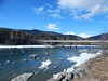
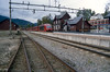


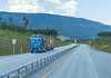
The above images may not be of the site on this page, but were taken nearby. They are loaded from Flickr so please click on them for image credits.
Click here to see more info for this site
Nearby sites
Click here to view sites on an interactive map of the areaKey: Red: member's photo, Blue: 3rd party photo, Yellow: other image, Green: no photo - please go there and take one, Grey: site destroyed
Download sites to:
KML (Google Earth)
GPX (GPS waypoints)
CSV (Garmin/Navman)
CSV (Excel)
To unlock full downloads you need to sign up as a Contributory Member. Otherwise downloads are limited to 50 sites.
Turn off the page maps and other distractions
Nearby sites listing. In the following links * = Image available
2.6km E 86° Grytberget* Rock Art
11.5km ESE 110° Sør-Fron-Prestegård* Round Barrow(s)
12.4km ESE 109° Tingflata* Stone Circle
12.8km ESE 114° Hundorp* Ancient Village or Settlement
25.6km ESE 116° Høgkleiva* Hillfort
32.3km NNW 330° Steinberget Hillfort* Hillfort
45.7km NW 313° Sve (Vågå)* Round Barrow(s)
46.6km NW 312° Jutulporten* Natural Stone / Erratic / Other Natural Feature
58.1km SE 142° Drotten Helleristning* Rock Art
59.0km SE 145° Fåberg Runestone* Carving
64.0km SE 143° Knutrudlunden* Barrow Cemetery
64.2km SE 143° Skårset* Barrow Cemetery
68.6km SW 215° Garberg* Barrow Cemetery
68.6km SW 218° Nordre-Hausåker* Round Barrow(s)
68.8km SW 218° Lysthaugen Vestre Slidre* Round Barrow(s)
68.9km SW 222° Kitilhaugen* Round Barrow(s)
69.0km SW 215° Einangssteinen* Standing Stone (Menhir)
69.5km SW 216° Timbervegen* Round Barrow(s)
71.5km SSW 212° Rønehaugen* Round Barrow(s)
75.1km SSW 204° Lille-Strand Barrow* Round Barrow(s)
76.8km SSE 167° Erstadenget* Cairn
80.3km SW 232° Sparstad* Standing Stones
81.5km SW 231° Vang Runestone* Carving
84.2km SE 140° Hølberget Hillfort* Hillfort
84.6km S 177° Møllerstufossen Helleristninger* Carving
View more nearby sites and additional images


 We would like to know more about this location. Please feel free to add a brief description and any relevant information in your own language.
 Wir möchten mehr über diese Stätte erfahren. Bitte zögern Sie nicht, eine kurze Beschreibung und relevante Informationen in Deutsch hinzuzufügen.
 Nous aimerions en savoir encore un peu sur les lieux. S'il vous plaît n'hesitez pas à ajouter une courte description et tous les renseignements pertinents dans votre propre langue.
 Quisieramos informarnos un poco más de las lugares. No dude en añadir una breve descripción y otros datos relevantes en su propio idioma.