<< Text Pages >> Sant'Alosio cup marks - Rock Art in Italy in Piemonte
Submitted by Wido on Sunday, 01 March 2009 Page Views: 4028
Rock ArtSite Name: Sant'Alosio cup marksCountry: Italy
NOTE: This site is 30.062 km away from the location you searched for.
Region: Piemonte Type: Rock Art
Nearest Town: Tortona Nearest Village: Sant'Alosio
Latitude: 44.797000N Longitude: 8.941000E
Condition:
| 5 | Perfect |
| 4 | Almost Perfect |
| 3 | Reasonable but with some damage |
| 2 | Ruined but still recognisable as an ancient site |
| 1 | Pretty much destroyed, possibly visible as crop marks |
| 0 | No data. |
| -1 | Completely destroyed |
| 5 | Superb |
| 4 | Good |
| 3 | Ordinary |
| 2 | Not Good |
| 1 | Awful |
| 0 | No data. |
| 5 | Can be driven to, probably with disabled access |
| 4 | Short walk on a footpath |
| 3 | Requiring a bit more of a walk |
| 2 | A long walk |
| 1 | In the middle of nowhere, a nightmare to find |
| 0 | No data. |
| 5 | co-ordinates taken by GPS or official recorded co-ordinates |
| 4 | co-ordinates scaled from a detailed map |
| 3 | co-ordinates scaled from a bad map |
| 2 | co-ordinates of the nearest village |
| 1 | co-ordinates of the nearest town |
| 0 | no data |
Internal Links:
External Links:
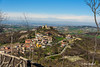
Sant'alosio is a little village on the top of a high hill in the south/east of Piedmont. The rocks are partially covered by the eastern tower and also by lots of vegetation, but you can still see some cup marks especially in winter without snow.
Some cups looks very old and little, one is bigger (20 cm) and, I think, more recent. From this place you have a great 360° view, you can see all the western Alps, Ligurian Appennino and hills.
You may be viewing yesterday's version of this page. To see the most up to date information please register for a free account.
Do not use the above information on other web sites or publications without permission of the contributor.
Nearby Images from Flickr
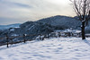
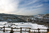
The above images may not be of the site on this page, but were taken nearby. They are loaded from Flickr so please click on them for image credits.
Click here to see more info for this site
Nearby sites
Click here to view sites on an interactive map of the areaKey: Red: member's photo, Blue: 3rd party photo, Yellow: other image, Green: no photo - please go there and take one, Grey: site destroyed
Download sites to:
KML (Google Earth)
GPX (GPS waypoints)
CSV (Garmin/Navman)
CSV (Excel)
To unlock full downloads you need to sign up as a Contributory Member. Otherwise downloads are limited to 50 sites.
Turn off the page maps and other distractions
Nearby sites listing. In the following links * = Image available
11.7km SSW 210° Libarna* Ancient Village or Settlement
34.0km WNW 288° Pietra Guaritrice di Villa del Foro* Standing Stone (Menhir)
37.5km SSW 201° Issel's Cup Mark Stone Rock Art
37.5km SSW 201° Giutte Cairn Cairn
42.7km SSW 210° Faiallo's standing stone (2)* Standing Stone (Menhir)
43.1km SSW 210° Faiallo's Stone* Standing Stone (Menhir)
48.6km SW 215° Della Biscia Pria Scugia Engraved stone Rock Art
48.8km SW 216° Della Biscia Dolmen Burial Chamber or Dolmen
52.4km SW 215° Faie Cup Mark Stone Rock Art
52.9km SW 215° Ceresa Rock Altar* Natural Stone / Erratic / Other Natural Feature
53.1km SW 215° Monte Beigua Strada Megalitica* Ancient Trackway
53.1km SW 215° South Beigua Menhir* Standing Stone (Menhir)
53.2km SW 219° Bric Aliberti Engraved stone Rock Art
53.2km SW 216° Ceresa Menhir 2* Standing Stone (Menhir)
53.3km SW 216° Ceresa Cup Mark Stone Rock Art
53.3km SW 216° Ceresa Menhir 1* Standing Stone (Menhir)
53.4km SW 216° Ceresa Engraved Stone* Rock Art
53.4km SW 216° Ceresa Marked Stone* Rock Art
54.2km SW 217° U Nicciu du Briccu du Broxin Christianised Menhir Early Christian Sculptured Stone
54.9km SSW 209° Cian da Munega Menhir* Standing Stone (Menhir)
61.5km SSE 150° Museo Archeologico di Chiavari Museum
76.7km NNE 14° Civico Museo Archeologico di Milano Museum
77.3km SW 235° Belbo Spring Menhir Standing Stone (Menhir)
79.5km SW 218° Riparo di Rocca Due Teste* Ancient Village or Settlement
79.9km SW 214° Pian del Ciliegio Rock Shelter* Cave or Rock Shelter
View more nearby sites and additional images


 We would like to know more about this location. Please feel free to add a brief description and any relevant information in your own language.
 Wir möchten mehr über diese Stätte erfahren. Bitte zögern Sie nicht, eine kurze Beschreibung und relevante Informationen in Deutsch hinzuzufügen.
 Nous aimerions en savoir encore un peu sur les lieux. S'il vous plaît n'hesitez pas à ajouter une courte description et tous les renseignements pertinents dans votre propre langue.
 Quisieramos informarnos un poco más de las lugares. No dude en añadir una breve descripción y otros datos relevantes en su propio idioma.