<< Our Photo Pages >> Kristofferhaugen - Round Barrow(s) in Norway in Telemark
Submitted by kenntha88 on Friday, 16 October 2015 Page Views: 779
Neolithic and Bronze AgeSite Name: Kristofferhaugen Alternative Name: BastuhaugenCountry: Norway
NOTE: This site is 1.048 km away from the location you searched for.
Fylke: Telemark Type: Round Barrow(s)
Nearest Town: Seljord
Latitude: 59.482171N Longitude: 8.636611E
Condition:
| 5 | Perfect |
| 4 | Almost Perfect |
| 3 | Reasonable but with some damage |
| 2 | Ruined but still recognisable as an ancient site |
| 1 | Pretty much destroyed, possibly visible as crop marks |
| 0 | No data. |
| -1 | Completely destroyed |
| 5 | Superb |
| 4 | Good |
| 3 | Ordinary |
| 2 | Not Good |
| 1 | Awful |
| 0 | No data. |
| 5 | Can be driven to, probably with disabled access |
| 4 | Short walk on a footpath |
| 3 | Requiring a bit more of a walk |
| 2 | A long walk |
| 1 | In the middle of nowhere, a nightmare to find |
| 0 | No data. |
| 5 | co-ordinates taken by GPS or official recorded co-ordinates |
| 4 | co-ordinates scaled from a detailed map |
| 3 | co-ordinates scaled from a bad map |
| 2 | co-ordinates of the nearest village |
| 1 | co-ordinates of the nearest town |
| 0 | no data |
Internal Links:
External Links:
")
On the top of a small hill and at the edge of the road to Nes camping is a round barrow. It is very easy to notice because it is covered only with some larger trees and grass. The barrow is called Kristofferhaugen or Bastuhaugen.
The barrow is 24 metres in diameter and 2,5 metres in height. It has a small crater on top and a clear ditch around its edges.
You may be viewing yesterday's version of this page. To see the most up to date information please register for a free account.
")
")
")
Do not use the above information on other web sites or publications without permission of the contributor.
Nearby Images from Flickr


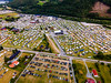
The above images may not be of the site on this page, but were taken nearby. They are loaded from Flickr so please click on them for image credits.
Click here to see more info for this site
Nearby sites
Click here to view sites on an interactive map of the areaKey: Red: member's photo, Blue: 3rd party photo, Yellow: other image, Green: no photo - please go there and take one, Grey: site destroyed
Download sites to:
KML (Google Earth)
GPX (GPS waypoints)
CSV (Garmin/Navman)
CSV (Excel)
To unlock full downloads you need to sign up as a Contributory Member. Otherwise downloads are limited to 50 sites.
Turn off the page maps and other distractions
Nearby sites listing. In the following links * = Image available
1.1km WSW 240° Fesjåplassen* Round Barrow(s)
22.3km ESE 104° Breskelimogane* Barrow Cemetery
22.5km ESE 113° Trellsborg hillfort* Hillfort
22.8km ESE 103° Breskelivegen* Round Barrow(s)
26.5km ESE 107° Grivi* Round Barrow(s)
27.2km ESE 104° Steinmerra* Rock Art
27.2km ESE 103° Gåra Gravfelt* Barrow Cemetery
29.1km ESE 103° Gullhaugen-Alstadhaug* Round Barrow(s)
30.1km ESE 106° Leikvang* Barrow Cemetery
31.0km ESE 109° Håtveit Barrows* Round Barrow(s)
33.5km ENE 72° Semhaugen* Round Barrow(s)
33.5km ESE 108° Nesbyen-Tinghaug* Modern Stone Circle etc
35.3km ESE 110° Neshaugen* Round Barrow(s)
36.1km WSW 257° Skafsås kirke* Standing Stones
36.7km SE 131° Tyri-Vedlandsvegen* Barrow Cemetery
37.7km SSW 196° Fjonemøane* Barrow Cemetery
38.7km E 101° Briskemoen* Barrow Cemetery
42.8km NW 306° Sporaneset* Rock Art
44.0km SW 226° Skeisteinen Runestone* Carving
45.5km SW 223° Øyskogen* Barrow Cemetery
47.3km SW 225° Røykjenessteinen Runestone* Carving
47.4km WNW 288° Dronninghaugen* Round Barrow(s)
49.7km S 189° Aaralfeltet barrow cemetery* Barrow Cemetery
57.0km SW 215° Berge Runestone* Carving
58.8km ESE 114° Nøklegård* Round Barrow(s)
View more nearby sites and additional images


 We would like to know more about this location. Please feel free to add a brief description and any relevant information in your own language.
 Wir möchten mehr über diese Stätte erfahren. Bitte zögern Sie nicht, eine kurze Beschreibung und relevante Informationen in Deutsch hinzuzufügen.
 Nous aimerions en savoir encore un peu sur les lieux. S'il vous plaît n'hesitez pas à ajouter une courte description et tous les renseignements pertinents dans votre propre langue.
 Quisieramos informarnos un poco más de las lugares. No dude en añadir una breve descripción y otros datos relevantes en su propio idioma.