

<< Our Photo Pages >> Wallburg Kahle - Hillfort in Germany in North Rhine-Westphalia
Submitted by Harald_Platta on Monday, 02 November 2015 Page Views: 722
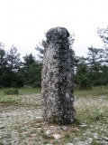
Iron Age and Later PrehistorySite Name: Wallburg KahleCountry: Germany
NOTE: This site is 0.604 km away from the location you searched for.
Land: North Rhine-Westphalia Type: Hillfort
Nearest Town: Lennestadt
Latitude: 51.121528N Longitude: 8.076056E
Condition:
| 5 | Perfect |
| 4 | Almost Perfect |
| 3 | Reasonable but with some damage |
| 2 | Ruined but still recognisable as an ancient site |
| 1 | Pretty much destroyed, possibly visible as crop marks |
| 0 | No data. |
| -1 | Completely destroyed |
| 5 | Superb |
| 4 | Good |
| 3 | Ordinary |
| 2 | Not Good |
| 1 | Awful |
| 0 | No data. |
| 5 | Can be driven to, probably with disabled access |
| 4 | Short walk on a footpath |
| 3 | Requiring a bit more of a walk |
| 2 | A long walk |
| 1 | In the middle of nowhere, a nightmare to find |
| 0 | No data. |
| 5 | co-ordinates taken by GPS or official recorded co-ordinates |
| 4 | co-ordinates scaled from a detailed map |
| 3 | co-ordinates scaled from a bad map |
| 2 | co-ordinates of the nearest village |
| 1 | co-ordinates of the nearest town |
| 0 | no data |
Internal Links:
External Links:
I have visited· I would like to visit
Janek visited on 15th Jul 2019 - their rating: Cond: 2 Amb: 3 Access: 4
")
The enclosure is situated on the top of a hill and is divided in three terraces. The ramparts are still up to 2 m high. A melting furnace was found inside the enclosure.
Text Reference:
[01] Lukanow, S.: Fundchronik des Kreises Olpe (1984).
You may be viewing yesterday's version of this page. To see the most up to date information please register for a free account.
")
Do not use the above information on other web sites or publications without permission of the contributor.
Nearby Images from Flickr


The above images may not be of the site on this page, but were taken nearby. They are loaded from Flickr so please click on them for image credits.
Click here to see more info for this site
Nearby sites
Click here to view sites on an interactive map of the areaKey: Red: member's photo, Blue: 3rd party photo, Yellow: other image, Green: no photo - please go there and take one, Grey: site destroyed
Download sites to:
KML (Google Earth)
GPX (GPS waypoints)
CSV (Garmin/Navman)
CSV (Excel)
To unlock full downloads you need to sign up as a Contributory Member. Otherwise downloads are limited to 50 sites.
Turn off the page maps and other distractions
Nearby sites listing. In the following links * = Image available
3.2km NW 322° Wallburg Weilenscheid* Hillfort
6.3km WNW 298° Wallburg Borghausen Hillfort
8.1km E 101° Heiligenborn Saalhausen Holy Well or Sacred Spring
8.2km WSW 239° Wallburg Hofkühl* Hillfort
8.3km NNE 12° Schoendelt Hexenstein* Rock Art
8.6km WSW 248° Wallburg Jäckelchen* Hillfort
18.1km ENE 79° Wallburg Wilzenberg* Hillfort
18.6km ESE 118° Wallburg Aue* Hillfort
20.5km E 90° Altarstein Latrop* Natural Stone / Erratic / Other Natural Feature
21.5km SSE 165° Alte Burg Obernau* Hillfort
25.6km SSE 152° Siegquelle* Holy Well or Sacred Spring
26.7km E 99° Wallburg Wemlinghausen* Hillfort
26.8km NNE 21° Stesser Burg* Hillfort
27.3km NNW 331° Museum für Vor- und Frühgeschichte Balve* Museum
27.5km S 187° Siegerlandmuseum* Museum
28.1km NNW 330° Balver Höhle* Cave or Rock Shelter
28.6km SW 225° Dreiherrenstein am Kamp* Marker Stone
29.5km NNW 333° Dahlmann Höhle* Cave or Rock Shelter
29.6km NNW 327° In den Gleiern* Hillfort
29.6km SSW 195° Siegen La Tène Ironworks Ancient Mine, Quarry or other Industry
29.8km NNW 332° Volkringhauser Höhle* Cave or Rock Shelter
29.9km WSW 248° Heiliger Brunnen Wiedenest* Holy Well or Sacred Spring
30.0km SSE 151° Heilige Ilsequelle* Holy Well or Sacred Spring
30.2km NE 48° Venetianer-Stollen* Ancient Mine, Quarry or other Industry
30.3km SE 133° Alte Burg (Wittgenstein)* Hillfort
View more nearby sites and additional images

 We would like to know more about this location. Please feel free to add a brief description and any relevant information in your own language.
 Wir möchten mehr über diese Stätte erfahren. Bitte zögern Sie nicht, eine kurze Beschreibung und relevante Informationen in Deutsch hinzuzufügen.
 Nous aimerions en savoir encore un peu sur les lieux. S'il vous plaît n'hesitez pas à ajouter une courte description et tous les renseignements pertinents dans votre propre langue.
 Quisieramos informarnos un poco más de las lugares. No dude en añadir una breve descripción y otros datos relevantes en su propio idioma.