<< Text Pages >> Crête-des-Barmes, St. Leonard - Rock Art in Switzerland in Wallis
Submitted by AlexHunger on Saturday, 18 February 2006 Page Views: 5028
Rock ArtSite Name: Crête-des-Barmes, St. LeonardCountry: Switzerland
NOTE: This site is 13.725 km away from the location you searched for.
Canton: Wallis Type: Rock Art
Nearest Town: Sion Nearest Village: Saint-Léonard
Latitude: 46.263480N Longitude: 7.419140E
Condition:
| 5 | Perfect |
| 4 | Almost Perfect |
| 3 | Reasonable but with some damage |
| 2 | Ruined but still recognisable as an ancient site |
| 1 | Pretty much destroyed, possibly visible as crop marks |
| 0 | No data. |
| -1 | Completely destroyed |
| 5 | Superb |
| 4 | Good |
| 3 | Ordinary |
| 2 | Not Good |
| 1 | Awful |
| 0 | No data. |
| 5 | Can be driven to, probably with disabled access |
| 4 | Short walk on a footpath |
| 3 | Requiring a bit more of a walk |
| 2 | A long walk |
| 1 | In the middle of nowhere, a nightmare to find |
| 0 | No data. |
| 5 | co-ordinates taken by GPS or official recorded co-ordinates |
| 4 | co-ordinates scaled from a detailed map |
| 3 | co-ordinates scaled from a bad map |
| 2 | co-ordinates of the nearest village |
| 1 | co-ordinates of the nearest town |
| 0 | no data |
Internal Links:
External Links:
I have visited· I would like to visit
aolson couldn't find on 21st Aug 1999 We approached the site from the south aiming for 46.265, 7.42044, but those coordinates were located seemingly on the face of a cliff. Further research is needed before the second attempt. Perhaps the pictures are of a vertical face best accessed from the N/NW.
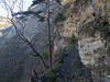
IMPORTANT NOTE: Position of site unknown, co-ordinates given for nearest village. Natural cliff face north of town with a multitude of carvings and cup holes.
You may be viewing yesterday's version of this page. To see the most up to date information please register for a free account.
Do not use the above information on other web sites or publications without permission of the contributor.
Nearby Images from Flickr
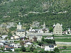
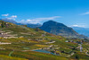
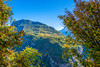

The above images may not be of the site on this page, but were taken nearby. They are loaded from Flickr so please click on them for image credits.
Click here to see more info for this site
Nearby sites
Click here to view sites on an interactive map of the areaKey: Red: member's photo, Blue: 3rd party photo, Yellow: other image, Green: no photo - please go there and take one, Grey: site destroyed
Download sites to:
KML (Google Earth)
GPX (GPS waypoints)
CSV (Garmin/Navman)
CSV (Excel)
To unlock full downloads you need to sign up as a Contributory Member. Otherwise downloads are limited to 50 sites.
Turn off the page maps and other distractions
Nearby sites listing. In the following links * = Image available
944m S 171° St-Léonard Menhirs Stone Row / Alignment
5.3km WSW 237° Dolmen Don Bosco* Burial Chamber or Dolmen
6.2km SW 235° Chemin des Collines Menhirs* Stone Row / Alignment
6.3km WSW 236° Sion Steinkistengrab* Burial Chamber or Dolmen
14.6km ESE 109° Pierre des Sauvages Rock Art
17.6km SSE 158° Les Pierres aux Fees Rock Art
30.4km W 277° Menhirs de Chessières* Standing Stones
30.5km E 80° Heidnisch Biel Hillfort
34.8km ESE 104° Heidnische Tossu Modern Dolmen* Modern Stone Circle etc
36.7km SE 140° Heidenstein Ofenen Rock Art
44.2km E 81° Naters Heidenstein Standing Stone (Menhir)
52.8km NNW 335° Menhir La Roche* Standing Stone (Menhir)
57.7km S 181° Vollein Necropolis Barrow Cemetery
59.1km NW 306° Pierre du dos á l'âne* Standing Stone (Menhir)
59.5km S 189° Saint Martin de Corleans Dolmen* Burial Chamber or Dolmen
62.3km WNW 296° Lutry Menhirs* Stone Circle
63.7km NNW 339° Bois de Moncor Artificial Mound
66.5km E 84° Crampiolo* Sculptured Stone
66.8km WNW 296° Musee cantonal de Lausanne* Museum
67.0km E 83° Montorfano* Sculptured Stone
68.2km E 98° Masso coppellato Alpe La Prasca* Sculptured Stone
69.4km E 90° Sasso Coppellato* Sculptured Stone
70.8km E 92° Muro del Diavolo* Ancient Temple
72.2km W 276° La Pierre du Diable (Allinges) Rock Art
73.8km W 277° Musée Archéologique (Allinges) Museum
View more nearby sites and additional images


 We would like to know more about this location. Please feel free to add a brief description and any relevant information in your own language.
 Wir möchten mehr über diese Stätte erfahren. Bitte zögern Sie nicht, eine kurze Beschreibung und relevante Informationen in Deutsch hinzuzufügen.
 Nous aimerions en savoir encore un peu sur les lieux. S'il vous plaît n'hesitez pas à ajouter une courte description et tous les renseignements pertinents dans votre propre langue.
 Quisieramos informarnos un poco más de las lugares. No dude en añadir una breve descripción y otros datos relevantes en su propio idioma.