

<< Our Photo Pages >> Flatelandsmoen - Barrow Cemetery in Norway in Aust-Agder
Submitted by kenntha88 on Saturday, 10 October 2020 Page Views: 325
Neolithic and Bronze AgeSite Name: FlatelandsmoenCountry: Norway
NOTE: This site is 23.744 km away from the location you searched for.
Fylke: Aust-Agder Type: Barrow Cemetery
Nearest Village: Valle
Latitude: 59.247094N Longitude: 7.479446E
Condition:
| 5 | Perfect |
| 4 | Almost Perfect |
| 3 | Reasonable but with some damage |
| 2 | Ruined but still recognisable as an ancient site |
| 1 | Pretty much destroyed, possibly visible as crop marks |
| 0 | No data. |
| -1 | Completely destroyed |
| 5 | Superb |
| 4 | Good |
| 3 | Ordinary |
| 2 | Not Good |
| 1 | Awful |
| 0 | No data. |
| 5 | Can be driven to, probably with disabled access |
| 4 | Short walk on a footpath |
| 3 | Requiring a bit more of a walk |
| 2 | A long walk |
| 1 | In the middle of nowhere, a nightmare to find |
| 0 | No data. |
| 5 | co-ordinates taken by GPS or official recorded co-ordinates |
| 4 | co-ordinates scaled from a detailed map |
| 3 | co-ordinates scaled from a bad map |
| 2 | co-ordinates of the nearest village |
| 1 | co-ordinates of the nearest town |
| 0 | no data |
Internal Links:
External Links:
")
Flatelandsmoen is an extensive barrow cemetery located on a flat natural sand terrace overlooking the Driva river to the west and a side river to the south east. The terrace and barrow cemetery is stretching around 180 metres south-west to noth-east and around 90 metres wide with the majority of barrows found at the south edge of the terrace. A small road goes straight trough the cemetery.
The cemetery has no brush or large trees vegetation and the barrows only have short moss and grass growing on them, making them very easy to see and photograph. Most of the barrows are medium-sized to small but one very large barrow stands out. In all there are 39 barrow in this cemetery, all of them look to be round barrows.
The largest barrow is called "Koshaug", it is around 30 metres in diameter and 5-6 metres in height. It has a beautiful shape and it previously had a huge crater in the top. The crater was filled in and the barrow restored in 1975.
There are three round barrows forming a triangle in the center of the cemetery, they are 12 to 16 metres in diameter and 1 to 2 metres in height. A line of five barrows are located at the south-west edge of the terrace, they are around 10-12 metres in diameter and 1 to 1,5 metres in height.
The rest of the barrows in the cemetery range in size from 6 to 9 metres and up to 0,5 metres in height. Another two medium sized barrows are so close to the old road that the edge of the barrows have been cut away by the road.
You may be viewing yesterday's version of this page. To see the most up to date information please register for a free account.
")
")
")
")
")
")
")
")
")
")
")
")
")
")
")
Do not use the above information on other web sites or publications without permission of the contributor.
Click here to see more info for this site
Nearby sites
Click here to view sites on an interactive map of the areaKey: Red: member's photo, Blue: 3rd party photo, Yellow: other image, Green: no photo - please go there and take one, Grey: site destroyed
Download sites to:
KML (Google Earth)
GPX (GPS waypoints)
CSV (Garmin/Navman)
CSV (Excel)
To unlock full downloads you need to sign up as a Contributory Member. Otherwise downloads are limited to 50 sites.
Turn off the page maps and other distractions
Nearby sites listing. In the following links * = Image available
4.9km SE 146° Nomelandshaugen* Round Barrow(s)
5.9km SE 145° Rike Standing Stone* Standing Stone (Menhir)
6.0km SE 143° Fagerbakk* Barrow Cemetery
15.5km S 172° Hovetvegen-Haugane* Barrow Cemetery
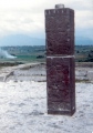
21.3km SSE 166° Shieldmaidens Arrow* Standing Stone (Menhir)
30.2km SSE 167° Sordal Nordre* Barrow Cemetery
31.8km SSE 160° Heistad Barrow* Round Barrow(s)
33.5km ESE 103° Røykjenessteinen Runestone* Carving
34.2km SSE 160° Austad Gamle Kirkested* Standing Stones
34.8km E 98° Skeisteinen Runestone* Carving
35.2km ENE 59° Skafsås kirke* Standing Stones
35.5km ESE 101° Øyskogen* Barrow Cemetery
39.5km ESE 122° Berge Runestone* Carving
45.3km NNE 26° Dronninghaugen* Round Barrow(s)
49.1km SSE 159° Hanehaug* Barrow Cemetery
49.7km SSE 159° Bygland Phallic Stones* Stone Row / Alignment
56.6km E 100° Fjonemøane* Barrow Cemetery
59.9km NNE 31° Sporaneset* Rock Art
60.8km ESE 123° Eikhom Pottholes* Natural Stone / Erratic / Other Natural Feature
63.0km ESE 111° Aaralfeltet barrow cemetery* Barrow Cemetery
63.2km SSE 162° Lande Runestone* Carving
64.5km WNW 292° Neset* Ancient Village or Settlement
64.7km WNW 293° Ritland barrow cemetery* Barrow Cemetery
69.5km ENE 68° Fesjåplassen* Round Barrow(s)
70.2km S 184° Sosteli* Ancient Village or Settlement
View more nearby sites and additional images


 We would like to know more about this location. Please feel free to add a brief description and any relevant information in your own language.
 Wir möchten mehr über diese Stätte erfahren. Bitte zögern Sie nicht, eine kurze Beschreibung und relevante Informationen in Deutsch hinzuzufügen.
 Nous aimerions en savoir encore un peu sur les lieux. S'il vous plaît n'hesitez pas à ajouter une courte description et tous les renseignements pertinents dans votre propre langue.
 Quisieramos informarnos un poco más de las lugares. No dude en añadir una breve descripción y otros datos relevantes en su propio idioma.