<< Text Pages >> Tirsin Plateau - Rock Art in Turkey
Submitted by davidmorgan on Thursday, 23 October 2014 Page Views: 1788
Rock ArtSite Name: Tirsin Plateau Alternative Name: Tırşin YaylasıCountry: Turkey Type: Rock Art
Nearest Town: Hakkari
Latitude: 37.575522N Longitude: 43.735808E
Condition:
| 5 | Perfect |
| 4 | Almost Perfect |
| 3 | Reasonable but with some damage |
| 2 | Ruined but still recognisable as an ancient site |
| 1 | Pretty much destroyed, possibly visible as crop marks |
| 0 | No data. |
| -1 | Completely destroyed |
| 5 | Superb |
| 4 | Good |
| 3 | Ordinary |
| 2 | Not Good |
| 1 | Awful |
| 0 | No data. |
| 5 | Can be driven to, probably with disabled access |
| 4 | Short walk on a footpath |
| 3 | Requiring a bit more of a walk |
| 2 | A long walk |
| 1 | In the middle of nowhere, a nightmare to find |
| 0 | No data. |
| 5 | co-ordinates taken by GPS or official recorded co-ordinates |
| 4 | co-ordinates scaled from a detailed map |
| 3 | co-ordinates scaled from a bad map |
| 2 | co-ordinates of the nearest village |
| 1 | co-ordinates of the nearest town |
| 0 | no data |
Be the first person to rate this site - see the 'Contribute!' box in the right hand menu.
Internal Links:
External Links:
Rock Art in Hakkari Province, Turkey
10,000-year-old rock art depicting "mountain goats, wild deer, snakes and humans".
You may be viewing yesterday's version of this page. To see the most up to date information please register for a free account.
Do not use the above information on other web sites or publications without permission of the contributor.
Nearby Images from Flickr
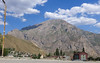
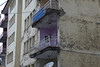
The above images may not be of the site on this page, but were taken nearby. They are loaded from Flickr so please click on them for image credits.
Click here to see more info for this site
Nearby sites
Click here to view sites on an interactive map of the areaKey: Red: member's photo, Blue: 3rd party photo, Yellow: other image, Green: no photo - please go there and take one, Grey: site destroyed
Download sites to:
KML (Google Earth)
GPX (GPS waypoints)
CSV (Garmin/Navman)
CSV (Excel)
To unlock full downloads you need to sign up as a Contributory Member. Otherwise downloads are limited to 50 sites.
Turn off the page maps and other distractions
Nearby sites listing. In the following links * = Image available
73.0km N 4° Yurtbasi Hillfort
89.7km NNW 344° Sardurihinili* Ancient Palace
96.5km SSE 153° Shanidar Cave Cave or Rock Shelter
97.9km NNW 332° Samran Channel* Ancient Mine, Quarry or other Industry
108.8km NNW 342° Urartu Museum Museum
109.0km NNW 341° Tushpa* Ancient Village or Settlement
109.2km NNW 345° Rusahinili* Hillfort
111.8km NNW 348° Anzaf Hillfort
114.1km NNW 343° Kalecik Stones Standing Stones
123.6km SSW 201° Tepe Gawra Ancient Village or Settlement
126.4km WSW 250° Amarsava Ancient Village or Settlement
126.8km SSW 201° Dur-Sharrukin* Ancient Village or Settlement
134.1km NNW 340° Ayanis Hillfort
143.9km SSW 201° Nineveh* Ancient Village or Settlement
148.8km N 0° Körzüt Castle* Hillfort
158.6km S 171° Arbil, Iraq* Ancient Village or Settlement
165.1km ESE 112° Hasanlu Tepe Ancient Village or Settlement
165.7km NNW 328° Kef Kalesi Hillfort
166.8km ESE 112° Hajji Firuz Tepe Ancient Village or Settlement
167.2km W 269° Cemka Hoyugu* Ancient Village or Settlement
167.9km W 269° Boncuklu Tarla* Ancient Temple
168.2km SSW 193° Nimrud* Ancient Village or Settlement
169.0km W 269° Zeviya Tivilki Ancient Village or Settlement
169.2km W 276° Güzir Höyük Ancient Village or Settlement
179.0km WSW 242° Tell Hamoukar Ancient Village or Settlement
View more nearby sites and additional images


 We would like to know more about this location. Please feel free to add a brief description and any relevant information in your own language.
 Wir möchten mehr über diese Stätte erfahren. Bitte zögern Sie nicht, eine kurze Beschreibung und relevante Informationen in Deutsch hinzuzufügen.
 Nous aimerions en savoir encore un peu sur les lieux. S'il vous plaît n'hesitez pas à ajouter une courte description et tous les renseignements pertinents dans votre propre langue.
 Quisieramos informarnos un poco más de las lugares. No dude en añadir una breve descripción y otros datos relevantes en su propio idioma.