 with our Megalithic Portal iPhone app")


<< Text Pages >> Kalecik Stones - Standing Stones in Turkey
Submitted by Andy B on Monday, 29 May 2006 Page Views: 6891
Neolithic and Bronze AgeSite Name: Kalecik StonesCountry: Turkey Type: Standing Stones
Nearest Town: Van Nearest Village: Kalecik
Latitude: 38.555613N Longitude: 43.351830E
Condition:
| 5 | Perfect |
| 4 | Almost Perfect |
| 3 | Reasonable but with some damage |
| 2 | Ruined but still recognisable as an ancient site |
| 1 | Pretty much destroyed, possibly visible as crop marks |
| 0 | No data. |
| -1 | Completely destroyed |
| 5 | Superb |
| 4 | Good |
| 3 | Ordinary |
| 2 | Not Good |
| 1 | Awful |
| 0 | No data. |
| 5 | Can be driven to, probably with disabled access |
| 4 | Short walk on a footpath |
| 3 | Requiring a bit more of a walk |
| 2 | A long walk |
| 1 | In the middle of nowhere, a nightmare to find |
| 0 | No data. |
| 5 | co-ordinates taken by GPS or official recorded co-ordinates |
| 4 | co-ordinates scaled from a detailed map |
| 3 | co-ordinates scaled from a bad map |
| 2 | co-ordinates of the nearest village |
| 1 | co-ordinates of the nearest town |
| 0 | no data |
Be the first person to rate this site - see the 'Contribute!' box in the right hand menu.
Internal Links:
External Links:
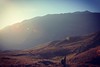
Standing Stones in Van Province, Turkey. The stone hoops and obelisks, which are in 1.5 km north-east of Kalecik village, near Van, and which belong to the Urartu period.
Work continues to solve the mystery of the 2,475 stones, which are believed to be related with astronomy, and which were arranged into a 400 square meters area.
You may be viewing yesterday's version of this page. To see the most up to date information please register for a free account.
Do not use the above information on other web sites or publications without permission of the contributor.
Nearby Images from Flickr
The above images may not be of the site on this page, but were taken nearby. They are loaded from Flickr so please click on them for image credits.
Click here to see more info for this site
Nearby sites
Click here to view sites on an interactive map of the areaKey: Red: member's photo, Blue: 3rd party photo, Yellow: other image, Green: no photo - please go there and take one, Grey: site destroyed
Download sites to:
KML (Google Earth)
GPX (GPS waypoints)
CSV (Garmin/Navman)
CSV (Excel)
To unlock full downloads you need to sign up as a Contributory Member. Otherwise downloads are limited to 50 sites.
Turn off the page maps and other distractions
Nearby sites listing. In the following links * = Image available
5.8km SE 131° Rusahinili* Hillfort
5.8km S 188° Urartu Museum Museum
6.0km SSW 194° Tushpa* Ancient Village or Settlement
10.4km E 88° Anzaf Hillfort
20.9km NW 324° Ayanis Hillfort
24.4km SSE 158° Sardurihinili* Ancient Palace
25.7km SSW 209° Samran Channel* Ancient Mine, Quarry or other Industry
52.4km NE 40° Körzüt Castle* Hillfort
52.4km SE 133° Yurtbasi Hillfort
63.0km WNW 300° Kef Kalesi Hillfort
85.2km NNW 331° Giriktepe Ancient Village or Settlement
114.1km SSE 163° Tirsin Plateau Rock Art
162.4km SW 236° Güzir Höyük Ancient Village or Settlement
165.5km WNW 291° Kayalidere Ancient Village or Settlement
169.9km N 5° Asagi Aktasli Ancient Palace
170.7km WNW 291° Tepekoy* Ancient Village or Settlement
171.5km WSW 246° Ayngerm Yani Ancient Village or Settlement
174.5km SSW 209° Amarsava Ancient Village or Settlement
175.2km SW 230° Cemka Hoyugu* Ancient Village or Settlement
175.3km SW 230° Boncuklu Tarla* Ancient Temple
175.8km SW 230° Zeviya Tivilki Ancient Village or Settlement
180.7km NE 35° Artashat Ancient Village or Settlement
181.0km NE 35° Khor Virap* Early Christian Sculptured Stone
187.7km NE 52° Ovchular Tepe Ancient Village or Settlement
187.7km W 259° Hallan Cemi Tepe Ancient Village or Settlement
View more nearby sites and additional images


 We would like to know more about this location. Please feel free to add a brief description and any relevant information in your own language.
 Wir möchten mehr über diese Stätte erfahren. Bitte zögern Sie nicht, eine kurze Beschreibung und relevante Informationen in Deutsch hinzuzufügen.
 Nous aimerions en savoir encore un peu sur les lieux. S'il vous plaît n'hesitez pas à ajouter une courte description et tous les renseignements pertinents dans votre propre langue.
 Quisieramos informarnos un poco más de las lugares. No dude en añadir una breve descripción y otros datos relevantes en su propio idioma.