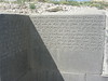
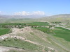
<< Our Photo Pages >> Sardurihinili - Ancient Palace in Turkey
Submitted by davidmorgan on Monday, 19 December 2016 Page Views: 9495
DigsSite Name: Sardurihinili Alternative Name: ÇavuştepeCountry: Turkey
NOTE: This site is 0.376 km away from the location you searched for.
Type: Ancient Palace
Nearest Town: Van
Latitude: 38.351888N Longitude: 43.456948E
Condition:
| 5 | Perfect |
| 4 | Almost Perfect |
| 3 | Reasonable but with some damage |
| 2 | Ruined but still recognisable as an ancient site |
| 1 | Pretty much destroyed, possibly visible as crop marks |
| 0 | No data. |
| -1 | Completely destroyed |
| 5 | Superb |
| 4 | Good |
| 3 | Ordinary |
| 2 | Not Good |
| 1 | Awful |
| 0 | No data. |
| 5 | Can be driven to, probably with disabled access |
| 4 | Short walk on a footpath |
| 3 | Requiring a bit more of a walk |
| 2 | A long walk |
| 1 | In the middle of nowhere, a nightmare to find |
| 0 | No data. |
| 5 | co-ordinates taken by GPS or official recorded co-ordinates |
| 4 | co-ordinates scaled from a detailed map |
| 3 | co-ordinates scaled from a bad map |
| 2 | co-ordinates of the nearest village |
| 1 | co-ordinates of the nearest town |
| 0 | no data |
Internal Links:
External Links:
I have visited· I would like to visit
Jansold visited on 16th Sep 2011 - their rating: Cond: 2 Amb: 3 Access: 4
")
Note: 2800-year-old sewage system unearthed in Turkey
You may be viewing yesterday's version of this page. To see the most up to date information please register for a free account.
Do not use the above information on other web sites or publications without permission of the contributor.
Nearby Images from Flickr


The above images may not be of the site on this page, but were taken nearby. They are loaded from Flickr so please click on them for image credits.
Click here to see more info for this site
Nearby sites
Click here to view sites on an interactive map of the areaKey: Red: member's photo, Blue: 3rd party photo, Yellow: other image, Green: no photo - please go there and take one, Grey: site destroyed
Download sites to:
KML (Google Earth)
GPX (GPS waypoints)
CSV (Garmin/Navman)
CSV (Excel)
To unlock full downloads you need to sign up as a Contributory Member. Otherwise downloads are limited to 50 sites.
Turn off the page maps and other distractions
Nearby sites listing. In the following links * = Image available
19.4km NNW 346° Rusahinili* Hillfort
19.6km NNW 330° Urartu Museum Museum
19.9km NNW 328° Tushpa* Ancient Village or Settlement
21.4km W 270° Samran Channel* Ancient Mine, Quarry or other Industry
23.1km N 3° Anzaf Hillfort
24.4km NNW 338° Kalecik Stones Standing Stones
31.8km ESE 115° Yurtbasi Hillfort
45.0km NNW 332° Ayanis Hillfort
67.3km NNE 22° Körzüt Castle* Hillfort
83.5km NW 310° Kef Kalesi Hillfort
89.7km SSE 164° Tirsin Plateau Rock Art
109.5km NNW 333° Giriktepe Ancient Village or Settlement
159.1km WSW 245° Güzir Höyük Ancient Village or Settlement
160.3km SW 216° Amarsava Ancient Village or Settlement
169.1km WSW 237° Cemka Hoyugu* Ancient Village or Settlement
169.3km WSW 238° Boncuklu Tarla* Ancient Temple
169.9km WSW 238° Zeviya Tivilki Ancient Village or Settlement
172.5km WSW 254° Ayngerm Yani Ancient Village or Settlement
183.0km WNW 297° Kayalidere Ancient Village or Settlement
185.3km SSE 158° Shanidar Cave Cave or Rock Shelter
188.3km WNW 297° Tepekoy* Ancient Village or Settlement
191.0km WSW 249° Hasankeyf Hoyuk Ancient Village or Settlement
192.0km N 2° Asagi Aktasli Ancient Palace
192.5km WSW 249° Hasankeyf* Ancient Village or Settlement
194.1km W 267° Hallan Cemi Tepe Ancient Village or Settlement
View more nearby sites and additional images


 We would like to know more about this location. Please feel free to add a brief description and any relevant information in your own language.
 Wir möchten mehr über diese Stätte erfahren. Bitte zögern Sie nicht, eine kurze Beschreibung und relevante Informationen in Deutsch hinzuzufügen.
 Nous aimerions en savoir encore un peu sur les lieux. S'il vous plaît n'hesitez pas à ajouter une courte description et tous les renseignements pertinents dans votre propre langue.
 Quisieramos informarnos un poco más de las lugares. No dude en añadir una breve descripción y otros datos relevantes en su propio idioma.