<< Our Photo Pages >> Stukmaņu Pētera akmens - Natural Stone / Erratic / Other Natural Feature in Latvia
Submitted by Alta-Falisa on Saturday, 21 February 2015 Page Views: 1491
Natural PlacesSite Name: Stukmaņu Pētera akmens Alternative Name: Pļaviņu Pētera akmensCountry: Latvia
NOTE: This site is 41.227 km away from the location you searched for.
Type: Natural Stone / Erratic / Other Natural Feature
Nearest Town: Pļaviņas
Latitude: 56.604300N Longitude: 25.673000E
Condition:
| 5 | Perfect |
| 4 | Almost Perfect |
| 3 | Reasonable but with some damage |
| 2 | Ruined but still recognisable as an ancient site |
| 1 | Pretty much destroyed, possibly visible as crop marks |
| 0 | No data. |
| -1 | Completely destroyed |
| 5 | Superb |
| 4 | Good |
| 3 | Ordinary |
| 2 | Not Good |
| 1 | Awful |
| 0 | No data. |
| 5 | Can be driven to, probably with disabled access |
| 4 | Short walk on a footpath |
| 3 | Requiring a bit more of a walk |
| 2 | A long walk |
| 1 | In the middle of nowhere, a nightmare to find |
| 0 | No data. |
| 5 | co-ordinates taken by GPS or official recorded co-ordinates |
| 4 | co-ordinates scaled from a detailed map |
| 3 | co-ordinates scaled from a bad map |
| 2 | co-ordinates of the nearest village |
| 1 | co-ordinates of the nearest town |
| 0 | no data |
Internal Links:
External Links:
")
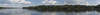
Easily accessible by car, about half-way between Rīga and Daugavpils along the highway A6. See Google Maps or similar : the stone stands on the side of an old road, now disused and replaced by the highway.
Information board nearby.
Ancient-monuments 'afficionados' will use this spot as a resting place, despite the (not too dense, in fact) traffic on the highway.
Photo : June 2014.
You may be viewing yesterday's version of this page. To see the most up to date information please register for a free account.
")
")
")
")
Do not use the above information on other web sites or publications without permission of the contributor.
Nearby Images from Flickr


The above images may not be of the site on this page, but were taken nearby. They are loaded from Flickr so please click on them for image credits.
Click here to see more info for this site
Nearby sites
Click here to view sites on an interactive map of the areaKey: Red: member's photo, Blue: 3rd party photo, Yellow: other image, Green: no photo - please go there and take one, Grey: site destroyed
Download sites to:
KML (Google Earth)
GPX (GPS waypoints)
CSV (Garmin/Navman)
CSV (Excel)
To unlock full downloads you need to sign up as a Contributory Member. Otherwise downloads are limited to 50 sites.
Turn off the page maps and other distractions
Nearby sites listing. In the following links * = Image available
13.6km W 281° Pastmuižas Velnakmens* Natural Stone / Erratic / Other Natural Feature
29.4km WNW 282° Meļķitāru Muldas akmens* Natural Stone / Erratic / Other Natural Feature
31.7km SE 129° Vaiķu Laukakmens* Natural Stone / Erratic / Other Natural Feature
33.7km W 275° Kraukļu akmens* Natural Stone / Erratic / Other Natural Feature
63.1km NNW 344° Ūdri (Pūķi) cross stone* Ancient Cross
69.9km SE 136° Nīcgales Lielais Akmens* Natural Stone / Erratic / Other Natural Feature
79.8km NW 322° Sigulda Pils* Modern Stone Circle etc
81.4km NW 322° Turaida Engraved Stone* Natural Stone / Erratic / Other Natural Feature
102.7km ENE 62° Medņu dižakmens* Natural Stone / Erratic / Other Natural Feature
102.7km WNW 293° Stone Head of Salaspils replica* Modern Stone Circle etc
103.0km WNW 292° Stone Head of Salaspils* Sculptured Stone
103.2km WNW 293° Latvian National History Museum* Museum
107.6km S 174° Lūžų akmuo su dubeniu* Holed Stone
110.7km NE 49° Jaunannas Akmen* Marker Stone
112.7km ENE 58° Lāča Darzs* Modern Stone Circle etc
117.1km NNW 346° Davini Great stone (Daviņu Lielais akmens)* Rock Art
117.6km SE 131° Ūdrīši Akmeņi* Modern Stone Circle etc
126.7km S 188° Zarasų akmuo su dubeniu* Holed Stone
126.7km S 188° Kilėviškių akmuo su dubeniu* Holed Stone
128.6km SSE 164° Vardžiukiemio akmuo* Natural Stone / Erratic / Other Natural Feature
130.3km SSW 197° Puntuko akmuo* Natural Stone / Erratic / Other Natural Feature
158.4km SSE 168° Bajorų akmuo* Natural Stone / Erratic / Other Natural Feature
159.1km W 270° Pokaini Forest* Ancient Village or Settlement
160.8km SSW 201° Ukmergės piliakalnis* Artificial Mound
161.2km SSE 168° Šventos akmuo* Natural Stone / Erratic / Other Natural Feature
View more nearby sites and additional images


 We would like to know more about this location. Please feel free to add a brief description and any relevant information in your own language.
 Wir möchten mehr über diese Stätte erfahren. Bitte zögern Sie nicht, eine kurze Beschreibung und relevante Informationen in Deutsch hinzuzufügen.
 Nous aimerions en savoir encore un peu sur les lieux. S'il vous plaît n'hesitez pas à ajouter une courte description et tous les renseignements pertinents dans votre propre langue.
 Quisieramos informarnos un poco más de las lugares. No dude en añadir una breve descripción y otros datos relevantes en su propio idioma.