<< Our Photo Pages >> Vranas Middle Helladic Graves - Chambered Tomb in Greece
Submitted by AlexHunger on Tuesday, 22 August 2006 Page Views: 5612
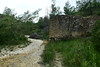
Neolithic and Bronze AgeSite Name: Vranas Middle Helladic GravesCountry: Greece
NOTE: This site is 8.474 km away from the location you searched for.
Type: Chambered Tomb
Nearest Town: Athens Nearest Village: Marathon
Latitude: 38.122250N Longitude: 23.946610E
Condition:
| 5 | Perfect |
| 4 | Almost Perfect |
| 3 | Reasonable but with some damage |
| 2 | Ruined but still recognisable as an ancient site |
| 1 | Pretty much destroyed, possibly visible as crop marks |
| 0 | No data. |
| -1 | Completely destroyed |
| 5 | Superb |
| 4 | Good |
| 3 | Ordinary |
| 2 | Not Good |
| 1 | Awful |
| 0 | No data. |
| 5 | Can be driven to, probably with disabled access |
| 4 | Short walk on a footpath |
| 3 | Requiring a bit more of a walk |
| 2 | A long walk |
| 1 | In the middle of nowhere, a nightmare to find |
| 0 | No data. |
| 5 | co-ordinates taken by GPS or official recorded co-ordinates |
| 4 | co-ordinates scaled from a detailed map |
| 3 | co-ordinates scaled from a bad map |
| 2 | co-ordinates of the nearest village |
| 1 | co-ordinates of the nearest town |
| 0 | no data |
Internal Links:
External Links:
I have visited· I would like to visit
bat400 visited on 20th May 2011 - their rating: Cond: 2 Amb: 3 Access: 4
")
Chambered tombs dating to between 2000 and 1200 BCE at the €15 million Marathon Museum. The excavated tombs are sheltered under a purpose built air conditioned pavilion, while a further unexcavated tomb still under its mound lies outside.
You may be viewing yesterday's version of this page. To see the most up to date information please register for a free account.
")
Do not use the above information on other web sites or publications without permission of the contributor.
Nearby Images from Flickr

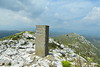
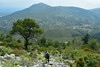
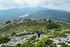
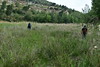
The above images may not be of the site on this page, but were taken nearby. They are loaded from Flickr so please click on them for image credits.
Click here to see more info for this site
Nearby sites
Click here to view sites on an interactive map of the areaKey: Red: member's photo, Blue: 3rd party photo, Yellow: other image, Green: no photo - please go there and take one, Grey: site destroyed
Download sites to:
KML (Google Earth)
GPX (GPS waypoints)
CSV (Garmin/Navman)
CSV (Excel)
To unlock full downloads you need to sign up as a Contributory Member. Otherwise downloads are limited to 50 sites.
Turn off the page maps and other distractions
Nearby sites listing. In the following links * = Image available
37m SSE 160° Marathon Museum* Museum
253m ENE 57° Tumulus of the Plataeans* Round Barrow(s)
698m E 98° Vranas Mycenaean Tholos* Chambered Cairn
1.9km ENE 67° Tsepi Early Helladic Graves* Chambered Tomb
2.8km E 100° Tumulus of the Athenians* Round Barrow(s)
3.6km SE 127° Sanctuary of the Egyptian Gods* Ancient Temple
4.0km NNW 342° Temple of Pythian Apollo* Ancient Temple
4.2km NNW 342° Pan Cave Cave or Rock Shelter
5.1km ENE 66° Trophy of the Athenians* Sculptured Stone
12.7km NNE 33° Ramnous Temple of Themis* Ancient Temple
12.7km NNE 33° Ramnous Temple of Nemesis* Ancient Temple
13.2km NNE 32° Ramnous* Hillfort
14.3km SSE 152° Askitario* Ancient Village or Settlement
16.8km SSE 161° Temple of Artemis Tauropolos* Ancient Temple
20.8km NNW 335° Amfiaraio* Ancient Temple
22.2km S 169° Vravrona Temple of Artemis* Ancient Temple
22.2km S 169° Vravrona Tomb of Iphigenia* Chambered Cairn
22.4km SSE 169° Vravrona Museum* Museum
23.9km SW 232° National Archaeological Museum Athens* Museum
24.2km SW 228° Cycladic Museum at Athens* Museum
24.3km W 266° Fili Fortress* Promontory Fort / Cliff Castle
25.2km SW 228° Temple of Olympian Zeus* Ancient Temple
25.5km SW 229° Acropolis Museum* Museum
25.5km SW 229° Erechteion* Ancient Temple
25.5km SW 229° Acropolis* Hillfort
View more nearby sites and additional images


 We would like to know more about this location. Please feel free to add a brief description and any relevant information in your own language.
 Wir möchten mehr über diese Stätte erfahren. Bitte zögern Sie nicht, eine kurze Beschreibung und relevante Informationen in Deutsch hinzuzufügen.
 Nous aimerions en savoir encore un peu sur les lieux. S'il vous plaît n'hesitez pas à ajouter une courte description et tous les renseignements pertinents dans votre propre langue.
 Quisieramos informarnos un poco más de las lugares. No dude en añadir una breve descripción y otros datos relevantes en su propio idioma.