

<< Our Photo Pages >> Cave of Nympholyptou - Cave or Rock Shelter in Greece in Central Greece
Submitted by Antonios on Monday, 20 April 2020 Page Views: 9972
Natural PlacesSite Name: Cave of Nympholyptou Alternative Name: Cave of Archedemos, Cave of PanCountry: Greece Region: Central Greece Type: Cave or Rock Shelter
Nearest Town: Vari Nearest Village: Voula
Latitude: 37.868371N Longitude: 23.791797E
Condition:
| 5 | Perfect |
| 4 | Almost Perfect |
| 3 | Reasonable but with some damage |
| 2 | Ruined but still recognisable as an ancient site |
| 1 | Pretty much destroyed, possibly visible as crop marks |
| 0 | No data. |
| -1 | Completely destroyed |
| 5 | Superb |
| 4 | Good |
| 3 | Ordinary |
| 2 | Not Good |
| 1 | Awful |
| 0 | No data. |
| 5 | Can be driven to, probably with disabled access |
| 4 | Short walk on a footpath |
| 3 | Requiring a bit more of a walk |
| 2 | A long walk |
| 1 | In the middle of nowhere, a nightmare to find |
| 0 | No data. |
| 5 | co-ordinates taken by GPS or official recorded co-ordinates |
| 4 | co-ordinates scaled from a detailed map |
| 3 | co-ordinates scaled from a bad map |
| 2 | co-ordinates of the nearest village |
| 1 | co-ordinates of the nearest town |
| 0 | no data |
Internal Links:
External Links:
")
Certain Nymphs would give divinatory powers to those who had a pure heart and clean conscience. Those who however did not have good intentions would go insane. The sculptor Archedemos came from Thera in 550 BCE and settled in the cave. He carved out from the stalactite material a bass relief of himself, a seated statue of Rhea-Kybele, an altar and some inscriptions dedicated to Pan (All), minor god of Nature, protector of the shepherds. Archedemos became possessed by the Nymphs “Nympholyptos” and made the cave a temple "Nymphaio", a place to worship the Nymphs and Pan. Archedemos is depicted next to his boat, holding a gnomon and a hammer, the tools of his work. The life size sculpture of the goddess was damaged by early Christian zealots.
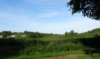
The cave is situated on Mount Hymettos between Voula and Vari. To reach the cave one has to pass the cemetery of Ano Voula, at half kilometre leave the car on the right side of the dirt road and walk about 600 Meters. The entrance to the cave is at ground level, literally under our feet, and that is why it is difficult to locate. The entrance is covered with an iron grill to keep away the vandals. Few visitors adhere to “take nothing but pictures” as a result the cave today is in a dreary condition, the stalactites are all taken, only the big ones that can not be broken are left. My last information is, to visit the site a permit is required from the Archaeological Department.
The cavern is separated in two sections. The first cavity is blackened from the fires the shepherds burned during the winter. I label this cavity-room Christian because in a corner we find present day icons of the Christian saints. In order to descend to the second cavity, one has to use the ancient steps that lead down hill. These steps were carved out by Archedemos. The decapitated statue of the goddess silently dominates the Nymphaio in a mystical way as if she wants us to stop profaning the Mother Earth.
The cave was excavated by the American Archaeological School in 1902. The findings, such as earthen oil lamps, and the inscriptions are on display in the Archaeological Museum of Athens. Lord Byron has visited the cave. According to the information provided by Aelian and Olympiodoros, the family of the great philosopher Plato, took him to the cave of Nympholyptou in order to acquire the favour of the Nymphs. Many ancient beliefs and traditions were incorporated into the Christian and folk culture. The curative spring water became the holy water, the offerings for the minor gods and goddesses were replaced by the Christian saints and the Nymphs became the fairies.
Note:
You may be viewing yesterday's version of this page. To see the most up to date information please register for a free account.
")
")
")
")
")
")
")
")
")
")
")
Do not use the above information on other web sites or publications without permission of the contributor.
Click here to see more info for this site
Nearby sites
Click here to view sites on an interactive map of the areaKey: Red: member's photo, Blue: 3rd party photo, Yellow: other image, Green: no photo - please go there and take one, Grey: site destroyed
Download sites to:
KML (Google Earth)
GPX (GPS waypoints)
CSV (Garmin/Navman)
CSV (Excel)
To unlock full downloads you need to sign up as a Contributory Member. Otherwise downloads are limited to 50 sites.
Turn off the page maps and other distractions
Nearby sites listing. In the following links * = Image available
12.3km NNW 336° Temple of Olympian Zeus* Ancient Temple
12.5km NNW 333° New Acropolis Museum* Museum
12.7km NNW 334° Theatre of Dionysus* Ancient Temple
12.7km NNW 340° Cycladic Museum at Athens* Museum
12.8km NNW 334° Acropolis Museum* Museum
12.8km NNW 334° Acropolis* Hillfort
12.8km NNW 333° Parthenon* Ancient Temple
12.8km NNW 333° Odeon Of Herodes Atticus* Ancient Village or Settlement
12.9km NNW 334° Erechteion* Ancient Temple
12.9km NNW 333° Propylaia* Ancient Temple
13.4km NNW 333° Temple of Hephaestos* Ancient Temple
14.4km NNW 339° National Archaeological Museum Athens* Museum
18.8km ENE 70° Vravrona Tomb of Iphigenia* Chambered Cairn
18.8km ENE 70° Vravrona Temple of Artemis* Ancient Temple
19.1km ENE 71° Vravrona Museum* Museum
22.7km ENE 57° Temple of Artemis Tauropolos* Ancient Temple
23.6km SE 129° Kitsos Cave Cave or Rock Shelter
25.6km NE 52° Askitario* Ancient Village or Settlement
26.0km WSW 241° Aphaia Temple* Ancient Temple
27.1km ESE 121° Velatouri Mycenaean Tholos 1* Cairn
27.2km ESE 121° Velatouri Hill Acropolis Ancient Temple
27.2km ESE 122° Velatouri Settlement* Ancient Village or Settlement
27.3km ESE 121° Velatouri Mycenaean Tholos 2 Cairn
28.7km NNW 338° Fili Fortress* Promontory Fort / Cliff Castle
30.8km NW 309° Temple of Eleusis* Ancient Temple
View more nearby sites and additional images


 We would like to know more about this location. Please feel free to add a brief description and any relevant information in your own language.
 Wir möchten mehr über diese Stätte erfahren. Bitte zögern Sie nicht, eine kurze Beschreibung und relevante Informationen in Deutsch hinzuzufügen.
 Nous aimerions en savoir encore un peu sur les lieux. S'il vous plaît n'hesitez pas à ajouter une courte description et tous les renseignements pertinents dans votre propre langue.
 Quisieramos informarnos un poco más de las lugares. No dude en añadir una breve descripción y otros datos relevantes en su propio idioma.