<< Our Photo Pages >> Skarmunken - Natural Stone / Erratic / Other Natural Feature in Norway
Submitted by kenntha88 on Friday, 16 November 2007 Page Views: 4497
Natural PlacesSite Name: Skarmunken Alternative Name: Skarmunken sacrificial siteCountry: Norway
NOTE: This site is 63.147 km away from the location you searched for.
Type: Natural Stone / Erratic / Other Natural Feature
Nearest Town: Tromsø
Latitude: 69.610336N Longitude: 19.709816E
Condition:
| 5 | Perfect |
| 4 | Almost Perfect |
| 3 | Reasonable but with some damage |
| 2 | Ruined but still recognisable as an ancient site |
| 1 | Pretty much destroyed, possibly visible as crop marks |
| 0 | No data. |
| -1 | Completely destroyed |
| 5 | Superb |
| 4 | Good |
| 3 | Ordinary |
| 2 | Not Good |
| 1 | Awful |
| 0 | No data. |
| 5 | Can be driven to, probably with disabled access |
| 4 | Short walk on a footpath |
| 3 | Requiring a bit more of a walk |
| 2 | A long walk |
| 1 | In the middle of nowhere, a nightmare to find |
| 0 | No data. |
| 5 | co-ordinates taken by GPS or official recorded co-ordinates |
| 4 | co-ordinates scaled from a detailed map |
| 3 | co-ordinates scaled from a bad map |
| 2 | co-ordinates of the nearest village |
| 1 | co-ordinates of the nearest town |
| 0 | no data |
Internal Links:
External Links:
")
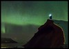
The sami people used to put their sacrificial gifts under the boulder in a small crack before they went fishing or hunting.
Still local fishermen take off their caps and salute the stone when they pass under it in their boats.
Note: Coordinates revised in August 2009
You may be viewing yesterday's version of this page. To see the most up to date information please register for a free account.
")
Do not use the above information on other web sites or publications without permission of the contributor.
Nearby Images from Flickr


The above images may not be of the site on this page, but were taken nearby. They are loaded from Flickr so please click on them for image credits.
Click here to see more info for this site
Nearby sites
Click here to view sites on an interactive map of the areaKey: Red: member's photo, Blue: 3rd party photo, Yellow: other image, Green: no photo - please go there and take one, Grey: site destroyed
Download sites to:
KML (Google Earth)
GPX (GPS waypoints)
CSV (Garmin/Navman)
CSV (Excel)
To unlock full downloads you need to sign up as a Contributory Member. Otherwise downloads are limited to 50 sites.
Turn off the page maps and other distractions
Nearby sites listing. In the following links * = Image available
31.0km W 275° University Museum, Tromso* Museum
36.5km SSW 203° Balsfjord rock carvings* Carving
36.7km W 279° Håkøya* Ancient Village or Settlement
37.8km W 262° Skavberget* Rock Art
43.6km S 187° Nordkjosbotn sacrificial site* Natural Stone / Erratic / Other Natural Feature
53.6km SW 217° Mårfjellskardet sacrificial site* Natural Stone / Erratic / Other Natural Feature
59.0km W 261° Greipstad* Ancient Village or Settlement
62.1km W 265° Buvika* Barrow Cemetery
63.1km W 271° Sandvik* Ancient Village or Settlement
64.0km W 271° Brensholmen stone age settlement* Ancient Village or Settlement
65.0km W 273° Sommarøy* Ancient Village or Settlement
65.1km W 270° Brensholmen iron age settlement* Ancient Village or Settlement
110.1km WSW 253° Grunnfarnes Neolithic Settlement* Ancient Village or Settlement
110.2km WSW 253° Grunnfarnes Iron Age Settlement* Ancient Village or Settlement
113.6km SW 225° Andasteinen* Natural Stone / Erratic / Other Natural Feature
118.8km SW 221° Lavangen* Barrow Cemetery
120.9km SSW 213° Lapphaugen sacrificial site* Natural Stone / Erratic / Other Natural Feature
122.4km WSW 240° Eidekjosen Settlement* Ancient Village or Settlement
123.4km SW 218° Spansdalen sacrificial site* Natural Stone / Erratic / Other Natural Feature
133.0km SW 217° Kvernmo Sacrificial Site* Natural Stone / Erratic / Other Natural Feature
136.4km SW 230° Vik on Rolla* Carving
138.7km ENE 73° Alta (Norway)* Rock Art
138.8km ENE 73° Hjemmeluft stone age settlement* Ancient Village or Settlement
142.6km WSW 243° Bjarkøya Centre, the chieftain's farm* Ancient Village or Settlement
142.9km ENE 68° Djupvika sacrificial site* Natural Stone / Erratic / Other Natural Feature
View more nearby sites and additional images


 We would like to know more about this location. Please feel free to add a brief description and any relevant information in your own language.
 Wir möchten mehr über diese Stätte erfahren. Bitte zögern Sie nicht, eine kurze Beschreibung und relevante Informationen in Deutsch hinzuzufügen.
 Nous aimerions en savoir encore un peu sur les lieux. S'il vous plaît n'hesitez pas à ajouter une courte description et tous les renseignements pertinents dans votre propre langue.
 Quisieramos informarnos un poco más de las lugares. No dude en añadir una breve descripción y otros datos relevantes en su propio idioma.