

<< Our Photo Pages >> Samara prehistoric park - Museum in France in Picardie:Somme (80)
Submitted by neolithique02 on Tuesday, 04 March 2014 Page Views: 4059
MuseumsSite Name: Samara prehistoric park Alternative Name: Parc de SamaraCountry: France Département: Picardie:Somme (80) Type: Museum
Nearest Town: Amiens Nearest Village: La Chaussée-Tirancourt
Latitude: 49.948614N Longitude: 2.171671E
Condition:
| 5 | Perfect |
| 4 | Almost Perfect |
| 3 | Reasonable but with some damage |
| 2 | Ruined but still recognisable as an ancient site |
| 1 | Pretty much destroyed, possibly visible as crop marks |
| 0 | No data. |
| -1 | Completely destroyed |
| 5 | Superb |
| 4 | Good |
| 3 | Ordinary |
| 2 | Not Good |
| 1 | Awful |
| 0 | No data. |
| 5 | Can be driven to, probably with disabled access |
| 4 | Short walk on a footpath |
| 3 | Requiring a bit more of a walk |
| 2 | A long walk |
| 1 | In the middle of nowhere, a nightmare to find |
| 0 | No data. |
| 5 | co-ordinates taken by GPS or official recorded co-ordinates |
| 4 | co-ordinates scaled from a detailed map |
| 3 | co-ordinates scaled from a bad map |
| 2 | co-ordinates of the nearest village |
| 1 | co-ordinates of the nearest town |
| 0 | no data |
Internal Links:
External Links:
I have visited· I would like to visit
neolithique02 has visited here
")
Samara is a place dedicated to Prehistory.
Website: Samara
You may be viewing yesterday's version of this page. To see the most up to date information please register for a free account.
Do not use the above information on other web sites or publications without permission of the contributor.
davidmorgan has found this location on Google Street View:
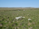
Nearby Images from Flickr
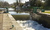
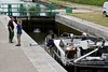
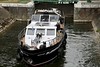
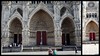
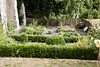
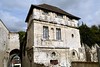
The above images may not be of the site on this page, but were taken nearby. They are loaded from Flickr so please click on them for image credits.
Click here to see more info for this site
Nearby sites
Click here to view sites on an interactive map of the areaKey: Red: member's photo, Blue: 3rd party photo, Yellow: other image, Green: no photo - please go there and take one, Grey: site destroyed
Download sites to:
KML (Google Earth)
GPX (GPS waypoints)
CSV (Garmin/Navman)
CSV (Excel)
To unlock full downloads you need to sign up as a Contributory Member. Otherwise downloads are limited to 50 sites.
Turn off the page maps and other distractions
Nearby sites listing. In the following links * = Image available
558m ENE 69° Oppidum dit Camp de César (Saint-Sauveur) Ancient Village or Settlement
3.4km ENE 74° Les Gres Burial Chamber or Dolmen
11.0km SE 126° Musée de Picardie* Museum
11.7km S 180° Planchat Not Known (by us)
12.3km NE 39° Underground City of Naours Ancient Mine, Quarry or other Industry
13.6km SSE 161° Au Fossé Gosset Burial Chamber or Dolmen
13.7km SE 125° Jardin archéologique de Saint-Acheul Museum
22.0km ENE 78° Menhir dit la Pierre d'Oblicamp* Standing Stone (Menhir)
23.1km SSW 202° Famechon Fouilles Archeologique Not Known (by us)
27.1km N 1° Dolmen de Béalcourt* Burial Chamber or Dolmen
28.3km E 87° Ribemont-Sur-Ancre Centre archéologique départemental* Museum
39.0km SSE 166° Vendeuil Gallo-Roman Theatre* Ancient Palace
48.7km W 279° Incheville Oppidum Ancient Village or Settlement
54.1km E 98° Neolithic sites of Villers-Carbonnel* Ancient Village or Settlement
56.5km E 92° Le Doigt de Gargantua (Doingt)* Standing Stone (Menhir)
57.1km NE 39° Les Pierres Jumelles (Mont-Saint-Éloi)* Standing Stones
59.5km NNE 29° Le Gal de Gauchin* Standing Stone (Menhir)
60.6km NNE 31° Dolmen dit la Table des Fées* Burial Chamber or Dolmen
62.1km SE 144° Gournay-Sur-Aronde* Ancient Village or Settlement
64.7km S 178° Dolmen de la Pierre aux Fées (Villers-St-Sépulcre)* Passage Grave
65.8km ESE 109° Alignement d'Eppeville* Stone Row / Alignment
67.9km ENE 57° Cromlech dit Les-Sept-Bonnettes* Stone Circle
69.2km SSW 201° Allée couverte du Bois de Champignolle* Passage Grave
70.1km SSW 202° Menhir dit la Borne du Bois Madame* Standing Stone (Menhir)
70.6km ENE 59° La Pierre du Diable (Lécluse)* Standing Stone (Menhir)
View more nearby sites and additional images


 We would like to know more about this location. Please feel free to add a brief description and any relevant information in your own language.
 Wir möchten mehr über diese Stätte erfahren. Bitte zögern Sie nicht, eine kurze Beschreibung und relevante Informationen in Deutsch hinzuzufügen.
 Nous aimerions en savoir encore un peu sur les lieux. S'il vous plaît n'hesitez pas à ajouter une courte description et tous les renseignements pertinents dans votre propre langue.
 Quisieramos informarnos un poco más de las lugares. No dude en añadir una breve descripción y otros datos relevantes en su propio idioma.