<< Text Pages >> Grodzisko Lędziny - Hillfort in Poland in Opolskie
Submitted by SolarMegalith on Friday, 22 April 2011 Page Views: 3246
Iron Age and Later PrehistorySite Name: Grodzisko LędzinyCountry: Poland
NOTE: This site is 5.894 km away from the location you searched for.
Voivodeship: Opolskie Type: Hillfort
Nearest Town: Opole
Latitude: 50.666650N Longitude: 18.034060E
Condition:
| 5 | Perfect |
| 4 | Almost Perfect |
| 3 | Reasonable but with some damage |
| 2 | Ruined but still recognisable as an ancient site |
| 1 | Pretty much destroyed, possibly visible as crop marks |
| 0 | No data. |
| -1 | Completely destroyed |
| 5 | Superb |
| 4 | Good |
| 3 | Ordinary |
| 2 | Not Good |
| 1 | Awful |
| 0 | No data. |
| 5 | Can be driven to, probably with disabled access |
| 4 | Short walk on a footpath |
| 3 | Requiring a bit more of a walk |
| 2 | A long walk |
| 1 | In the middle of nowhere, a nightmare to find |
| 0 | No data. |
| 5 | co-ordinates taken by GPS or official recorded co-ordinates |
| 4 | co-ordinates scaled from a detailed map |
| 3 | co-ordinates scaled from a bad map |
| 2 | co-ordinates of the nearest village |
| 1 | co-ordinates of the nearest town |
| 0 | no data |
Internal Links:
External Links:
Hillfort in Opolskie
Remains of an early medieval hillfort dated for tribal period. It was build in 8th century AD by Opolanie tribe. Only slight traces of a ditch on a field are distinguishable.
You may be viewing yesterday's version of this page. To see the most up to date information please register for a free account.
Do not use the above information on other web sites or publications without permission of the contributor.
Nearby Images from Flickr
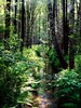
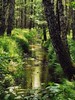

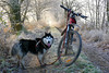
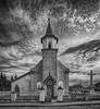
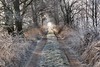
The above images may not be of the site on this page, but were taken nearby. They are loaded from Flickr so please click on them for image credits.
Click here to see more info for this site
Nearby sites
Click here to view sites on an interactive map of the areaKey: Red: member's photo, Blue: 3rd party photo, Yellow: other image, Green: no photo - please go there and take one, Grey: site destroyed
Download sites to:
KML (Google Earth)
GPX (GPS waypoints)
CSV (Garmin/Navman)
CSV (Excel)
To unlock full downloads you need to sign up as a Contributory Member. Otherwise downloads are limited to 50 sites.
Turn off the page maps and other distractions
Nearby sites listing. In the following links * = Image available
30.9km SW 226° Grodzisko Chrzelice Hillfort
38.7km ENE 78° Kopiec Dzielna Round Barrow(s)
40.3km S 189° Grodzisko Naczęsławice Hillfort
50.8km WNW 302° Grodzisko Lipki* Hillfort
52.6km WNW 304° Grodzisko Ryczyn Wielki* Hillfort
52.7km WNW 303° Grodzisko Ryczyn Mały* Hillfort
53.0km S 175° Grodzisko Dzielawy Hillfort
56.3km SE 140° Kurhan Łany Wielkie* Round Barrow(s)
58.1km W 268° Grodzisko Jagielnica* Hillfort
65.0km SSE 168° Muzeum w Raciborzu* Museum
69.3km N 6° Grodzisko Podzamcze* Hillfort
71.2km NE 43° Przywóz Bronze Age Settlement Ancient Village or Settlement
71.3km NE 43° Kurhany Przywóz* Barrow Cemetery
71.3km NNW 334° Kurhany Jemielna* Barrow Cemetery
74.0km NW 316° Kurhany Oleśniczka* Barrow Cemetery
76.5km W 269° Kurhany Muszkowice (3)* Barrow Cemetery
77.2km W 269° Grobowce Megalityczne Muszkowice* Long Barrow
77.4km W 269° Kurhany Muszkowice (2)* Barrow Cemetery
78.5km W 268° Kurhany Muszkowice (1)* Barrow Cemetery
82.6km WNW 292° Kurhan Kuklice Round Barrow(s)
83.0km ENE 76° Wyczerpy Górne Bronze Age Settlement Ancient Village or Settlement
83.5km WNW 296° Grodzisko Magnice Hillfort
86.6km W 278° Grodzisko Przystronie Promontory Fort / Cliff Castle
86.6km ENE 78° Grodzisko Gąszczyk* Hillfort
87.7km E 82° Jaskinia Towarna Cave or Rock Shelter
View more nearby sites and additional images


 We would like to know more about this location. Please feel free to add a brief description and any relevant information in your own language.
 Wir möchten mehr über diese Stätte erfahren. Bitte zögern Sie nicht, eine kurze Beschreibung und relevante Informationen in Deutsch hinzuzufügen.
 Nous aimerions en savoir encore un peu sur les lieux. S'il vous plaît n'hesitez pas à ajouter une courte description et tous les renseignements pertinents dans votre propre langue.
 Quisieramos informarnos un poco más de las lugares. No dude en añadir una breve descripción y otros datos relevantes en su propio idioma.