<< Our Photo Pages >> Grodzisko Objezierze - Hillfort in Poland in Wielkopolskie
Submitted by SolarMegalith on Tuesday, 21 April 2009 Page Views: 3610
Iron Age and Later PrehistorySite Name: Grodzisko ObjezierzeCountry: Poland
NOTE: This site is 12.162 km away from the location you searched for.
Voivodeship: Wielkopolskie Type: Hillfort
Nearest Town: Oborniki Nearest Village: Objezierze
Latitude: 52.598750N Longitude: 16.742290E
Condition:
| 5 | Perfect |
| 4 | Almost Perfect |
| 3 | Reasonable but with some damage |
| 2 | Ruined but still recognisable as an ancient site |
| 1 | Pretty much destroyed, possibly visible as crop marks |
| 0 | No data. |
| -1 | Completely destroyed |
| 5 | Superb |
| 4 | Good |
| 3 | Ordinary |
| 2 | Not Good |
| 1 | Awful |
| 0 | No data. |
| 5 | Can be driven to, probably with disabled access |
| 4 | Short walk on a footpath |
| 3 | Requiring a bit more of a walk |
| 2 | A long walk |
| 1 | In the middle of nowhere, a nightmare to find |
| 0 | No data. |
| 5 | co-ordinates taken by GPS or official recorded co-ordinates |
| 4 | co-ordinates scaled from a detailed map |
| 3 | co-ordinates scaled from a bad map |
| 2 | co-ordinates of the nearest village |
| 1 | co-ordinates of the nearest town |
| 0 | no data |
Be the first person to rate this site - see the 'Contribute!' box in the right hand menu.
Internal Links:
External Links:
")
Near the road to Ślepuchowo there's a medium-sized hillfort. There is conflicting information about its age. Some sources say it is the Bronze Age site of Lusatian culture, others claim it is of early medieval origin.
The excavations were carried out here in 1964 under direction of Dr. Stanisław Jasnosz.
You may be viewing yesterday's version of this page. To see the most up to date information please register for a free account.
")
Do not use the above information on other web sites or publications without permission of the contributor.
Nearby Images from Flickr
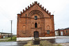
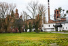
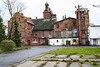
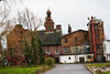
The above images may not be of the site on this page, but were taken nearby. They are loaded from Flickr so please click on them for image credits.
Click here to see more info for this site
Nearby sites
Click here to view sites on an interactive map of the areaKey: Red: member's photo, Blue: 3rd party photo, Yellow: other image, Green: no photo - please go there and take one, Grey: site destroyed
Download sites to:
KML (Google Earth)
GPX (GPS waypoints)
CSV (Garmin/Navman)
CSV (Excel)
To unlock full downloads you need to sign up as a Contributory Member. Otherwise downloads are limited to 50 sites.
Turn off the page maps and other distractions
Nearby sites listing. In the following links * = Image available
19.7km WSW 239° Grodzisko Piersko Hillfort
22.5km NNE 22° Grodzisko Ninino Hillfort
24.2km NE 42° Grodzisko Żydowska Górka - Rogoźno* Hillfort
25.0km SSE 148° Muzeum Archeologiczne w Poznaniu* Museum
27.9km E 98° Kurhany Zielonka* Barrow Cemetery
30.8km ENE 61° Grodzisko Przysieka (Wągrowiec)* Hillfort
33.0km E 96° Grodzisko Turostowo* Promontory Fort / Cliff Castle
35.1km E 80° Grodzisko Glinno* Misc. Earthwork
38.5km ENE 79° Grodzisko Jabłkowo Hillfort
39.5km SSW 206° Grodzisko Dakowy Mokre* Hillfort
41.8km ESE 104° Grodzisko Moraczewo* Hillfort
43.7km E 100° Ostrów Lednicki* Hillfort
48.0km SSE 149° Grodzisko Bnin* Promontory Fort / Cliff Castle
49.4km WSW 246° Grudna Burial Mound Barrow Cemetery
51.9km SSW 196° Kurhany Łęki Małe* Barrow Cemetery
53.7km S 190° Grodzisko Bonikowo* Hillfort
58.2km NNE 18° Grodzisko Miasteczko Krajeńskie Hillfort
59.1km SSW 195° Grodzisko Stary Białcz* Hillfort
61.5km SSW 201° Grodzisko Reńsko* Hillfort
63.8km NE 38° Grodzisko Smogulec Hillfort
64.8km S 189° Grodzisko Przysieka Polska* Hillfort
66.8km ESE 113° Grodzisko Grzybowo* Hillfort
67.0km S 170° Grodzisko Zbęchy Promontory Fort / Cliff Castle
67.8km NNE 20° Grodzisko Wysoczka Hillfort
71.4km S 176° Grodzisko Czerwona Wieś Hillfort
View more nearby sites and additional images


 We would like to know more about this location. Please feel free to add a brief description and any relevant information in your own language.
 Wir möchten mehr über diese Stätte erfahren. Bitte zögern Sie nicht, eine kurze Beschreibung und relevante Informationen in Deutsch hinzuzufügen.
 Nous aimerions en savoir encore un peu sur les lieux. S'il vous plaît n'hesitez pas à ajouter une courte description et tous les renseignements pertinents dans votre propre langue.
 Quisieramos informarnos un poco más de las lugares. No dude en añadir una breve descripción y otros datos relevantes en su propio idioma.