<< Our Photo Pages >> Sannōdake - Stone Circle in Japan in Kyūshū
Submitted by Aska on Thursday, 24 August 2017 Page Views: 1106
Date UncertainSite Name: Sannōdake Alternative Name: 山王岳 SannodakeCountry: Japan
NOTE: This site is 6.659 km away from the location you searched for.
Region: Kyūshū Type: Stone Circle
Nearest Town: SatsumaSendai (Kagoshima pref.) Nearest Village: KetōinchōImuta 祁答
Latitude: 31.816400N Longitude: 130.461580E
Condition:
| 5 | Perfect |
| 4 | Almost Perfect |
| 3 | Reasonable but with some damage |
| 2 | Ruined but still recognisable as an ancient site |
| 1 | Pretty much destroyed, possibly visible as crop marks |
| 0 | No data. |
| -1 | Completely destroyed |
| 5 | Superb |
| 4 | Good |
| 3 | Ordinary |
| 2 | Not Good |
| 1 | Awful |
| 0 | No data. |
| 5 | Can be driven to, probably with disabled access |
| 4 | Short walk on a footpath |
| 3 | Requiring a bit more of a walk |
| 2 | A long walk |
| 1 | In the middle of nowhere, a nightmare to find |
| 0 | No data. |
| 5 | co-ordinates taken by GPS or official recorded co-ordinates |
| 4 | co-ordinates scaled from a detailed map |
| 3 | co-ordinates scaled from a bad map |
| 2 | co-ordinates of the nearest village |
| 1 | co-ordinates of the nearest town |
| 0 | no data |
Internal Links:
External Links:
")
At the foot of a hill called "Sannō-dake (山王岳)" surrounding "Imuta-ike (藺牟田池)" caldera pond which is included in the Ramsar List, 6 sundial-shaped stone circles covered with green moss lie in a wood close to a modern cemetery.
You may be viewing yesterday's version of this page. To see the most up to date information please register for a free account.
")
Do not use the above information on other web sites or publications without permission of the contributor.
Nearby Images from Flickr

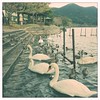
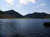


The above images may not be of the site on this page, but were taken nearby. They are loaded from Flickr so please click on them for image credits.
Click here to see more info for this site
Nearby sites
Click here to view sites on an interactive map of the areaKey: Red: member's photo, Blue: 3rd party photo, Yellow: other image, Green: no photo - please go there and take one, Grey: site destroyed
Download sites to:
KML (Google Earth)
GPX (GPS waypoints)
CSV (Garmin/Navman)
CSV (Excel)
To unlock full downloads you need to sign up as a Contributory Member. Otherwise downloads are limited to 50 sites.
Turn off the page maps and other distractions
Nearby sites listing. In the following links * = Image available
15.3km NE 35° Byūbaru* Chambered Cairn
17.2km W 278° Yoko-oka* Chambered Cairn
25.3km NNE 27° Uzun Kofungun* Chambered Cairn
27.3km ESE 108° Hayato-zuka* Ancient Temple
29.8km S 191° Kurokawa cave* Cave or Rock Shelter
29.9km S 190° Saigō Takamori Gyoza-ishi* Natural Stone / Erratic / Other Natural Feature
33.2km NE 53° Nagayama* Chambered Cairn
35.2km SSW 197° Ishizuka Koumi-ishi* Natural Stone / Erratic / Other Natural Feature
37.4km SSW 199° Iriki* Burial Chamber or Dolmen
40.1km NE 50° Shimauchi underground tunnel tombs* Not Known (by us)
42.5km SSW 198° Tamate Jinja shrine* Burial Chamber or Dolmen
43.9km N 356° Hatsuno* Chambered Cairn
44.1km NW 322° Kasedō Kofun* Chambered Cairn
44.7km NW 323° Komukae* Chambered Cairn
45.2km SSW 199° Takaya Jinja shrine* Natural Stone / Erratic / Other Natural Feature
46.9km SSW 197° Kaseda Samurai Residence gardens Modern Stone Circle etc
48.7km S 182° Chiran Buke Yashiki gardens* Modern Stone Circle etc
49.6km NW 319° Sasue Kofun* Chambered Cairn
52.3km NW 320° Shirogane Kofun* Chambered Cairn
52.3km NNE 32° Ōmura* Rock Cut Tomb
52.4km NW 320° Obanzaki Kofun* Chambered Cairn
52.8km NW 320° Myōjin Kofun* Chambered Cairn
52.8km NW 320° Myōjin Shimo-oka* Burial Chamber or Dolmen
53.6km NE 37° Kyōgamine* Rock Cut Tomb
53.6km NW 322° Nukunoura Kofungun* Chambered Cairn
View more nearby sites and additional images


 We would like to know more about this location. Please feel free to add a brief description and any relevant information in your own language.
 Wir möchten mehr über diese Stätte erfahren. Bitte zögern Sie nicht, eine kurze Beschreibung und relevante Informationen in Deutsch hinzuzufügen.
 Nous aimerions en savoir encore un peu sur les lieux. S'il vous plaît n'hesitez pas à ajouter une courte description et tous les renseignements pertinents dans votre propre langue.
 Quisieramos informarnos un poco más de las lugares. No dude en añadir una breve descripción y otros datos relevantes en su propio idioma.