<< Text Pages >> Algutstorp Domarring - Stone Circle in Sweden in Västergötland
Submitted by ShamrockStone on Friday, 01 July 2016 Page Views: 1194
Neolithic and Bronze AgeSite Name: Algutstorp Domarring Alternative Name: Algutstorp 42:1Country: Sweden
NOTE: This site is 14.785 km away from the location you searched for.
Landskap: Västergötland Type: Stone Circle
Nearest Village: Vårgårda
Latitude: 58.033650N Longitude: 12.854370E
Condition:
| 5 | Perfect |
| 4 | Almost Perfect |
| 3 | Reasonable but with some damage |
| 2 | Ruined but still recognisable as an ancient site |
| 1 | Pretty much destroyed, possibly visible as crop marks |
| 0 | No data. |
| -1 | Completely destroyed |
| 5 | Superb |
| 4 | Good |
| 3 | Ordinary |
| 2 | Not Good |
| 1 | Awful |
| 0 | No data. |
| 5 | Can be driven to, probably with disabled access |
| 4 | Short walk on a footpath |
| 3 | Requiring a bit more of a walk |
| 2 | A long walk |
| 1 | In the middle of nowhere, a nightmare to find |
| 0 | No data. |
| 5 | co-ordinates taken by GPS or official recorded co-ordinates |
| 4 | co-ordinates scaled from a detailed map |
| 3 | co-ordinates scaled from a bad map |
| 2 | co-ordinates of the nearest village |
| 1 | co-ordinates of the nearest town |
| 0 | no data |
Be the first person to rate this site - see the 'Contribute!' box in the right hand menu.
Internal Links:
External Links:
Stone Circle in Västergötland
There are 9 stones in this circle, which is 18m in diameter.
You may be viewing yesterday's version of this page. To see the most up to date information please register for a free account.
Do not use the above information on other web sites or publications without permission of the contributor.
Nearby Images from Flickr
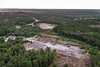
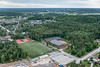
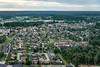
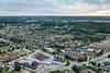

The above images may not be of the site on this page, but were taken nearby. They are loaded from Flickr so please click on them for image credits.
Click here to see more info for this site
Nearby sites
Click here to view sites on an interactive map of the areaKey: Red: member's photo, Blue: 3rd party photo, Yellow: other image, Green: no photo - please go there and take one, Grey: site destroyed
Download sites to:
KML (Google Earth)
GPX (GPS waypoints)
CSV (Garmin/Navman)
CSV (Excel)
To unlock full downloads you need to sign up as a Contributory Member. Otherwise downloads are limited to 50 sites.
Turn off the page maps and other distractions
Nearby sites listing. In the following links * = Image available
5.8km NNW 344° Lundskullen* Standing Stones
5.8km NNW 343° Lundskullen Hällkista* Cist
6.0km NNE 25° Håkansgårdenstenen* Carving
6.7km NNW 348° Jättakullen* Cist
8.3km NE 51° Nycklabacken* Standing Stones
8.8km NE 51° Fölene 23:1* Burial Chamber or Dolmen
9.0km NE 50° Fölenestenen (1)* Carving
9.0km NE 50° Fölenestenen (2)* Carving
9.4km NNW 339° Fåglum* Rock Art
12.4km NNE 31° Högastenar* Standing Stones
12.7km NNE 32° Västerbitterna 17:1* Standing Stone (Menhir)
12.8km NNE 32° Stommen Domarring* Stone Circle
33.1km N 5° Levenestenen* Carving
33.9km E 80° Skånumstenen* Carving
34.1km N 4° Levene Hällkista* Cist
34.9km N 359° Sparlösastenen* Carving
37.3km E 84° Sörbystenen* Carving
37.6km E 79° Kinneved 15:1* Passage Grave
37.7km N 3° Slädenestenen* Carving
37.9km E 79° Kinneved 14:1* Passage Grave
38.0km ENE 68° Gökhem 72:1* Passage Grave
39.2km E 81° Slutarpdösen* Burial Chamber or Dolmen
39.7km ESE 112° Dalumstenen (1)* Carving
39.7km ESE 112° Dalumstenen (2)* Carving
40.8km E 97° Lillegårdenstenen* Carving
View more nearby sites and additional images


 We would like to know more about this location. Please feel free to add a brief description and any relevant information in your own language.
 Wir möchten mehr über diese Stätte erfahren. Bitte zögern Sie nicht, eine kurze Beschreibung und relevante Informationen in Deutsch hinzuzufügen.
 Nous aimerions en savoir encore un peu sur les lieux. S'il vous plaît n'hesitez pas à ajouter une courte description et tous les renseignements pertinents dans votre propre langue.
 Quisieramos informarnos un poco más de las lugares. No dude en añadir una breve descripción y otros datos relevantes en su propio idioma.