<< Text Pages >> Xianrendong Cave - Cave or Rock Shelter in China
Submitted by davidmorgan on Friday, 29 June 2012 Page Views: 5154
Natural PlacesSite Name: Xianrendong CaveCountry: China
NOTE: This site is 160.021 km away from the location you searched for.
Type: Cave or Rock Shelter
Nearest Town: Jiujiang
Latitude: 29.564349N Longitude: 115.957677E
Condition:
| 5 | Perfect |
| 4 | Almost Perfect |
| 3 | Reasonable but with some damage |
| 2 | Ruined but still recognisable as an ancient site |
| 1 | Pretty much destroyed, possibly visible as crop marks |
| 0 | No data. |
| -1 | Completely destroyed |
| 5 | Superb |
| 4 | Good |
| 3 | Ordinary |
| 2 | Not Good |
| 1 | Awful |
| 0 | No data. |
| 5 | Can be driven to, probably with disabled access |
| 4 | Short walk on a footpath |
| 3 | Requiring a bit more of a walk |
| 2 | A long walk |
| 1 | In the middle of nowhere, a nightmare to find |
| 0 | No data. |
| 5 | co-ordinates taken by GPS or official recorded co-ordinates |
| 4 | co-ordinates scaled from a detailed map |
| 3 | co-ordinates scaled from a bad map |
| 2 | co-ordinates of the nearest village |
| 1 | co-ordinates of the nearest town |
| 0 | no data |
Be the first person to rate this site - see the 'Contribute!' box in the right hand menu.
Internal Links:
External Links:
Cave or Rock Shelter in Jiangxi, China
A Palaeolithic cave settlement where 20,000-year-old pottery has recently been found.
You may be viewing yesterday's version of this page. To see the most up to date information please register for a free account.
Do not use the above information on other web sites or publications without permission of the contributor.
Nearby Images from Flickr
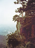

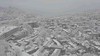
The above images may not be of the site on this page, but were taken nearby. They are loaded from Flickr so please click on them for image credits.
Click here to see more info for this site
Nearby sites
Click here to view sites on an interactive map of the areaKey: Red: member's photo, Blue: 3rd party photo, Yellow: other image, Green: no photo - please go there and take one, Grey: site destroyed
Download sites to:
KML (Google Earth)
GPX (GPS waypoints)
CSV (Garmin/Navman)
CSV (Excel)
To unlock full downloads you need to sign up as a Contributory Member. Otherwise downloads are limited to 50 sites.
Turn off the page maps and other distractions
Nearby sites listing. In the following links * = Image available
157.3km S 187° Fujiacun Ancient Village or Settlement
402.4km NE 45° Yangshan Mountain Steles Ancient Mine, Quarry or other Industry
420.7km ENE 61° Dongshan Ancient Village or Settlement
425.9km E 84° Yunnan Neolithic age site Ancient Village or Settlement
509.1km NW 307° Gucheng ancient tombs* Burial Chamber or Dolmen
560.2km ENE 69° Shanghai Museum* Museum
590.5km WNW 289° Shen Nong Gorge Hanging Coffins* Rock Cut Tomb
636.3km NNE 28° General's Cliff* Rock Art
644.5km NNW 330° Longmen Caves* Sculptured Stone
647.9km NNW 333° Erlitou Ancient Village or Settlement
652.8km NNW 332° White Horse Temple* Ancient Temple
655.6km NNW 331° Luoyang Museum* Museum
657.2km NNW 331° Longshan Neolithic Site Ancient Village or Settlement
691.3km NW 313° Yangce Rock Art Rock Art
737.4km SE 130° Yangmingshan Pyramid Pyramid / Mastaba
742.4km NNW 349° Ancient City of Anyang Ancient Village or Settlement
756.5km N 5° Great Wall of Qi* Misc. Earthwork
763.1km SSW 201° Guangzhou Museum* Museum
817.2km SSW 192° Kau Sai Chau Rock Carvings* Carving
822.0km SE 144° Laiji Tsou ceremonial site* Carving
823.5km SSW 192° Lung Ha Wan Rock Carving* Carving
826.9km SSW 193° Hong Kong Museum of History* Museum
827.1km NW 312° Terracotta Army* Artificial Mound
827.4km SSW 193° Hong Kong Heritage Discovery Centre* Museum
829.6km SSW 192° Cape Collinson Rock Carving* Rock Art
View more nearby sites and additional images


 We would like to know more about this location. Please feel free to add a brief description and any relevant information in your own language.
 Wir möchten mehr über diese Stätte erfahren. Bitte zögern Sie nicht, eine kurze Beschreibung und relevante Informationen in Deutsch hinzuzufügen.
 Nous aimerions en savoir encore un peu sur les lieux. S'il vous plaît n'hesitez pas à ajouter une courte description et tous les renseignements pertinents dans votre propre langue.
 Quisieramos informarnos un poco más de las lugares. No dude en añadir una breve descripción y otros datos relevantes en su propio idioma.