<< Text Pages >> Gryme's Dyke - Ancient Village or Settlement in England in Essex
Submitted by vicky on Sunday, 21 July 2002 Page Views: 9642
Multi-periodSite Name: Gryme's DykeCountry: England
NOTE: This site is 0.48 km away from the location you searched for.
County: Essex Type: Ancient Village or Settlement
Nearest Town: Colchester Nearest Village: Malting Green
Map Ref: TL965200 Landranger Map Number: 168
Latitude: 51.844011N Longitude: 0.851208E
Condition:
| 5 | Perfect |
| 4 | Almost Perfect |
| 3 | Reasonable but with some damage |
| 2 | Ruined but still recognisable as an ancient site |
| 1 | Pretty much destroyed, possibly visible as crop marks |
| 0 | No data. |
| -1 | Completely destroyed |
| 5 | Superb |
| 4 | Good |
| 3 | Ordinary |
| 2 | Not Good |
| 1 | Awful |
| 0 | No data. |
| 5 | Can be driven to, probably with disabled access |
| 4 | Short walk on a footpath |
| 3 | Requiring a bit more of a walk |
| 2 | A long walk |
| 1 | In the middle of nowhere, a nightmare to find |
| 0 | No data. |
| 5 | co-ordinates taken by GPS or official recorded co-ordinates |
| 4 | co-ordinates scaled from a detailed map |
| 3 | co-ordinates scaled from a bad map |
| 2 | co-ordinates of the nearest village |
| 1 | co-ordinates of the nearest town |
| 0 | no data |
Be the first person to rate this site - see the 'Contribute!' box in the right hand menu.
Internal Links:
External Links:
Misc Earthwork in Essex
Have you visited this site? Please add a comment below.
You may be viewing yesterday's version of this page. To see the most up to date information please register for a free account.
Do not use the above information on other web sites or publications without permission of the contributor.
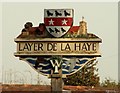
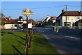
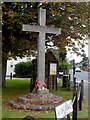
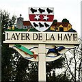
Nearby Images from Geograph Britain and Ireland:
©2006(licence)
©2017(licence)
©2014(licence)
©2023(licence)
©2021(licence)
The above images may not be of the site on this page, they are loaded from Geograph.
Please Submit an Image of this site or go out and take one for us!
Click here to see more info for this site
Nearby sites
Key: Red: member's photo, Blue: 3rd party photo, Yellow: other image, Green: no photo - please go there and take one, Grey: site destroyed
Download sites to:
KML (Google Earth)
GPX (GPS waypoints)
CSV (Garmin/Navman)
CSV (Excel)
To unlock full downloads you need to sign up as a Contributory Member. Otherwise downloads are limited to 50 sites.
Turn off the page maps and other distractions
Nearby sites listing. In the following links * = Image available
1.8km N 359° Heath Farm Dyke Ancient Village or Settlement (TL964218)
2.7km NNW 342° Stanway Gravel Pit Ancient Village or Settlement (TL956225)
2.7km N 9° Gosbecks Archaeological Park* Ancient Village or Settlement (TL968227)
3.7km ENE 61° Berechurch Dyke Misc. Earthwork
3.9km WNW 283° Birch Long Barrow (TL927207)
4.6km N 2° Triple Dyke Ancient Village or Settlement (TL965246)
4.7km ENE 64° Tamworth Mound Misc. Earthwork (TM0065922209)
4.8km NNE 15° Lexden Tumulus* Artificial Mound (TL9753724712)
5.6km NE 36° St John's Green (Colchester) Cairn (TL99642468)
5.7km S 190° Wigborough Henge* Henge (TL957144)
5.7km SSW 199° Mill Mound Artificial Mound (TL9487914575)
5.9km NNE 24° Sheepden Dyke Ancient Village or Settlement (TL987255)
6.2km NE 34° Colchester Castle Museum* Museum (TL998253)
6.6km NW 307° Marks Tey Puddingstone* Natural Stone / Erratic / Other Natural Feature (TL911238)
7.0km NE 56° Annan Road Bronze Age Barrow Cemetery* Barrow Cemetery (TM0215024164)
7.1km WSW 258° Tiptree Moud Round Barrow(s) (TL896182)
7.1km NNE 13° Lexden Dyke* Ancient Village or Settlement (TL978270)
7.4km NE 52° Greenstead Stones* Natural Stone / Erratic / Other Natural Feature (TM021248)
7.6km SE 135° West Mersea* Artificial Mound (TM021149)
8.2km NNW 330° Fordstreet Puddingstone* Marker Stone (TL921269)
8.6km SSE 154° St Peter's Well (West Mersea)* Holy Well or Sacred Spring (TM006124)
8.7km W 262° Inworth Cursus Cursus (TL8794718454)
9.0km N 3° Pitchbury Ramparts Hillfort (TL966290)
9.4km NNW 344° Fordham Puddingstone* Marker Stone (TL9348028891)
9.8km E 91° Alresford Hill Cairn (TM06282022)
View more nearby sites and additional images


 We would like to know more about this location. Please feel free to add a brief description and any relevant information in your own language.
 Wir möchten mehr über diese Stätte erfahren. Bitte zögern Sie nicht, eine kurze Beschreibung und relevante Informationen in Deutsch hinzuzufügen.
 Nous aimerions en savoir encore un peu sur les lieux. S'il vous plaît n'hesitez pas à ajouter une courte description et tous les renseignements pertinents dans votre propre langue.
 Quisieramos informarnos un poco más de las lugares. No dude en añadir una breve descripción y otros datos relevantes en su propio idioma.