


<< Our Photo Pages >> Wigborough Henge - Henge in England in Essex
Submitted by Thorgrim on Friday, 11 June 2004 Page Views: 9879
Neolithic and Bronze AgeSite Name: Wigborough HengeCountry: England
NOTE: This site is 1.206 km away from the location you searched for.
County: Essex Type: Henge
Nearest Town: Colchester Nearest Village: Great Wigborough
Map Ref: TL957144 Landranger Map Number: 168
Latitude: 51.794004N Longitude: 0.836448E
Condition:
| 5 | Perfect |
| 4 | Almost Perfect |
| 3 | Reasonable but with some damage |
| 2 | Ruined but still recognisable as an ancient site |
| 1 | Pretty much destroyed, possibly visible as crop marks |
| 0 | No data. |
| -1 | Completely destroyed |
| 5 | Superb |
| 4 | Good |
| 3 | Ordinary |
| 2 | Not Good |
| 1 | Awful |
| 0 | No data. |
| 5 | Can be driven to, probably with disabled access |
| 4 | Short walk on a footpath |
| 3 | Requiring a bit more of a walk |
| 2 | A long walk |
| 1 | In the middle of nowhere, a nightmare to find |
| 0 | No data. |
| 5 | co-ordinates taken by GPS or official recorded co-ordinates |
| 4 | co-ordinates scaled from a detailed map |
| 3 | co-ordinates scaled from a bad map |
| 2 | co-ordinates of the nearest village |
| 1 | co-ordinates of the nearest town |
| 0 | no data |
Internal Links:
External Links:
I have visited· I would like to visit
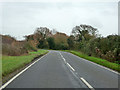
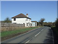
PaulButterworthEssex visited on 21st Jun 2023 - their rating: Cond: -1 Amb: 3 Access: 4 I accessed via Abbott Hall in Great Wigborough, as you enter the carpark area. On your right hand side take a track and follow until it bears left, keep following then less than half way the fields length, is the location of the Henge on the right side of the track.
If you stand on the track with the field & Henge on your right you should see a large tree in front left of the track, if you look about 2 o'clock you mat see the Church Tower of Salcott-cum-Virley, & if you turn around and approach the bend if the track back towards Abbott Hall in the distance that's the Church of Great Wigborough, which is worth visiting as it has amazing visits of the Henge, Mersea Island & Blackwater Estuary.
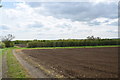
I wondered around the field which has a mix of wild flowers many Corn Marigolds, & weeds, the ground was fairly dry and cracked due to the hot weather, I couldn't see any ditches or indentations in the field, guess its been worked over for 5000 years!, but with wishful thinking I thought I could see the outline.
The location is well positioned as from the Henges location you can clearly see three hills, two of which have the Church towers visible of Salcott-cum-Virley & Great Wigborough, (Both 1 Mile distance).
Interestingly the Village of Goldhanger further along the Blackwater Estuary which runs close by, gets its name Gold from the Corn Marigold Flower which grows here, Goldhanger has had 20 odd variations of its name but always starts with Gold. its believed the Neolithic settlers who planted the seeds came from Europe, I think they may have helped build this monument or visited it each year on this day fascinating.
My personal view is that the same people that built the Henge in Wiltshire passed down the knowledge to Great Wigboroughs builders, or could it be the other way round?, could it be that Essex Estuary Henge is Older, either way it's location is ideal & worth a visit
")
Although no longer visible at ground level, it survives as a circular ditch that can be clearly seen as a cropmark and on aerial photographs. The ditch is 46m in diameter with two opposed entrances. Access via a permitted footpath from the Visitors' Centre of Abbot's Hall farm (Essex Wildlife Trust)
You may be viewing yesterday's version of this page. To see the most up to date information please register for a free account.
")
")
Do not use the above information on other web sites or publications without permission of the contributor.
Nearby Images from Geograph Britain and Ireland:
©2018(licence)
©2015(licence)
©2013(licence)

©2013(licence)
©2017(licence)
The above images may not be of the site on this page, they are loaded from Geograph.
Please Submit an Image of this site or go out and take one for us!
Click here to see more info for this site
Nearby sites
Key: Red: member's photo, Blue: 3rd party photo, Yellow: other image, Green: no photo - please go there and take one, Grey: site destroyed
Download sites to:
KML (Google Earth)
GPX (GPS waypoints)
CSV (Garmin/Navman)
CSV (Excel)
To unlock full downloads you need to sign up as a Contributory Member. Otherwise downloads are limited to 50 sites.
Turn off the page maps and other distractions
Nearby sites listing. In the following links * = Image available
837m WNW 284° Mill Mound Artificial Mound (TL9487914575)
5.3km ESE 114° St Peter's Well (West Mersea)* Holy Well or Sacred Spring (TM006124)
5.7km N 10° Gryme's Dyke Ancient Village or Settlement (TL965200)
6.4km E 88° West Mersea* Artificial Mound (TM021149)
7.0km NNW 337° Birch Long Barrow (TL927207)
7.2km NW 304° Tiptree Moud Round Barrow(s) (TL896182)
7.4km N 8° Heath Farm Dyke Ancient Village or Settlement (TL964218)
8.1km N 2° Stanway Gravel Pit Ancient Village or Settlement (TL956225)
8.4km N 10° Gosbecks Archaeological Park* Ancient Village or Settlement (TL968227)
8.5km NNE 30° Berechurch Dyke Misc. Earthwork
8.7km WNW 300° Inworth Cursus Cursus (TL8794718454)
9.2km NE 35° Tamworth Mound Misc. Earthwork (TM0065922209)
9.7km SE 133° Othona Roman Fort* Early Christian Sculptured Stone (TM031081)
10.2km N 7° Triple Dyke Ancient Village or Settlement (TL965246)
10.5km NNW 336° Marks Tey Puddingstone* Natural Stone / Erratic / Other Natural Feature (TL911238)
10.5km NNE 12° Lexden Tumulus* Artificial Mound (TL9753724712)
10.9km NW 307° Feering Cursus Cursus (TL867206)
11.0km NNE 23° St John's Green (Colchester) Cairn (TL99642468)
11.2km WNW 284° Rivenhall Cursus Cursus (TL847166)
11.3km WNW 283° Rivenhall Henge (TL846165)
11.4km WNW 284° Rivenhall Long Barrow (TL845167)
11.5km NNE 17° Sheepden Dyke Ancient Village or Settlement (TL987255)
11.6km NNE 23° Colchester Castle Museum* Museum (TL998253)
11.7km NE 36° Annan Road Bronze Age Barrow Cemetery* Barrow Cemetery (TM0215024164)
11.7km NW 310° Feeringbury Puddingstone* Marker Stone (TL8637621552)
View more nearby sites and additional images
<< Filitosa, the mysterious, and most celebrated prehistoric site on Corsica


 We would like to know more about this location. Please feel free to add a brief description and any relevant information in your own language.
 Wir möchten mehr über diese Stätte erfahren. Bitte zögern Sie nicht, eine kurze Beschreibung und relevante Informationen in Deutsch hinzuzufügen.
 Nous aimerions en savoir encore un peu sur les lieux. S'il vous plaît n'hesitez pas à ajouter une courte description et tous les renseignements pertinents dans votre propre langue.
 Quisieramos informarnos un poco más de las lugares. No dude en añadir una breve descripción y otros datos relevantes en su propio idioma.