<< Text Pages >> Tiptree Moud - Round Barrow(s) in England in Essex
Submitted by Anonymous on Wednesday, 18 July 2012 Page Views: 3025
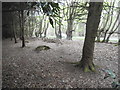
Neolithic and Bronze AgeSite Name: Tiptree MoudCountry: England
NOTE: This site is 0.725 km away from the location you searched for.
County: Essex Type: Round Barrow(s)
Nearest Town: Tiptree
Map Ref: TL896182
Latitude: 51.830230N Longitude: 0.750181E
Condition:
| 5 | Perfect |
| 4 | Almost Perfect |
| 3 | Reasonable but with some damage |
| 2 | Ruined but still recognisable as an ancient site |
| 1 | Pretty much destroyed, possibly visible as crop marks |
| 0 | No data. |
| -1 | Completely destroyed |
| 5 | Superb |
| 4 | Good |
| 3 | Ordinary |
| 2 | Not Good |
| 1 | Awful |
| 0 | No data. |
| 5 | Can be driven to, probably with disabled access |
| 4 | Short walk on a footpath |
| 3 | Requiring a bit more of a walk |
| 2 | A long walk |
| 1 | In the middle of nowhere, a nightmare to find |
| 0 | No data. |
| 5 | co-ordinates taken by GPS or official recorded co-ordinates |
| 4 | co-ordinates scaled from a detailed map |
| 3 | co-ordinates scaled from a bad map |
| 2 | co-ordinates of the nearest village |
| 1 | co-ordinates of the nearest town |
| 0 | no data |
Internal Links:
External Links:
I have visited· I would like to visit
Hurricane_Luis visited on 20th Feb 2013 - their rating: Cond: 5 Amb: 4 Access: 3
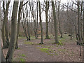
A Mound In Conyfeild Wood. It is Surrounded by a fence
You may be viewing yesterday's version of this page. To see the most up to date information please register for a free account.
Do not use the above information on other web sites or publications without permission of the contributor.
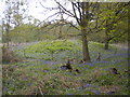
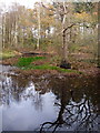
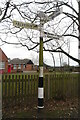
Nearby Images from Geograph Britain and Ireland:
©2012(licence)
©2007(licence)
©2021(licence)
©2015(licence)
©2017(licence)
The above images may not be of the site on this page, they are loaded from Geograph.
Please Submit an Image of this site or go out and take one for us!
Click here to see more info for this site
Nearby sites
Key: Red: member's photo, Blue: 3rd party photo, Yellow: other image, Green: no photo - please go there and take one, Grey: site destroyed
Download sites to:
KML (Google Earth)
GPX (GPS waypoints)
CSV (Garmin/Navman)
CSV (Excel)
To unlock full downloads you need to sign up as a Contributory Member. Otherwise downloads are limited to 50 sites.
Turn off the page maps and other distractions
Nearby sites listing. In the following links * = Image available
1.7km W 281° Inworth Cursus Cursus (TL8794718454)
3.8km NW 312° Feering Cursus Cursus (TL867206)
4.0km NE 53° Birch Long Barrow (TL927207)
4.6km NW 318° Feeringbury Puddingstone* Marker Stone (TL8637621552)
5.1km WSW 254° Rivenhall Cursus Cursus (TL847166)
5.3km WSW 253° Rivenhall Henge (TL846165)
5.3km WSW 256° Rivenhall Long Barrow (TL845167)
5.8km NNE 17° Marks Tey Puddingstone* Natural Stone / Erratic / Other Natural Feature (TL911238)
6.2km WSW 248° Witham Cursus Cursus (TL839157)
6.4km SE 127° Mill Mound Artificial Mound (TL9487914575)
7.1km ENE 78° Gryme's Dyke Ancient Village or Settlement (TL965200)
7.2km SE 124° Wigborough Henge* Henge (TL957144)
7.4km ENE 56° Stanway Gravel Pit Ancient Village or Settlement (TL956225)
7.7km ENE 64° Heath Farm Dyke Ancient Village or Settlement (TL964218)
8.3km WSW 250° Chipping Hill Enclosure Misc. Earthwork (TL819151)
8.5km ENE 60° Gosbecks Archaeological Park* Ancient Village or Settlement (TL968227)
9.0km NNE 18° Fordstreet Puddingstone* Marker Stone (TL921269)
9.4km NE 49° Triple Dyke Ancient Village or Settlement (TL965246)
9.6km WSW 244° Ivy Chimneys (Witham) Ancient Village or Settlement (TL8111513611)
10.2km NE 53° Lexden Tumulus* Artificial Mound (TL9753724712)
10.7km ENE 72° Berechurch Dyke Misc. Earthwork
10.8km W 270° White Notley Puddingstone* Marker Stone (TL7880517722)
11.0km W 281° Cressing Henge Henge (TL787199)
11.1km NNW 345° Earl's Colne Pudding stone Natural Stone / Erratic / Other Natural Feature (TL864288)
11.4km NNE 22° Fordham Puddingstone* Marker Stone (TL9348028891)
View more nearby sites and additional images


 We would like to know more about this location. Please feel free to add a brief description and any relevant information in your own language.
 Wir möchten mehr über diese Stätte erfahren. Bitte zögern Sie nicht, eine kurze Beschreibung und relevante Informationen in Deutsch hinzuzufügen.
 Nous aimerions en savoir encore un peu sur les lieux. S'il vous plaît n'hesitez pas à ajouter une courte description et tous les renseignements pertinents dans votre propre langue.
 Quisieramos informarnos un poco más de las lugares. No dude en añadir una breve descripción y otros datos relevantes en su propio idioma.