<< Other Photo Pages >> Timworth Puddingstone - Marker Stone in England in Suffolk
Submitted by Thorgrim on Tuesday, 18 January 2005 Page Views: 4787
Multi-periodSite Name: Timworth PuddingstoneCountry: England
NOTE: This site is 0.307 km away from the location you searched for.
County: Suffolk Type: Marker Stone
Nearest Town: Thetford Nearest Village: Timworth Green
Map Ref: TL8580969281
Latitude: 52.290238N Longitude: 0.723001E
Condition:
| 5 | Perfect |
| 4 | Almost Perfect |
| 3 | Reasonable but with some damage |
| 2 | Ruined but still recognisable as an ancient site |
| 1 | Pretty much destroyed, possibly visible as crop marks |
| 0 | No data. |
| -1 | Completely destroyed |
| 5 | Superb |
| 4 | Good |
| 3 | Ordinary |
| 2 | Not Good |
| 1 | Awful |
| 0 | No data. |
| 5 | Can be driven to, probably with disabled access |
| 4 | Short walk on a footpath |
| 3 | Requiring a bit more of a walk |
| 2 | A long walk |
| 1 | In the middle of nowhere, a nightmare to find |
| 0 | No data. |
| 5 | co-ordinates taken by GPS or official recorded co-ordinates |
| 4 | co-ordinates scaled from a detailed map |
| 3 | co-ordinates scaled from a bad map |
| 2 | co-ordinates of the nearest village |
| 1 | co-ordinates of the nearest town |
| 0 | no data |
Internal Links:
External Links:
I have visited· I would like to visit
willowman1 visited on 31st Jul 2015 - their rating: Cond: 3 Amb: 3 Access: 5
Very large puddingstone on the footpath by the stables. Site No. 10 on the Puddingstone Trail
You may be viewing yesterday's version of this page. To see the most up to date information please register for a free account.
Do not use the above information on other web sites or publications without permission of the contributor.
willowman1 has found this location on Google Street View:
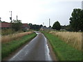
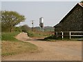
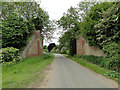
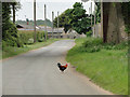
Nearby Images from Geograph Britain and Ireland:
©2009(licence)
©2011(licence)
©2015(licence)
©2015(licence)
©2005(licence)
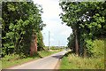
The above images may not be of the site on this page, they are loaded from Geograph.
Please Submit an Image of this site or go out and take one for us!
Click here to see more info for this site
Nearby sites
Key: Red: member's photo, Blue: 3rd party photo, Yellow: other image, Green: no photo - please go there and take one, Grey: site destroyed
Download sites to:
KML (Google Earth)
GPX (GPS waypoints)
CSV (Garmin/Navman)
CSV (Excel)
To unlock full downloads you need to sign up as a Contributory Member. Otherwise downloads are limited to 50 sites.
Turn off the page maps and other distractions
Nearby sites listing. In the following links * = Image available
1.6km N 353° Ingham Puddingstone* Marker Stone (TL8556770828)
2.2km SSE 166° Hall Farm Puddingstone Marker Stone (TL864672)
2.7km SW 221° Fornham All Saints A Cursus Cursus (TL841672)
2.7km SW 235° Fornham All Saints C Cursus Cursus (TL83636765)
2.8km WSW 244° Fornham All Saints B Cursus Cursus (TL83346794)
2.9km W 263° Fornham All Saints A Cursus Cursus (TL829688)
3.0km NW 316° The Hill of Health* Round Barrow(s) (TL8365171319)
3.9km SE 130° St. John's Well (Suffolk)* Holy Well or Sacred Spring (TL889669)
4.4km N 8° Seven hills, Rymer Barrow Cemetery (TL863737)
4.9km S 188° Moyse's Hall Museum Museum (TL8530264367)
5.0km W 275° Flempton Cursus Cursus (TL808695)
5.3km WNW 291° West Stow* Ancient Village or Settlement (TL808710)
5.5km NNW 345° Traveller's Hill* Round Barrow(s) (TL842745)
5.6km NNE 32° Black Hill-Suffolk* Round Barrow(s) (TL886742)
6.1km NE 40° Troston Mount* Round Barrow(s) (TL896741)
6.3km NW 307° West Stow Field Barrow* Round Barrow(s) (TL806729)
7.1km NE 37° Honington Barrows Round Barrow(s) (TL899751)
8.2km E 96° Pakenham Cursus Cursus (TL940688)
9.7km N 7° Millfield Barn Round Barrow(s) (TL86717898)
9.8km N 7° Mill House Barrow Round Barrow(s) (TL867790)
10.3km N 6° Barnham Puddingstone Marker Stone (TL865796)
10.8km NNE 18° Barnham Heath Pit Natural Stone / Erratic / Other Natural Feature (TL887797)
12.0km SSW 199° Baal Stone* Natural Stone / Erratic / Other Natural Feature (TL82375776)
12.0km NW 308° How Hill Round Barrow(s) (TL75987626)
12.8km E 81° Artificial Mound near Wrenshall Farm Artificial Mound (TL9836071843)
View more nearby sites and additional images


 We would like to know more about this location. Please feel free to add a brief description and any relevant information in your own language.
 Wir möchten mehr über diese Stätte erfahren. Bitte zögern Sie nicht, eine kurze Beschreibung und relevante Informationen in Deutsch hinzuzufügen.
 Nous aimerions en savoir encore un peu sur les lieux. S'il vous plaît n'hesitez pas à ajouter une courte description et tous les renseignements pertinents dans votre propre langue.
 Quisieramos informarnos un poco más de las lugares. No dude en añadir una breve descripción y otros datos relevantes en su propio idioma.