<< Our Photo Pages >> Source des Pierres - Holy Well or Sacred Spring in France in Aquitaine:Dordogne (24)
Submitted by LaDragonne on Sunday, 10 March 2024 Page Views: 72
Springs and Holy WellsSite Name: Source des Pierres Alternative Name: Dolmen des PierresCountry: France Département: Aquitaine:Dordogne (24) Type: Holy Well or Sacred Spring
Nearest Town: Bergerac Nearest Village: Sourzac
Latitude: 45.042290N Longitude: 0.381170E
Condition:
| 5 | Perfect |
| 4 | Almost Perfect |
| 3 | Reasonable but with some damage |
| 2 | Ruined but still recognisable as an ancient site |
| 1 | Pretty much destroyed, possibly visible as crop marks |
| 0 | No data. |
| -1 | Completely destroyed |
| 5 | Superb |
| 4 | Good |
| 3 | Ordinary |
| 2 | Not Good |
| 1 | Awful |
| 0 | No data. |
| 5 | Can be driven to, probably with disabled access |
| 4 | Short walk on a footpath |
| 3 | Requiring a bit more of a walk |
| 2 | A long walk |
| 1 | In the middle of nowhere, a nightmare to find |
| 0 | No data. |
| 5 | co-ordinates taken by GPS or official recorded co-ordinates |
| 4 | co-ordinates scaled from a detailed map |
| 3 | co-ordinates scaled from a bad map |
| 2 | co-ordinates of the nearest village |
| 1 | co-ordinates of the nearest town |
| 0 | no data |
Internal Links:
External Links:
")
Une grosse dalle de grès foncé et lisse posée par l'homme protège l'ancienne émergence d'une source.,RD 6089, route de Périgueux. Un réceptacle abreuvoir est aménagé, même si le débit s'est fortement réduit.
Cette dalle a été confondue avec une table dolménique et elle a donné son nom à la route voisine "Route du Dolmen".
You may be viewing yesterday's version of this page. To see the most up to date information please register for a free account.
")
")
Do not use the above information on other web sites or publications without permission of the contributor.
Nearby Images from Flickr
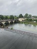

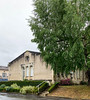
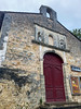

The above images may not be of the site on this page, but were taken nearby. They are loaded from Flickr so please click on them for image credits.
Click here to see more info for this site
Nearby sites
Click here to view sites on an interactive map of the areaKey: Red: member's photo, Blue: 3rd party photo, Yellow: other image, Green: no photo - please go there and take one, Grey: site destroyed
Download sites to:
KML (Google Earth)
GPX (GPS waypoints)
CSV (Garmin/Navman)
CSV (Excel)
To unlock full downloads you need to sign up as a Contributory Member. Otherwise downloads are limited to 50 sites.
Turn off the page maps and other distractions
Nearby sites listing. In the following links * = Image available
276m S 181° Grotte de Las Agnelas* Cave or Rock Shelter
2.4km NW 308° Menhir de la Croix Blanche* Standing Stone (Menhir)
2.7km SW 214° Dolmen de Drouillas* Burial Chamber or Dolmen
4.0km SSE 154° Dolmen de La Caze* Burial Chamber or Dolmen
4.3km WNW 289° Dolmen de la Joncasse* Burial Chamber or Dolmen
5.9km S 177° Menhir de Les Leyches* Standing Stone (Menhir)
6.5km SE 128° Menhir dit La Peyre-Chaume* Standing Stone (Menhir)
10.0km ESE 116° Dolmen Peyrelevade de Beleymas* Burial Chamber or Dolmen
11.3km SE 130° Dolmen Le Cayre de Beleymas* Burial Chamber or Dolmen
11.4km SE 131° Le Roc del Cayre* Natural Stone / Erratic / Other Natural Feature
12.4km SE 135° Pierre Teule* Marker Stone
13.7km ESE 105° Menhir de Pierrefiche (Villamblard)* Standing Stone (Menhir)
13.7km SE 143° Le rocher pointu* Standing Stone (Menhir)
14.3km NE 46° Dolmen de La Redondie* Burial Chamber or Dolmen
15.5km E 95° Dolmen de Peyrelevade (Villamblard)* Burial Chamber or Dolmen
15.8km E 96° Pierre philosophale de Peyrelevade* Natural Stone / Erratic / Other Natural Feature
18.0km NNE 19° Peyrebrune (Seyssac)* Burial Chamber or Dolmen
18.5km NNE 27° La Vigerie tumulus* Chambered Tomb
20.0km NNE 17° Dolmen de Palus* Burial Chamber or Dolmen
20.4km NNW 331° Les Pierres Noires* Stone Row / Alignment
20.6km ESE 106° Dolmen dit Pierre Levée (Beauregard-et-Bassac)* Burial Chamber or Dolmen
21.1km SW 214° Dolmen de Barbeyrolle Burial Chamber or Dolmen
21.3km SSW 214° Menhir de Barbeyrolle* Standing Stone (Menhir)
21.8km SW 230° Dolmen Pierre Plantade* Burial Chamber or Dolmen
22.3km NNE 17° Dolmen de la Vaurelie* Burial Chamber or Dolmen
View more nearby sites and additional images


 We would like to know more about this location. Please feel free to add a brief description and any relevant information in your own language.
 Wir möchten mehr über diese Stätte erfahren. Bitte zögern Sie nicht, eine kurze Beschreibung und relevante Informationen in Deutsch hinzuzufügen.
 Nous aimerions en savoir encore un peu sur les lieux. S'il vous plaît n'hesitez pas à ajouter une courte description et tous les renseignements pertinents dans votre propre langue.
 Quisieramos informarnos un poco más de las lugares. No dude en añadir una breve descripción y otros datos relevantes en su propio idioma.