<< Text Pages >> Redwell springs - Holy Well or Sacred Spring in England in Kent
Submitted by HOLYWELL on Tuesday, 01 March 2011 Page Views: 4751
Springs and Holy WellsSite Name: Redwell springsCountry: England
NOTE: This site is 0.869 km away from the location you searched for.
County: Kent Type: Holy Well or Sacred Spring
Nearest Village: Igthham
Map Ref: TQ591558
Latitude: 51.279131N Longitude: 0.279757E
Condition:
| 5 | Perfect |
| 4 | Almost Perfect |
| 3 | Reasonable but with some damage |
| 2 | Ruined but still recognisable as an ancient site |
| 1 | Pretty much destroyed, possibly visible as crop marks |
| 0 | No data. |
| -1 | Completely destroyed |
| 5 | Superb |
| 4 | Good |
| 3 | Ordinary |
| 2 | Not Good |
| 1 | Awful |
| 0 | No data. |
| 5 | Can be driven to, probably with disabled access |
| 4 | Short walk on a footpath |
| 3 | Requiring a bit more of a walk |
| 2 | A long walk |
| 1 | In the middle of nowhere, a nightmare to find |
| 0 | No data. |
| 5 | co-ordinates taken by GPS or official recorded co-ordinates |
| 4 | co-ordinates scaled from a detailed map |
| 3 | co-ordinates scaled from a bad map |
| 2 | co-ordinates of the nearest village |
| 1 | co-ordinates of the nearest town |
| 0 | no data |
Internal Links:
External Links:
Holy Well or Sacred Spring in Kent
Redwell springs which are said to emerge at the base of a tumulus or barrow, about a mile from the church. The proximity of the tumulus may indicate that the spring was important in prehistoric periods, and may have been a local cult focus. The name Redwell suggests that the water is chalybeate, or perhaps it derives from Ragwell, from the past placing of clootties or torn cloth around the spring in hope of a cure. Alternatively, as in other places, it could derive from Redwell, for cross over the well. Mr. Williamson informed me that he believes that the well in question is found at Redwell Farm, owned by a Mr. D. Cloke, who utilises its water to supply an ornamental pond. Subsequently, there is now little to see of the spring and the barrow.
You may be viewing yesterday's version of this page. To see the most up to date information please register for a free account.
Do not use the above information on other web sites or publications without permission of the contributor.
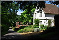
Nearby Images from Geograph Britain and Ireland:
©2012(licence)
©2013(licence)
©2013(licence)
©2012(licence)
©2008(licence)
The above images may not be of the site on this page, they are loaded from Geograph.
Please Submit an Image of this site or go out and take one for us!
Click here to see more info for this site
Nearby sites
Key: Red: member's photo, Blue: 3rd party photo, Yellow: other image, Green: no photo - please go there and take one, Grey: site destroyed
Download sites to:
KML (Google Earth)
GPX (GPS waypoints)
CSV (Garmin/Navman)
CSV (Excel)
To unlock full downloads you need to sign up as a Contributory Member. Otherwise downloads are limited to 50 sites.
Turn off the page maps and other distractions
Nearby sites listing. In the following links * = Image available
889m NW 318° Oldbury Rock Shelters* Cave or Rock Shelter (TQ5848056439)
982m WNW 296° Oldbury Hillfort* Hillfort (TQ582562)
2.9km SSE 153° Plaxtol Not Known (by us) (TQ605533)
4.0km NNE 33° Gateway granites* Ancient Trackway (TQ61175924)
4.6km NW 310° St Edith's Well (Kemsing)* Holy Well or Sacred Spring (TQ5548458678)
5.3km W 281° Millpond Wood Barrow* Round Barrow(s) (TQ53815661)
5.9km NE 55° Mount Mead* Round Barrow(s) (TQ63835933)
6.1km WNW 281° Saint John's Spring (Greatness) Holy Well or Sacred Spring (TQ531568)
6.5km NW 308° Stumblebury Round Barrow(s) (TQ53845966)
6.8km WNW 302° St Thomas a Becket's Well* Holy Well or Sacred Spring (TQ532592)
7.0km ENE 63° Chestnuts* Long Barrow (TQ65265917)
7.0km ENE 64° Addington Long Barrow* Long Barrow (TQ65335910)
7.2km WNW 301° Colet's Well* Holy Well or Sacred Spring (TQ5283459333)
7.9km NE 56° Addington Sarsens Natural Stone / Erratic / Other Natural Feature (TQ65516047)
8.0km NE 54° Coldrum* Chambered Tomb (TQ65446072)
8.1km ESE 110° Pizien Well Holy Well or Sacred Spring (TQ668533)
8.5km NE 44° White Horse Wood Barrow Round Barrow(s) (TQ649621)
8.6km E 83° St Leonard's Well (West Malling)* Holy Well or Sacred Spring (TQ6763557095)
8.6km NE 56° Ryarsh Sarson Stones Natural Stone / Erratic / Other Natural Feature (TQ66076089)
9.8km NE 43° Cock Adam Shaw Natural Stone / Erratic / Other Natural Feature (TQ65576323)
10.8km SE 128° Hob's pool Holy Well or Sacred Spring (TQ678494)
10.9km NNW 334° Eynsford Stone* Natural Stone / Erratic / Other Natural Feature (TQ540655)
11.0km NE 46° Dode Church Well* Holy Well or Sacred Spring (TQ668637)
11.4km ENE 76° Larkfield Cairnfield (Maidstone) Cairn (TQ70155891)
11.7km NNE 29° St John The Baptist Church Sarson Stone Natural Stone / Erratic / Other Natural Feature (TQ644662)
View more nearby sites and additional images


 We would like to know more about this location. Please feel free to add a brief description and any relevant information in your own language.
 Wir möchten mehr über diese Stätte erfahren. Bitte zögern Sie nicht, eine kurze Beschreibung und relevante Informationen in Deutsch hinzuzufügen.
 Nous aimerions en savoir encore un peu sur les lieux. S'il vous plaît n'hesitez pas à ajouter une courte description et tous les renseignements pertinents dans votre propre langue.
 Quisieramos informarnos un poco más de las lugares. No dude en añadir una breve descripción y otros datos relevantes en su propio idioma.