Featured: Explore Scotland (and everywhere else) with our Megalithic Portal iPhone app

Explore Scotland (and everywhere else) with our Megalithic Portal iPhone app

Random Image


Ardestie

Singing Up the Country: The Songlines of Avebury and Beyond

Singing Up the Country: The Songlines of Avebury and Beyond

Who's Online

There are currently, 396 guests and 1 members online.

You are a guest. To join in, please register for free by clicking here

Sponsors

<< Our Photo Pages >> Teotihuacan - Ancient Village or Settlement in Mexico

Submitted by bat400 on Thursday, 01 March 2012  Page Views: 12362

Multi-periodSite Name: Teotihuacan
Country: Mexico
NOTE: This site is 0.119 km away from the location you searched for.

Type: Ancient Village or Settlement
Nearest Town: Mexico City
Latitude: 19.692500N  Longitude: 98.84653W
Condition:
5Perfect
4Almost Perfect
3Reasonable but with some damage
2Ruined but still recognisable as an ancient site
1Pretty much destroyed, possibly visible as crop marks
0No data.
-1Completely destroyed
4 Ambience:
5Superb
4Good
3Ordinary
2Not Good
1Awful
0No data.
4 Access:
5Can be driven to, probably with disabled access
4Short walk on a footpath
3Requiring a bit more of a walk
2A long walk
1In the middle of nowhere, a nightmare to find
0No data.
5 Accuracy:
5co-ordinates taken by GPS or official recorded co-ordinates
4co-ordinates scaled from a detailed map
3co-ordinates scaled from a bad map
2co-ordinates of the nearest village
1co-ordinates of the nearest town
0no data
5

Internal Links:
External Links:

I have visited· I would like to visit

jdeblois83 would like to visit

ChrisHealey visited on 14th Sep 2014 - their rating: Cond: 3 Amb: 4 Access: 5

mfrincu visited on 30th Dec 2013 - their rating: Cond: 5 Amb: 5 Access: 5 The pyramids are some of the best preserved I've ever seen! A must. Take a local bus from Mexico City and stay there for 4-5 hours! Explore on your own.

MartinJEley visited on 6th Feb 2010 - their rating: Cond: 4 Amb: 5 Access: 5 The scale of the structures leave you in complete wonder at they must have looked like in their day. It was well worth the slow journey out of Mexico City in the heavy traffic.


Average ratings for this site from all visit loggers: Condition: 4 Ambience: 4.67 Access: 5

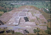
Teotihuacan - Pyramid of the Moon
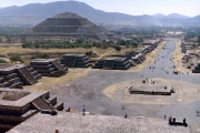
Teotihuacan - Pyramid of the Moon submitted by LivingRocks : The Pyramid of the Moon from the Pyramid of the Sun. (Vote or comment on this photo)
Ancient City in Mexico.Teotihuacan was the largest pre-Columbian city in the Americas. The city covered more than 7,000 acres and at its height (150-450 AD) is estimated to have had a population estimated at around 200,000 at that time.

The culture that built it is also known as Teotihucan and may have been the single most influential culture of Mesoamerica in regards both architecture and culture. The earliest buildings date to 200 BC, but the largest structures were completed by 250 AD. Major archetectural and decorative features include square stepped pyramids with rectangualr panels on the sloping sides (talud-tablero.)

The city appears to have declined through 500-600 AD and at some time in the 7th or 8th century portions of the city were burned and sacked. The Aztecs and their allies (the Triple Alliance) discovered the massive monuments centuries later as they exerted their influence in central Mexico, but the site was never abandoned entirely at any time after its construction. The name of the city, "place of those who have the road of the gods" or alternately "place of the origin of gods" was given by these later cultures, who used it as a pilgrimage site.

A Unesco World Heritage Site.

Note: The role of cosmetics in Teotihuacan funerary rites, see the latest comment
You may be viewing yesterday's version of this page. To see the most up to date information please register for a free account.
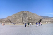
Teotihuacan - Pyramid of the Moon
Teotihuacan - Pyramid of the Moon submitted by DrewParsons : Teotihuacan - The Pyramid of the Moon taken in 1989 (Vote or comment on this photo)

Teotihuacan - Temple of Quetzalcoatl
Teotihuacan - Temple of Quetzalcoatl submitted by DrewParsons : The Temple of Quetzalcoatl photographed during an overland trip from Los Angeles to Belize and Guatemala in December 1992. (Vote or comment on this photo)

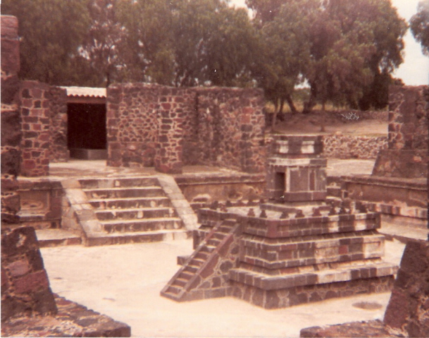
Teotihuacan - Atelelco
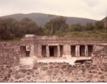
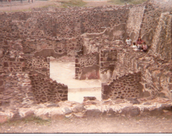
Teotihuacan - Atelelco submitted by AlexHunger : Palace or small temple section West of the complex. Altar of sorts in cener of complex. Scan of picture dating back to 1982. At the time this section was recently reopened, but not much was published about it. (Vote or comment on this photo)

Teotihuacan
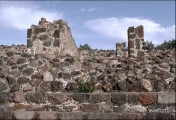
Teotihuacan submitted by AlexHunger : Palace of the Butterflies at Teotihuacan. ruins Scans of Photos dating to 1982. (Vote or comment on this photo)

Teotihuacan - Temple of Quetzalcoatl
Teotihuacan - Temple of Quetzalcoatl submitted by wirzroland : Site in Estado de Mexico Mexico

Teotihuacan - Pyramid of the Moon
Teotihuacan - Pyramid of the Moon submitted by wirzroland

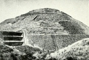
Teotihuacan - Pyramid of the Moon
Teotihuacan - Pyramid of the Moon submitted by durhamnature : Old photo from "Archaeological relics..." via archive.org Site in Estado de Mexico Mexico

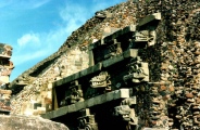
Teotihuacan - Temple of Quetzalcoatl
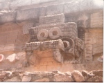
Teotihuacan - Temple of Quetzalcoatl submitted by DrewParsons : Carvings on the front of the temple. December 1992.

Teotihuacan - Pyramid of the Moon
Teotihuacan - Pyramid of the Moon submitted by DrewParsons : Photographed in December 1989

Teotihuacan - Temple of Quetzalcoatl
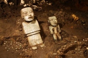
Teotihuacan - Temple of Quetzalcoatl submitted by dodomad : This Nov. 19, 2013 photo released by Mexico's National Institute of Anthropology and History (INAH), shows sculptures unearthed by investigators at the Teotihuacan archeological site in Mexico. Mexican archaeologists have concluded a year long exploration of a tunnel sealed nearly 2,000 years ago at the ancient city of Teotihuacan and found thousands of relics. Teotihuacan dominated central Mexico... (1 comment)

Teotihuacan
Teotihuacan submitted by wirzroland : Site in Mexico

Teotihuacan - Pyramid of the Moon
Teotihuacan - Pyramid of the Moon submitted by DrewParsons : Photographed during a second visit here in December 1992

Teotihuacan - Temple of Quetzalcoatl
Teotihuacan - Temple of Quetzalcoatl submitted by DrewParsons : View of the temple taken in December 1992

Teotihuacan
Teotihuacan submitted by AlexHunger : Palace of the Butterflies at Teotihuacan. Scans of Photos dating to 1982.

Teotihuacan
Teotihuacan submitted by AlexHunger : Palace of the Butterflies at Teotihuacan. West Side. Scans of Photos dating to 1982.

Teotihuacan
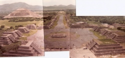
Teotihuacan submitted by AlexHunger : Composite picture of The plaza of the moon in front of the Pyramid of the Moon, the Avenue of the Dead and the Pyramid of the Sun dating to July 1982 and taken from an extremely basic 110 Camera.

Teotihuacan - Temple of Quetzalcoatl
Teotihuacan - Temple of Quetzalcoatl submitted by AlexHunger : Figure of the God Quetzalcoatl, on the side of the Pyramid. Quetzalcoatl was essentially a flyng serpant, while at the same time being a bearded Jesus equivalent to the ancient Mexican tribes.

Teotihuacan - Pyramid of the Sun
Teotihuacan - Pyramid of the Sun submitted by DrewParsons : View of the Pyramid of the Sun taken from the Pyramid of the Moon. Photographed in December 1989

Teotihuacan - Pyramid of the Sun
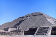
Teotihuacan - Pyramid of the Sun submitted by DrewParsons : Photographed in December 1989

Teotihuacan - Pyramid of the Sun
Teotihuacan - Pyramid of the Sun submitted by DrewParsons

Teotihuacan - Pyramid of the Sun
Teotihuacan - Pyramid of the Sun submitted by wirzroland : Site in Estado de Mexico Mexico

Teotihuacan - Pyramid of the Sun
Teotihuacan - Pyramid of the Sun submitted by durhamnature : San Juan Teotihuacan from the Pyramid of the Moon. Old photo from "Prehistoric America" via archive.org Site in Estado de Mexico Mexico

Teotihuacan - Pyramid of the Sun
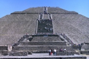
Teotihuacan - Pyramid of the Sun submitted by DrewParsons : View showing the immense size of the pyramid. Photographed in December 1992.

Teotihuacan - Pyramid of the Sun
Teotihuacan - Pyramid of the Sun submitted by AlexHunger : North side of the multi tiered Pyramid of the Sun as seen from the pyramid of the Moon

These are just the first 25 photos of Teotihuacan. If you log in with a free user account you will be able to see our entire collection.

Do not use the above information on other web sites or publications without permission of the contributor.
Click here to see more info for this site

Nearby sites

Click here to view sites on an interactive map of the area

Key: Red: member's photo, Blue: 3rd party photo, Yellow: other image, Green: no photo - please go there and take one, Grey: site destroyed

Download sites to:
KML (Google Earth)
GPX (GPS waypoints)
CSV (Garmin/Navman)
CSV (Excel)

To unlock full downloads you need to sign up as a Contributory Member. Otherwise downloads are limited to 50 sites.


Turn off the page maps and other distractions

Nearby sites listing. In the following links * = Image available
 310m E 96° Teotihuacan - Pyramid of the Sun* Pyramid / Mastaba
 709m W 259° Teotihuacan - Atelelco* Ancient Palace
 838m NNE 18° Teotihuacan - Pyramid of the Moon* Pyramid / Mastaba
 875m WSW 240° Teotihuacan - Tetitla Ancient Village or Settlement
 1.2km S 181° Teotihuacan - Temple of Quetzalcoatl* Pyramid / Mastaba
 21.9km S 172° Texcotzingo* Ancient Palace
 33.2km ENE 66° Tepeapulco Pyramid* Pyramid / Mastaba
 37.6km WSW 246° Acatitlan* Ancient Temple
 38.1km WSW 242° Tenayuca* Pyramid / Mastaba
 40.6km SW 229° Tlatelolco* Ancient Village or Settlement
 41.4km SW 226° Tenochtitlan - Templo Mayor* Ancient Temple
 46.3km SW 230° Museo Nacional de Antropología* Museum
 55.8km SW 219° Cuicuilco* Pyramid / Mastaba
 56.1km SW 217° Tlalpan Ancient Village or Settlement
 66.1km NW 309° Tula.* Ancient Village or Settlement
 69.2km NE 47° Huapalcalco Pyramid Pyramid / Mastaba
 72.0km SE 134° Xochitecatl* Pyramid / Mastaba
 72.5km SE 133° Cacaxtla* Ancient Village or Settlement
 81.4km SSW 199° Tepoztlan* Ancient Village or Settlement
 90.7km SE 141° Cholula* Pyramid / Mastaba
 93.5km SSW 205° Cuernavaca - Piramide de Teopanzolco* Pyramid / Mastaba
 102.0km SW 231° Teotenango* Ancient Temple
 109.5km SSW 206° Xochicalco* Ancient Village or Settlement
 111.3km WNW 287° Huamango Ancient Village or Settlement
 113.2km S 176° Chalcatzingo* Rock Art
View more nearby sites and additional images

<< Barrow Hill (Worcestershire)

Dalvule >>

Please add your thoughts on this site

Prehistoric Settlements

Prehistoric Settlements

Sponsors

Auto-Translation (Google)

Translate from English into:

"Teotihuacan" | Login/Create an Account | 10 News and Comments
  
Go back to top of page    Comments are owned by the poster. We aren't responsible for their content.
Teotihuacán Pyramids: Where Sun, Moon and Death come together by Andy B on Friday, 28 August 2020
(User Info | Send a Message)
Between 100 BCE and 650–750 CE, Mesoamerica witnessed the rise and fall of its first great city known as Teotihuacán. It was a defining period of cultural development, which influenced every part of the American world until the Spaniards’ invasion.

Unlike many other places in the region, this city was not destroyed by the Europeans; it was already abandoned some 750 years before the Spanish conquistadors arrived and no one knows why! Several theories have been advanced about the city’s collapse such as water shortage (caused by climate change), over-exploitation of natural resources and internal fighting. From a thriving city with about 65,000 inhabitants around the 3rd century CE, it declined to a population of about 5,000 in the year 750.

Even though the city was abandoned by residents when the Aztecs found it, the place always attracted pilgrims as well as people who came to marvel at the pyramids and take inspiration for building similar cities. The Aztecs were so fascinated by the city that they called it Teotihuacán, meaning “the place where Gods* are born”.

The first thing I noticed on visiting the ruins of Teotihuacán was the preponderance of pyramids. It was as if every structure of importance had been placed on a pyramid. The buildings that once stood atop the pyramids were gone; only the pyramidical bases with staircases remained. The Sun Pyramid was, of course, the tallest and most eye-catching one followed by the shorter Moon Pyramid but there was also an impressive Avenue of the Dead which had scores of pyramids on either side.

Luis Nieto, our guide at Teotihuacán started the tour by taking us to the remains of a dwelling complex excavated at Tepantitla, which was a mile away from the pyramids. There are some 2,000 apartment compounds of which Tetila, Atetelco, Tepantitla and Zacuala contain the finest murals found in Teotihuacan. “No guide will bring you here,” said Luis. “But, you really won’t understand how people lived here if you don’t see these pictures drawn by them.” Indeed, we felt immensely grateful to get a glimpse of art showing the social life of the people. Scores of humans seemed to be engaged in a variety of activities, which must have been quite a puzzle to decode. For instance, there was a group of four persons holding hands in between their legs! Were they playing a game? There were flowers and insects, leaves and reptiles in the murals.

What fascinated me most was the manner in which speech was depicted in the pictures. At first, I thought something was coming out of the mouths of people; then the guide told me that the scrolls coming out of the mouths indicated that the people were speaking. He said they were called virgula.

Read more at
https://medium.com/@sahana.singh/teotihuac%C3%A1n-pyramids-where-sun-moon-and-death-come-together-3f565a80590a
[ Reply to This ]

The Teotihuacan Sound Mapping Project by Andy B on Thursday, 27 August 2020
(User Info | Send a Message)
The Teotihuacan Sound Mapping Project: Exploring The Sonic Sphere of the City of The Gods, Mexico
Adje Both (University of Huddersfield)

The cultural remains of the UNESCO World Heritage site of Teotihuacan belong to a powerful society dominating the splendid period
of Classic Mesoamerica during the first half of the first millennium CE. However, many aspects of this culture are still not well under-
stood, including the role that sound and music played in its urban environment. With the aid of new technologies in geo-referenced
sound mapping and multimedia applications, the musical instruments of Teotihuacan will be recreated and played, their sounds test-
ed both under laboratorial conditions and on-site in different architectural settings, and a virtual sound-map of the city on the basis
of the results created.This research will contribute to a better understanding of the site and the sonic interaction of its inhabitants,
as will significantly develop the field of archaeoacoustical research. Funded through a Marie Curie fellowship of the European Union,
the Teotihuacan Virtual Sound Map is a pilot-project for creating a model for exhibiting sound in the actual environment of ancient
archaeological sites.

Presentation at Virtual EAA Conference 2020
[ Reply to This ]

The role of cosmetics in Teotihuacan funerary rites by Andy B on Thursday, 01 March 2012
(User Info | Send a Message)
If you’ve ever read Janet Evanovich’s Stephanie Plum novels, you know that makeup can play a very important role in funerals. The use of coloring and makeup in funeral rites and burials is not unknown in the past either. Red or yellow ochre was often used to paint the bodies of the deceased in various regions during the Neolithic period. Egyptians had containers and palettes for makeup in their tombs, and their eyelids were often decorated after death.

A new article from the Journal of Archaeological Sciences by Domenech-Carbo et al. 2012, analyzes the chemical composition of samples of cosmetic materials from Teotihaucan in order to assess their function in funerary rites.

The grave goods found with individuals also vary by status ranging from ceramic vessels and obsidian to jadeite and highly decorated vessels. Elite burials are found in tombs with exotic materials and metals.

31 miniature vessels were recovered from a burial dating to 200-350 CE. The materials found within were thought to be some type of pigmentation. A multi-technique approach was taken to understand their composition.

The paper's authors argue that the recovery of these materials from a burial site suggests that they were either used in the funeral rites or were an offering to the deceased as representative of their profession. The burial is considered to be among the elite, perhaps warriors or dancers. They conclude that they don’t have any clear answers as to the function of these cosmetics, but that this find is important because it is the first evidence of cosmetics in this period of history in Mesoamerica.

What I consider to most important from this paper is the elaboration of funeral rituals. When we assess status it is often done by the materials they are found with or the perceived effort that went into burial. This often ignores the importance of the process of the funeral leading up to the burial.

Read more at Katy Meyers' bioarchaeology and mortuary archaeology news blog:
http://bonesdontlie.wordpress.com/2012/02/23/the-role-of-cosmetics-in-teotihuacan-funerary-rites/
[ Reply to This ]

Re: Teotihuacan by davidmorgan on Friday, 11 February 2011
(User Info | Send a Message)
Street View -
View Larger Map
[ Reply to This ]

Ancient Mexicans crossbred wolf-dogs by davidmorgan on Thursday, 06 January 2011
(User Info | Send a Message)
Mexican researchers said Wednesday they have identified jaw bones found in the pre-Hispanic ruins of Teotihuacan as those of wolf-dogs that were apparently crossbred as a symbol of the city's warriors.

The National Institute of Anthropology and History said the jaw bones were found during excavations in 2004 and are the first physical evidence of what appears to be intentional crossbreeding in ancient Mexican cultures.

The jaw bones were found in a warrior's burial at a Teotihuacan pyramid. Anthropological studies performed at Mexico's National Autonomous University indicate the animal was a wolf-dog.

"In oral traditions and old chronicles, dog-like animals
appear with symbols of power or divinity," said institute spokesman Francisco De Anda. "But we did not have skeletal evidence ... this is the first time we have proof."

Wolf- or dog-like creatures appear in paintings at Teotihuacan, but had long been thought to be depictions of coyotes, which also inhabit the region. But archaeologists are now re-evaluating that interpretation.

Several jaw bones were made into a sort of decorative garment found on the warrior's skeleton at the 2,000-year-old site north of Mexico City.

The wolf-dog apparently served as a symbol of strength and power.

Dogs and wolves are very similar genetically, and there has been evidence of ancient remains that may show natural crossbreeding.

But archaeologist Raul Valadez said the animal was the result of intentional selection. While the inhabitants of Teotihuacan had dogs, wolves and coyotes, they almost exclusively used wolf-dog bones in the ceremonial arrangement.

Of the bones found, eight were wolf-dog, three were dogs and two were crosses of coyotes and wolf-dogs.

http://www.physorg.com/news/2010-12-experts-ancient-mexicans-crossbred-wolf-dogs.html

Submitted by coldrum.
[ Reply to This ]

Teotihuacan Lineage at Tikal Studied by davidmorgan on Monday, 22 November 2010
(User Info | Send a Message)
From coldrum:

Iconographic studies of Teotihuacan murals confirm the extension of the lineage of a ruler of the ancient city of Tikal, Guatemala, already revealed by epigraphists of the Maya area.

The aforementioned investigation sums up to interpretations of Stele 31 of Tikal that relate to the dynastic line of Atlatl-Cauac (“Dart-thrower Owl”), possible ruler of Teotihuacan between 374 and 439 AD, and whose son, Yax Nuun Ayiin I, was seignior of Tikal. The emblem of this lineage would be represented by the image of a bird with a shield, observed in Teotihuacan murals, declared Dr. Raul Garcia Chavez, researcher at the National Institute of Anthropology and History (INAH).

There would be a relation between the register at Tikal and other Maya sites of late 4th century, which refers to the son of Atlatl-Cauac, Yax Nuun Ayiin I, as ruler of Tikal between 379 and 404 AD, commented the researcher during his participation at the 6th Academic Conference of Archaeology at Templo Mayor Museum.

The archaeologist from Estado de Mexico INAH Center, remarked that a series of enthroned figures with eye rings and headdress began appearing at iconographic register of Teotihuacan from 370 of the Common Era, possibly symbolizing the supreme ruler of the Central High Plateau city.

Iconography apparently indicates that the Teotihuacan ruler “was part of a clan whose emblem was an owl with a shield crossed by a hand taking up a dart or the dart-thrower. Sometimes it was represented with a cotton tassel headdress and the eye rings; others, without eye rings but enthroned”, explained the specialist.

“Evidence (at Teotihuacan) is fragmented. Some representations at the murals, among them a green-feathered bird with a dart-thrower (atlatl) and a shield, could refer to this character “Dart-thrower Owl” or maybe to his representation as a mythic element”.

“This representation has been found in many examples of Teotihuacan mural painting. Nevertheless, most paintings are fragmented so iconographic discourse is incomprehensible”.

Archaeologist Jorge Angulo Villaseñor, from INAH Direction of Archaeological Studies, commented that it is hard to believe that arrival of Teotihuacan people to Tikal and other Maya cities like Copan and Kamilnaljuyu, also in Guatemala, derived from a military conquest, since troop supply seems like an enormous effort, so it is feasible that there were political alliances.

“In Teotihuacan there is a fragmented iconographic system that given the formal similarities makes sense. Numerous representations found in the Central High Plateau are evidence of a representation-communication system with a specific purpose, maybe veneration and exaltation of a group of persons, in this case, the supreme ruler of Teotihuacan, Atlatl-Cauac and his genealogy”, concluded Dr. Garcia.

http://www.artdaily.org/index.asp?int_sec=2&int_new=37184
[ Reply to This ]

Origin of Kaan Dynasty Could be in Ichkabal by coldrum on Thursday, 18 June 2009
(User Info | Send a Message)
Origin of Kaan Dynasty Could be in Ichkabal

Ichkabal Archaeological Site is located in Quintana Roo, where answers to important Maya questions might be found, such as their agricultural system, scopes of their relation with Teotihuacan, and early history of Kaan reign, the most powerful among Maya States.

Transcendence of the site located 90 kilometers away from Bacalar Lagoon as link to Prehispanic civilization, turns it into a priority project of the National Institute of Anthropology and History (INAH).

Two and a half months after the beginning of the exploration work, Dr. Enrique Nalda, head of the Southern Quintana Roo Archaeological Project, announced that the first stage of excavation and reconstruction of 4 buildings will take 2 years to be completed.

He commented that one of the most interesting mysteries regarding Mayas that could be cleared up in Ichkabal is related to Kaan dynasty (represented with a serpent’s head glyph), the most powerful one in the Classic period.

Recent findings at Dzibanche, 10 kilometers away from Ichkabal, where INAH has conducted work for over 22 years, demonstrate that the dynasty settled down between 450 and 620 AD and later, in Calakmul, Campeche.

Parting from such discovering, detailed archaeologist Nalda, “the team began to expound where would this dynasty’s origin would be; some experts point out that it might be in El Mirador, an archaeological zone located at the Guatemala border”.

“Nevertheless, at present we consider we should track down the region looking for a site of certain monumentality with an important occupation during the first 4 centuries of the Common Era. Ichkabal is the right place to look for the beginnings of the Kaan dynasty”.

Although many monticules at Ichkabal are covered by weed, they outstand by their size, pointing out its former relevance.

First excavations have discovered a series of structures from the Superior Pre Classic period (beginning of the Common Era), with the possibility of some structures dating from the Medium Pre Classic, according to ceramic ware found and with the Peten constructive style.

The INAH specialist commented that the relation between Teotihuacan and the Maya area, mainly during the peak of the High Plateau (Altiplano) city in the Classic period, is another polemic issue that research at Ichkabal could uncover, determining if Teotihuacana influence was just symbolic, since vestiges of Teotihuacan influence are found at the Maya region later on.

This would confirm the hypothesis of motives other than war, commerce and migration were determinant for Teotihuacan presence in the area.

“We concluded at Dzibanche that its abandonment did not take place in 9th century, during the Maya Collapse of the Classic period, because we found evidence of intense occupation that might have extended until Spaniards arrival to Yucatan during the 16th century”.

“This dwelling continuity surprises us; Ichkabal exploration may end the Maya Collapse myth, which points out that great ceremonial centers were abandoned by the end of Classic period, around 900 AD, remaining like that until European contact”.

Another important aspect related to Maya population sustenance that can be figured out based on Ichkabal research, is agricultural system: a method different from “tumba y quema” (cut down and burn) was employed; this proposal has been used since 1970’s decade, but archaeological evidence has not been found to prove it.

The thesis developed by North American archaeologist Peter Harrison points out that Maya built lifted fields, similar to Chinampas placed on rivers’ meanders.

http://www.artdaily.org/index.asp?int_sec=2&int_new=31347
[ Reply to This ]

Stanford Speaker discusses rise, demise of ancient Mexican city by bat400 on Wednesday, 23 May 2007
(User Info | Send a Message)
Summary of conclusions from digs at the site:

"By Ben Casement
Archaeologist Linda Manzanilla showcases her latest research findings during a presentation about the rich culture and mysterious end of the ancient Teotihuacan civilization.
Teotihuacan, one of the largest and most visited archaeological sites in the Americas.

"According to Manzanilla, its population was comprised of many different ethnic groups, each of which lived in its own neighborhood.Unlike most Mesoamerican civilizations, the city lacked clear borders.

"Equally interesting to many academics is the civilization’s mysterious demise. One hypothesis is that climate change wrought a devastating drought that wiped the civilization out.

"Others speculate that inter-ethnic tensions boiled over into civil strife which brought the civilization down. To illustrate her point, Manzanilla referenced a large fire that swept the elite sections of the city between 550 and 570. She speculated that the fire was caused by an internal revolt.

"Manzanilla also spoke about the characteristically Mesoamerican human sacrifice that was practiced at Teotihuacan. 'They were skinned, flayed, decapitated dismembered,' she said. 'Who the victims were is unclear. We do not know, but we will try to find out.' "

For more, see: The Stanford Daily.
[ Reply to This ]

7000 Nudes on a Pyramid: Photo Stunt at Teotihuacan? by bat400 on Wednesday, 18 April 2007
(User Info | Send a Message)
Mexico is unlikely to allow U.S. artist Spencer Tunick stage a nude photo shoot at its famous Teotihuacan pyramids, citing possible damage to the ancient site.

"The application has been filed and the National Anthropology and History Institute is evaluating it, but it looks like they won't let him." Alejandro Sarabia, who runs the Teotihuacan site, told Reuters on Monday.

Tunick has caused controversy by staging [public] nude photo shoots. Organizers say the Mexico City event might top his record of 7,000 naked people photographed in Barcelona in 2003.

A spokesperson for Tunick's photography project would not comment on the likely rejection but promised the event would go on, either at Teotihuacan or in Mexico City itself.

More more see Reuters at the Scottsman.

[ Reply to This ]
    Permission to shoot at Teotihuacan Denied. Zocolo used instead. by bat400 on Wednesday, 23 May 2007
    (User Info | Send a Message)
    The nude photo shoot took place in the historic marketplace, nect to the Cathedral and Templo Mayor.
    [ Reply to This ]

Your Name: Anonymous [ Register Now ]
Subject:


Add your comment or contribution to this page. Spam or offensive posts are deleted immediately, don't even bother

<<< What is five plus one as a number? (Please type the answer to this question in the little box on the left)
You can also embed videos and other things. For Youtube please copy and paste the 'embed code'.
For Google Street View please include Street View in the text.
Create a web link like this: <a href="https://www.megalithic.co.uk">This is a link</a>  

Allowed HTML is:
<p> <b> <i> <a> <img> <em> <br> <strong> <blockquote> <tt> <li> <ol> <ul> <object> <param> <embed> <iframe>

We would like to know more about this location. Please feel free to add a brief description and any relevant information in your own language.
Wir möchten mehr über diese Stätte erfahren. Bitte zögern Sie nicht, eine kurze Beschreibung und relevante Informationen in Deutsch hinzuzufügen.
Nous aimerions en savoir encore un peu sur les lieux. S'il vous plaît n'hesitez pas à ajouter une courte description et tous les renseignements pertinents dans votre propre langue.
Quisieramos informarnos un poco más de las lugares. No dude en añadir una breve descripción y otros datos relevantes en su propio idioma.