<< Other Photo Pages >> Rowlandton Mound Site - Artificial Mound in United States in Great Lakes Midwest
Submitted by AKFisher on Wednesday, 09 August 2023 Page Views: 324
Pre-ColumbianSite Name: Rowlandton Mound SiteCountry: United States
NOTE: This site is 36.833 km away from the location you searched for.
Region: Great Lakes Midwest Type: Artificial Mound
Nearest Town: Paducah, KY
Latitude: 37.095820N Longitude: 88.63647W
Condition:
| 5 | Perfect |
| 4 | Almost Perfect |
| 3 | Reasonable but with some damage |
| 2 | Ruined but still recognisable as an ancient site |
| 1 | Pretty much destroyed, possibly visible as crop marks |
| 0 | No data. |
| -1 | Completely destroyed |
| 5 | Superb |
| 4 | Good |
| 3 | Ordinary |
| 2 | Not Good |
| 1 | Awful |
| 0 | No data. |
| 5 | Can be driven to, probably with disabled access |
| 4 | Short walk on a footpath |
| 3 | Requiring a bit more of a walk |
| 2 | A long walk |
| 1 | In the middle of nowhere, a nightmare to find |
| 0 | No data. |
| 5 | co-ordinates taken by GPS or official recorded co-ordinates |
| 4 | co-ordinates scaled from a detailed map |
| 3 | co-ordinates scaled from a bad map |
| 2 | co-ordinates of the nearest village |
| 1 | co-ordinates of the nearest town |
| 0 | no data |
Internal Links:
External Links:
")
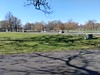
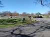
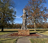
The Rowlandton Mound Site (15MCN3) is a Mississippian culture archaeological site located in Paducah in McCracken County, Kentucky, on the edge of an old oxbow lake a little south of the Ohio River.
The site was occupied from about 1100 to about 1350 CE. The 3 hectares (7.4 acres) site has a large platform mound and an associated village area,[1] being roughly similar in size to the Wickliffe Mounds Site in far western Kentucky.[2]
It was once thought that large civic sites in Western Kentucky such as Rowlandton Mound, the Twin Mounds Site and the Tolu Site were expansions of the Kincaid Mounds polity in nearby Southern Illinois in the 13th century, but archaeological excavations in 2006 by Dr. Kit Wesler of Murray State University have shown that this was not the case. It is probable that these civic sites were established originally by local Late Woodland peoples.[2]"
References:
1. Kriesa, Paul P. (1998). "Chronology in Western Kentucky". In O'Brien, Michael J.; Dunnell, Robert C. (eds.). Changing perspectives on the archaeology of the Central Mississippi Valley. University of Alabama Press. ISBN 0-8173-0909-8.
2. Pollack, David (2008), "Chapter 6:Mississippi Period" (PDF), in David Pollack (ed.), The Archaeology of Kentucky:An update, Kentucky Heritage Council, pp. 614–615, retrieved 2010-10-29
Further reading and information:
Wikipedia
https://en.wikipedia.org/wiki/Rowlandton_Mound_Site
Directions:
From Downtown Paducah via North 8th St., 2.7 mi.
You may be viewing yesterday's version of this page. To see the most up to date information please register for a free account.
Do not use the above information on other web sites or publications without permission of the contributor.
Nearby Images from Flickr


The above images may not be of the site on this page, but were taken nearby. They are loaded from Flickr so please click on them for image credits.
Click here to see more info for this site
Nearby sites
Click here to view sites on an interactive map of the areaKey: Red: member's photo, Blue: 3rd party photo, Yellow: other image, Green: no photo - please go there and take one, Grey: site destroyed
Download sites to:
KML (Google Earth)
GPX (GPS waypoints)
CSV (Garmin/Navman)
CSV (Excel)
To unlock full downloads you need to sign up as a Contributory Member. Otherwise downloads are limited to 50 sites.
Turn off the page maps and other distractions
Nearby sites listing. In the following links * = Image available
12.8km E 97° Kincaid Mounds* Ancient Village or Settlement
42.8km WSW 251° Wickliffe Mounds* Ancient Village or Settlement
64.6km SW 222° O'Bayum's Fort* Artificial Mound
69.4km SW 230° Towosahgy Ancient Village or Settlement
74.2km NNE 24° Great Salt Spring Ancient Mine, Quarry or other Industry
76.6km SW 221° Adams Site* Artificial Mound
76.8km NW 320° Giant City Stone Fort Site* Hillfort
80.0km SSE 163° Obion Mounds* Artificial Mound
93.2km NE 36° Slack Farm Ancient Village or Settlement
101.4km NE 38° Hovey Lake Village Ancient Village or Settlement
102.8km SW 236° Lilbourn Mound Ancient Village or Settlement
108.6km NE 35° GE. Mound Artificial Mound
110.5km NW 314° Cleiman Mound and Village Site* Artificial Mound
113.8km NNE 28° Wilson Mounds and Village Site* Artificial Mound
114.9km NE 37° Mann Site Misc. Earthwork
140.0km NE 48° Angel Mounds - Mound F* Pyramid / Mastaba
140.3km NE 47° Angel Mounds - Mound E* Artificial Mound
140.4km NE 48° Angel Mounds - Mound A* Artificial Mound
140.6km NE 48° Angel Mounds* Ancient Village or Settlement
140.8km NE 48° Angel Mounds Museum* Museum
141.2km NE 48° Angel Mounds - Mound G* Artificial Mound
148.8km E 82° Indian Knoll* Barrow Cemetery
153.2km ESE 122° Copena Mound Site* Artificial Mound
154.2km E 94° Page Site, Kentucky* Artificial Mound
154.5km NW 309° Common Fields* Artificial Mound
View more nearby sites and additional images


 We would like to know more about this location. Please feel free to add a brief description and any relevant information in your own language.
 Wir möchten mehr über diese Stätte erfahren. Bitte zögern Sie nicht, eine kurze Beschreibung und relevante Informationen in Deutsch hinzuzufügen.
 Nous aimerions en savoir encore un peu sur les lieux. S'il vous plaît n'hesitez pas à ajouter une courte description et tous les renseignements pertinents dans votre propre langue.
 Quisieramos informarnos un poco más de las lugares. No dude en añadir una breve descripción y otros datos relevantes en su propio idioma.