<< Other Photo Pages >> Coker Ford Site - Ancient Village or Settlement in United States in The South
Submitted by stonetracker on Saturday, 11 February 2023 Page Views: 694
Pre-ColumbianSite Name: Coker Ford SiteCountry: United States
NOTE: This site is 36.306 km away from the location you searched for.
Region: The South Type: Ancient Village or Settlement
Nearest Town: Cedar Bluff AL
Latitude: 34.247020N Longitude: 85.58837W
Condition:
| 5 | Perfect |
| 4 | Almost Perfect |
| 3 | Reasonable but with some damage |
| 2 | Ruined but still recognisable as an ancient site |
| 1 | Pretty much destroyed, possibly visible as crop marks |
| 0 | No data. |
| -1 | Completely destroyed |
| 5 | Superb |
| 4 | Good |
| 3 | Ordinary |
| 2 | Not Good |
| 1 | Awful |
| 0 | No data. |
| 5 | Can be driven to, probably with disabled access |
| 4 | Short walk on a footpath |
| 3 | Requiring a bit more of a walk |
| 2 | A long walk |
| 1 | In the middle of nowhere, a nightmare to find |
| 0 | No data. |
| 5 | co-ordinates taken by GPS or official recorded co-ordinates |
| 4 | co-ordinates scaled from a detailed map |
| 3 | co-ordinates scaled from a bad map |
| 2 | co-ordinates of the nearest village |
| 1 | co-ordinates of the nearest town |
| 0 | no data |
Be the first person to rate this site - see the 'Contribute!' box in the right hand menu.
Internal Links:
External Links:
I have visited· I would like to visit
stonetracker would like to visit
")
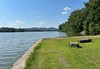
These new people built villages along the banks of the Chatuga, Coosa, and Little Rivers. The Coker Ford site overlooks the Little River and includes the largest of these villages along with two unusual stone-covered earthen mounds built to memorialize their ancestors.
By studying the pottery styles made and used at these sites, archaeologists believe that their culture originated in the Tennessee River Valley near Guntersville and that they had moved to the area in search of new opportunities. The Coker Ford site was likely one of the larger towns the Spanish encountered during their first exploration of the Southeast in 1541. By then, the Coker Ford site had long been abandoned and the mounds left as a monument to the ancestors.
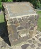
Location coordinates are given for an interpretive sign at Cornwall Furnace Memorial Park, as the Coker Ford site is remote and inaccessible. It is currently under the management of Alabama Power.
For more info, see https://alabamamoundtrail.org/mound-site/coker-ford-mound
You may be viewing yesterday's version of this page. To see the most up to date information please register for a free account.
Do not use the above information on other web sites or publications without permission of the contributor.
Nearby Images from Flickr

The above images may not be of the site on this page, but were taken nearby. They are loaded from Flickr so please click on them for image credits.
Click here to see more info for this site
Nearby sites
Click here to view sites on an interactive map of the areaKey: Red: member's photo, Blue: 3rd party photo, Yellow: other image, Green: no photo - please go there and take one, Grey: site destroyed
Download sites to:
KML (Google Earth)
GPX (GPS waypoints)
CSV (Garmin/Navman)
CSV (Excel)
To unlock full downloads you need to sign up as a Contributory Member. Otherwise downloads are limited to 50 sites.
Turn off the page maps and other distractions
Nearby sites listing. In the following links * = Image available
25.3km W 275° Collinsville Indian Mound* Artificial Mound
50.6km SSW 194° Shelton Stone Mound Complex* Cairn
63.9km SSW 194° Choccolocco Stone Standing Stone (Menhir)
71.6km E 99° Arborrigg* Modern Stone Circle etc
73.0km E 100° Etowah Mounds - Ditch and Palisade* Misc. Earthwork
73.1km E 100° Etowah Mounds Museum* Museum
73.1km E 101° Etowah Mounds - Mound B* Artificial Mound
73.1km E 100° Etowah Mounds - Mound A* Artificial Mound
73.2km E 101° Etowah Mounds - Mound C* Artificial Mound
74.0km SSW 195° Choccolocco Creek Mounds* Artificial Mound
74.1km SSW 194° Oxford Stone Mound* Artificial Mound
80.6km SSW 193° Talladega National Forest Stone 1Ta756 Standing Stone (Menhir)
83.7km NNW 346° Russell Cave Mound* Artificial Mound
83.7km NNW 346° Russell Cave* Cave or Rock Shelter
95.5km E 85° Funk Heritage Center* Museum
98.3km NNE 18° Roxbury Indian Mound* Artificial Mound
99.5km NE 55° Fort Mountain Stone Enclosure* Cairn
104.6km S 175° Rother L. Harris Reservoir Stone Standing Stone (Menhir)
120.9km SSW 203° Horn Mountain Stone Standing Stone (Menhir)
125.5km NNE 30° Candies Creek Village Archaeological Preserve* Ancient Village or Settlement
130.4km SSW 205° Talladega Natl Forest Stone 1Ta719* Standing Stone (Menhir)
141.7km NNE 23° Hiwassee Island Mounds* Artificial Mound
145.4km NNW 341° Old Stone Fort* Hillfort
147.6km W 279° Oakville Mounds* Artificial Mound
157.1km SW 234° Bessemer Mounds* Artificial Mound
View more nearby sites and additional images


 We would like to know more about this location. Please feel free to add a brief description and any relevant information in your own language.
 Wir möchten mehr über diese Stätte erfahren. Bitte zögern Sie nicht, eine kurze Beschreibung und relevante Informationen in Deutsch hinzuzufügen.
 Nous aimerions en savoir encore un peu sur les lieux. S'il vous plaît n'hesitez pas à ajouter une courte description et tous les renseignements pertinents dans votre propre langue.
 Quisieramos informarnos un poco más de las lugares. No dude en añadir una breve descripción y otros datos relevantes en su propio idioma.