<< Our Photo Pages >> Rathurlisk Ring Fort - Hillfort in Ireland (Republic of) in Co. Sligo
Submitted by dooclay on Friday, 03 May 2024 Page Views: 14
Iron Age and Later PrehistorySite Name: Rathurlisk Ring FortCountry: Ireland (Republic of)
NOTE: This site is 0.422 km away from the location you searched for.
County: Co. Sligo Type: Hillfort
Nearest Village: Dromore West
Latitude: 54.244076N Longitude: 8.809262W
Condition:
| 5 | Perfect |
| 4 | Almost Perfect |
| 3 | Reasonable but with some damage |
| 2 | Ruined but still recognisable as an ancient site |
| 1 | Pretty much destroyed, possibly visible as crop marks |
| 0 | No data. |
| -1 | Completely destroyed |
| 5 | Superb |
| 4 | Good |
| 3 | Ordinary |
| 2 | Not Good |
| 1 | Awful |
| 0 | No data. |
| 5 | Can be driven to, probably with disabled access |
| 4 | Short walk on a footpath |
| 3 | Requiring a bit more of a walk |
| 2 | A long walk |
| 1 | In the middle of nowhere, a nightmare to find |
| 0 | No data. |
| 5 | co-ordinates taken by GPS or official recorded co-ordinates |
| 4 | co-ordinates scaled from a detailed map |
| 3 | co-ordinates scaled from a bad map |
| 2 | co-ordinates of the nearest village |
| 1 | co-ordinates of the nearest town |
| 0 | no data |
Internal Links:
External Links:
")
The Historic Environment Viewer states: 'In pasture, situated on top of a ridge with extensive views. Large slightly raised circular area (diam. 72m) enclosed by a substantial earthen bank (Wth 6.3m; int. H 1.1m; ext. H 2.3m), with a very shallow external fosse'. The ring Fort is quite substantial and visible from the road. No idea of the date.
You may be viewing yesterday's version of this page. To see the most up to date information please register for a free account.
")
")
Do not use the above information on other web sites or publications without permission of the contributor.
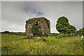
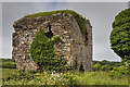
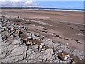
Nearby Images from Geograph Britain and Ireland:
©2014(licence)
©2014(licence)
©2010(licence)
The above images may not be of the site on this page, they are loaded from Geograph.
Please Submit an Image of this site or go out and take one for us!
Click here to see more info for this site
Nearby sites
Click here to view sites on an interactive map of the areaKey: Red: member's photo, Blue: 3rd party photo, Yellow: other image, Green: no photo - please go there and take one, Grey: site destroyed
Download sites to:
KML (Google Earth)
GPX (GPS waypoints)
CSV (Garmin/Navman)
CSV (Excel)
To unlock full downloads you need to sign up as a Contributory Member. Otherwise downloads are limited to 50 sites.
Turn off the page maps and other distractions
Nearby sites listing. In the following links * = Image available
8.8km SW 235° Tawnatruffaun* Portal Tomb (G400282)
14.1km ENE 76° Sligo Airport* Chambered Tomb (G61073641)
14.4km NE 36° Knocklane* Promontory Fort / Cliff Castle
15.0km ESE 101° Tanrego Bay Stone Circle (G6230)
15.3km E 84° Knocknarea* Passage Grave (G6260434583)
15.4km E 83° Knocknarea-North* Passage Grave (G62613470)
15.4km ENE 65° Saint Patrick's Chair (Coney Island)* Natural Stone / Erratic / Other Natural Feature (G61353951)
18.8km E 88° Carrowmore 55* Passage Grave
18.8km E 88° Carrowmore 52a* Passage Grave (G6610833507)
18.8km E 88° Carrowmore 53* Chambered Tomb (G6611433542)
18.8km E 88° Carrowmore 52* Passage Grave (G6613833502)
18.8km E 89° Carrowmore 48* Passage Grave (G6614733297)
18.8km E 88° Carrowmore 54* Passage Grave (G6615433556)
18.8km E 88° Carrowmore 1.* Passage Grave (G6616033692)
18.8km E 88° Carrowmore 2.* Passage Grave (G6617433701)
18.8km E 88° Carrowmore* Passage Grave (G66183365)
18.9km E 87° Carrowmore 4.* Passage Grave (G6621133727)
18.9km E 88° Carrowmore 51 (Listoghil)* Passage Grave (G6624833442)
18.9km E 87° Carrowmore 5.* Passage Grave (G6625233768)
18.9km E 88° Carrowmore 56* Passage Grave (G6626033537)
18.9km E 88° Carrowmore 57* Stone Circle (G6628133555)
19.0km E 88° Carrowmore 58* Passage Grave (G6632833605)
19.0km E 88° Carrowmore 59* Burial Chamber or Dolmen (G6634333614)
19.0km E 87° Carrowmore 7* Passage Grave (G6633933877)
19.0km E 87° Carrowmore Well* Holy Well or Sacred Spring
View more nearby sites and additional images


 We would like to know more about this location. Please feel free to add a brief description and any relevant information in your own language.
 Wir möchten mehr über diese Stätte erfahren. Bitte zögern Sie nicht, eine kurze Beschreibung und relevante Informationen in Deutsch hinzuzufügen.
 Nous aimerions en savoir encore un peu sur les lieux. S'il vous plaît n'hesitez pas à ajouter une courte description et tous les renseignements pertinents dans votre propre langue.
 Quisieramos informarnos un poco más de las lugares. No dude en añadir una breve descripción y otros datos relevantes en su propio idioma.