

<< Text Pages >> Castro de Alcabre - Castro or Chafurdão in Spain in Galicia
Submitted by TheCaptain on Wednesday, 08 September 2010 Page Views: 1318
Iron Age and Later PrehistorySite Name: Castro de AlcabreCountry: Spain
NOTE: This site is 0.939 km away from the location you searched for.
Region: Galicia Type: Castro or Chafurdão
Nearest Town: Pontevedra Nearest Village: Vigo
Latitude: 42.231000N Longitude: 8.712W
Condition:
| 5 | Perfect |
| 4 | Almost Perfect |
| 3 | Reasonable but with some damage |
| 2 | Ruined but still recognisable as an ancient site |
| 1 | Pretty much destroyed, possibly visible as crop marks |
| 0 | No data. |
| -1 | Completely destroyed |
| 5 | Superb |
| 4 | Good |
| 3 | Ordinary |
| 2 | Not Good |
| 1 | Awful |
| 0 | No data. |
| 5 | Can be driven to, probably with disabled access |
| 4 | Short walk on a footpath |
| 3 | Requiring a bit more of a walk |
| 2 | A long walk |
| 1 | In the middle of nowhere, a nightmare to find |
| 0 | No data. |
| 5 | co-ordinates taken by GPS or official recorded co-ordinates |
| 4 | co-ordinates scaled from a detailed map |
| 3 | co-ordinates scaled from a bad map |
| 2 | co-ordinates of the nearest village |
| 1 | co-ordinates of the nearest town |
| 0 | no data |
Be the first person to rate this site - see the 'Contribute!' box in the right hand menu.
Internal Links:
External Links:
Castro in Galicia
Castro de Alcabre is a Castro in the community of Vigo, Province of Pontevedra, region of Galicia
You may be viewing yesterday's version of this page. To see the most up to date information please register for a free account.
Do not use the above information on other web sites or publications without permission of the contributor.
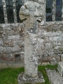
Nearby Images from Flickr

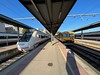
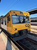
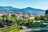


The above images may not be of the site on this page, but were taken nearby. They are loaded from Flickr so please click on them for image credits.
Click here to see more info for this site
Nearby sites
Click here to view sites on an interactive map of the areaKey: Red: member's photo, Blue: 3rd party photo, Yellow: other image, Green: no photo - please go there and take one, Grey: site destroyed
Download sites to:
KML (Google Earth)
GPX (GPS waypoints)
CSV (Garmin/Navman)
CSV (Excel)
To unlock full downloads you need to sign up as a Contributory Member. Otherwise downloads are limited to 50 sites.
Turn off the page maps and other distractions
Nearby sites listing. In the following links * = Image available
82m W 270° Castro de Monte da Guía Castro or Chafurdão
1.3km W 274° Poblado do Castro Ancient Village or Settlement
3.5km ENE 65° Dolmen de Candeán* Burial Chamber or Dolmen
3.8km SW 218° Petróglifo dos Redondelos Rock Art
4.0km ENE 63° Mámoa Chan do Labrador Round Barrow(s)
4.2km ENE 61° Mámoa Chan dos Touciños 1 Burial Chamber or Dolmen
4.2km ENE 61° Mámoa Chan dos Touciños 2 Round Barrow(s)
4.3km ENE 61° Mámoa Chan dos Touciños 3 Round Barrow(s)
4.4km ENE 61° Mámoa Chan dos Touciños 4 Round Barrow(s)
4.6km SSW 205° Petróglifo das Millaradas Rock Art
4.8km SE 127° Mamoa III de Rebullón Burial Chamber or Dolmen
4.8km ENE 63° Mámoa Ferradouro 1 Round Barrow(s)
4.9km ENE 63° Mámoa Ferradouro 2 Burial Chamber or Dolmen
5.0km ENE 62° Mámoa Costa Freiría 3 Burial Chamber or Dolmen
5.1km ENE 62° Mámoa Costa Freiría 1 Burial Chamber or Dolmen
5.6km ENE 68° Mámoa do Vixiador Burial Chamber or Dolmen
6.0km NNE 11° Petroglifo da Borna Rock Art
6.4km NNE 12° Petroglifo de A Pegada de San Pedro Rock Art
6.8km SSW 197° Castro do Monte Alba Castro or Chafurdão
6.8km WNW 303° Castro de Aldán Castro or Chafurdão
6.9km SSE 161° Mámoas d´As Xunqueiras Barrow Cemetery
7.0km NE 50° Petróglifo da Porteliña Rock Art
7.1km SSE 151° Mámoa de Meixoeiro* Burial Chamber or Dolmen
7.2km NE 48° Petróglifos de Poza da Lagoa Rock Art
7.2km ENE 59° Mamoa do Rei* Burial Chamber or Dolmen
View more nearby sites and additional images


 We would like to know more about this location. Please feel free to add a brief description and any relevant information in your own language.
 Wir möchten mehr über diese Stätte erfahren. Bitte zögern Sie nicht, eine kurze Beschreibung und relevante Informationen in Deutsch hinzuzufügen.
 Nous aimerions en savoir encore un peu sur les lieux. S'il vous plaît n'hesitez pas à ajouter une courte description et tous les renseignements pertinents dans votre propre langue.
 Quisieramos informarnos un poco más de las lugares. No dude en añadir una breve descripción y otros datos relevantes en su propio idioma.