<< Text Pages >> Tanrego Bay - Stone Circle in Ireland (Republic of) in Co. Sligo
Submitted by Tom_Bullock on Sunday, 14 July 2002 Page Views: 8176
Neolithic and Bronze AgeSite Name: Tanrego Bay Alternative Name: Cuchallin's TombCountry: Ireland (Republic of)
NOTE: This site is 9.269 km away from the location you searched for.
County: Co. Sligo Type: Stone Circle
Map Ref: G6230
Discovery Map Number: D25
Latitude: 54.217539N Longitude: 8.583251W
Condition:
| 5 | Perfect |
| 4 | Almost Perfect |
| 3 | Reasonable but with some damage |
| 2 | Ruined but still recognisable as an ancient site |
| 1 | Pretty much destroyed, possibly visible as crop marks |
| 0 | No data. |
| -1 | Completely destroyed |
| 5 | Superb |
| 4 | Good |
| 3 | Ordinary |
| 2 | Not Good |
| 1 | Awful |
| 0 | No data. |
| 5 | Can be driven to, probably with disabled access |
| 4 | Short walk on a footpath |
| 3 | Requiring a bit more of a walk |
| 2 | A long walk |
| 1 | In the middle of nowhere, a nightmare to find |
| 0 | No data. |
| 5 | co-ordinates taken by GPS or official recorded co-ordinates |
| 4 | co-ordinates scaled from a detailed map |
| 3 | co-ordinates scaled from a bad map |
| 2 | co-ordinates of the nearest village |
| 1 | co-ordinates of the nearest town |
| 0 | no data |
Internal Links:
External Links:
Ancient site in Sligo
Have you visited this site? Please add a comment below.
You may be viewing yesterday's version of this page. To see the most up to date information please register for a free account.
Do not use the above information on other web sites or publications without permission of the contributor.
Nearby Images from Geograph Britain and Ireland:
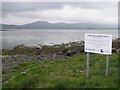
©2008(licence)
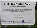
©2008(licence)
The above images may not be of the site on this page, they are loaded from Geograph.
Please Submit an Image of this site or go out and take one for us!
Click here to see more info for this site
Nearby sites
Click here to view sites on an interactive map of the areaKey: Red: member's photo, Blue: 3rd party photo, Yellow: other image, Green: no photo - please go there and take one, Grey: site destroyed
Download sites to:
KML (Google Earth)
GPX (GPS waypoints)
CSV (Garmin/Navman)
CSV (Excel)
To unlock full downloads you need to sign up as a Contributory Member. Otherwise downloads are limited to 50 sites.
Turn off the page maps and other distractions
Nearby sites listing. In the following links * = Image available
4.6km N 7° Knocknarea* Passage Grave (G6260434583)
4.7km N 7° Knocknarea-North* Passage Grave (G62613470)
5.3km NE 51° Carrowmore 48* Passage Grave (G6614733297)
5.4km NE 49° Carrowmore 52a* Passage Grave (G6610833507)
5.4km NE 49° Carrowmore 52* Passage Grave (G6613833502)
5.4km NE 49° Carrowmore 53* Chambered Tomb (G6611433542)
5.4km NE 48° Carrowmore 55* Passage Grave
5.5km NE 50° Carrowmore 51 (Listoghil)* Passage Grave (G6624833442)
5.5km NE 49° Carrowmore 54* Passage Grave (G6615433556)
5.5km NE 50° Carrowmore 56* Passage Grave (G6626033537)
5.5km NE 48° Carrowmore* Passage Grave (G66183365)
5.5km NE 48° Carrowmore 1.* Passage Grave (G6616033692)
5.6km NE 50° Carrowmore 57* Stone Circle (G6628133555)
5.6km NE 54° Carrowmore 27* Passage Grave
5.6km NE 48° Carrowmore 2.* Passage Grave (G6617433701)
5.6km NE 48° Carrowmore 4.* Passage Grave (G6621133727)
5.6km NE 50° Carrowmore 58* Passage Grave (G6632833605)
5.6km NE 54° Carrowmore 26* Stone Circle (G6658233284)
5.6km NE 50° Carrowmore 59* Burial Chamber or Dolmen (G6634333614)
5.7km NE 53° Carrowmore Cairn 21* Passage Grave
5.7km NE 48° Carrowmore 5.* Passage Grave (G6625233768)
5.7km NE 53° Carrowmore Cairn 20* Passage Grave
5.7km NE 53° Carrowmore Cairn 22* Passage Grave
5.7km NE 49° Carrowmore Well* Holy Well or Sacred Spring
5.7km NE 51° Carrowmore Cairn 17* Passage Grave
View more nearby sites and additional images


 We would like to know more about this location. Please feel free to add a brief description and any relevant information in your own language.
 Wir möchten mehr über diese Stätte erfahren. Bitte zögern Sie nicht, eine kurze Beschreibung und relevante Informationen in Deutsch hinzuzufügen.
 Nous aimerions en savoir encore un peu sur les lieux. S'il vous plaît n'hesitez pas à ajouter une courte description et tous les renseignements pertinents dans votre propre langue.
 Quisieramos informarnos un poco más de las lugares. No dude en añadir una breve descripción y otros datos relevantes en su propio idioma.