


<< Our Photo Pages >> Saint Patrick's Chair (Coney Island) - Natural Stone / Erratic / Other Natural Feature in Ireland (Republic of) in Co. Sligo
Submitted by TimPrevett on Sunday, 24 April 2011 Page Views: 5894
Natural PlacesSite Name: Saint Patrick's Chair (Coney Island)Country: Ireland (Republic of)
NOTE: This site is 6.995 km away from the location you searched for.
County: Co. Sligo Type: Natural Stone / Erratic / Other Natural Feature
Nearest Town: Sligon Nearest Village: Coney Island
Map Ref: G61353951
Latitude: 54.302920N Longitude: 8.594441W
Condition:
| 5 | Perfect |
| 4 | Almost Perfect |
| 3 | Reasonable but with some damage |
| 2 | Ruined but still recognisable as an ancient site |
| 1 | Pretty much destroyed, possibly visible as crop marks |
| 0 | No data. |
| -1 | Completely destroyed |
| 5 | Superb |
| 4 | Good |
| 3 | Ordinary |
| 2 | Not Good |
| 1 | Awful |
| 0 | No data. |
| 5 | Can be driven to, probably with disabled access |
| 4 | Short walk on a footpath |
| 3 | Requiring a bit more of a walk |
| 2 | A long walk |
| 1 | In the middle of nowhere, a nightmare to find |
| 0 | No data. |
| 5 | co-ordinates taken by GPS or official recorded co-ordinates |
| 4 | co-ordinates scaled from a detailed map |
| 3 | co-ordinates scaled from a bad map |
| 2 | co-ordinates of the nearest village |
| 1 | co-ordinates of the nearest town |
| 0 | no data |
Internal Links:
External Links:
 (PID:76275)")
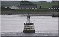
A natural rock formation on the north west of Coney Island in Sligo. A drive (or walk) across a tidal causeway, then a good walk to the feature.
You may be viewing yesterday's version of this page. To see the most up to date information please register for a free account.
 (PID:76274)")
Do not use the above information on other web sites or publications without permission of the contributor.
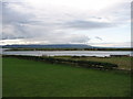
Nearby Images from Geograph Britain and Ireland:
©2009(licence)
©2010(licence)
©2009(licence)
©2006(licence)
©2008(licence)
The above images may not be of the site on this page, they are loaded from Geograph.
Please Submit an Image of this site or go out and take one for us!
Click here to see more info for this site
Nearby sites
Click here to view sites on an interactive map of the areaKey: Red: member's photo, Blue: 3rd party photo, Yellow: other image, Green: no photo - please go there and take one, Grey: site destroyed
Download sites to:
KML (Google Earth)
GPX (GPS waypoints)
CSV (Garmin/Navman)
CSV (Excel)
To unlock full downloads you need to sign up as a Contributory Member. Otherwise downloads are limited to 50 sites.
Turn off the page maps and other distractions
Nearby sites listing. In the following links * = Image available
3.1km S 185° Sligo Airport* Chambered Tomb (G61073641)
5.0km SSE 165° Knocknarea-North* Passage Grave (G62613470)
5.1km SSE 165° Knocknarea* Passage Grave (G6260434583)
7.5km SE 138° Carrowmore 7* Passage Grave (G663339)
7.5km SE 139° Carrowmore 5.* Passage Grave (G662338)
7.5km SE 140° Carrowmore 2.* Passage Grave (G661337)
7.5km NW 313° Knocklane* Promontory Fort / Cliff Castle
7.5km SE 140° Carrowmore 1.* Passage Grave
7.6km SE 140° Carrowmore 4.* Passage Grave (G662337)
7.6km SE 140° Carrowmore* Passage Grave (G6621633706)
7.6km SE 138° Carrowmore 13* Burial Chamber or Dolmen
7.6km SE 140° Carrowmore 55* Passage Grave (G662336)
7.6km SE 140° Carrowmore 52* Passage Grave (G662336)
7.6km SE 140° Carrowmore 54* Passage Grave (G662336)
7.6km SE 141° Carrowmore 53* Chambered Tomb (G661335)
7.7km SE 139° Carrowmore 59* Burial Chamber or Dolmen
7.7km SE 141° Carrowmore 57* Stone Circle (G662335)
7.7km SE 141° Carrowmore 57 Passage Grave (G662335)
7.7km SE 143° Carrowmore 52a* Passage Grave (G660333)
7.8km SE 140° Carrowmore 26* Stone Circle (G663335)
7.8km SE 140° Carrowmore 11* Stone Circle (G663335)
7.8km SE 140° Carrowmore 9* Stone Circle (G663335)
7.8km SE 141° Carrowmore 51 (Listoghil)* Passage Grave (G66243345)
7.8km SE 142° Carrowmore 48* Passage Grave (G661333)
7.9km SE 139° Carrowmore 18* Passage Grave
View more nearby sites and additional images


 We would like to know more about this location. Please feel free to add a brief description and any relevant information in your own language.
 Wir möchten mehr über diese Stätte erfahren. Bitte zögern Sie nicht, eine kurze Beschreibung und relevante Informationen in Deutsch hinzuzufügen.
 Nous aimerions en savoir encore un peu sur les lieux. S'il vous plaît n'hesitez pas à ajouter une courte description et tous les renseignements pertinents dans votre propre langue.
 Quisieramos informarnos un poco más de las lugares. No dude en añadir una breve descripción y otros datos relevantes en su propio idioma.