


<< Our Photo Pages >> Castro de Mohías - Castro or Chafurdão in Spain in Asturias
Submitted by holger_rix on Friday, 04 December 2015 Page Views: 967
Iron Age and Later PrehistorySite Name: Castro de Mohías Alternative Name: MouguíasCountry: Spain
NOTE: This site is 1.935 km away from the location you searched for.
Region: Asturias Type: Castro or Chafurdão
Nearest Town: Navia Nearest Village: Coaña
Latitude: 43.549440N Longitude: 6.74722W
Condition:
| 5 | Perfect |
| 4 | Almost Perfect |
| 3 | Reasonable but with some damage |
| 2 | Ruined but still recognisable as an ancient site |
| 1 | Pretty much destroyed, possibly visible as crop marks |
| 0 | No data. |
| -1 | Completely destroyed |
| 5 | Superb |
| 4 | Good |
| 3 | Ordinary |
| 2 | Not Good |
| 1 | Awful |
| 0 | No data. |
| 5 | Can be driven to, probably with disabled access |
| 4 | Short walk on a footpath |
| 3 | Requiring a bit more of a walk |
| 2 | A long walk |
| 1 | In the middle of nowhere, a nightmare to find |
| 0 | No data. |
| 5 | co-ordinates taken by GPS or official recorded co-ordinates |
| 4 | co-ordinates scaled from a detailed map |
| 3 | co-ordinates scaled from a bad map |
| 2 | co-ordinates of the nearest village |
| 1 | co-ordinates of the nearest town |
| 0 | no data |
Internal Links:
External Links:
")
You may be viewing yesterday's version of this page. To see the most up to date information please register for a free account.
")
")
")
")
Do not use the above information on other web sites or publications without permission of the contributor.
Nearby Images from Flickr
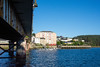
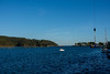
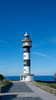
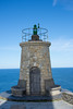
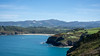

The above images may not be of the site on this page, but were taken nearby. They are loaded from Flickr so please click on them for image credits.
Click here to see more info for this site
Nearby sites
Click here to view sites on an interactive map of the areaKey: Red: member's photo, Blue: 3rd party photo, Yellow: other image, Green: no photo - please go there and take one, Grey: site destroyed
Download sites to:
KML (Google Earth)
GPX (GPS waypoints)
CSV (Garmin/Navman)
CSV (Excel)
To unlock full downloads you need to sign up as a Contributory Member. Otherwise downloads are limited to 50 sites.
Turn off the page maps and other distractions
Nearby sites listing. In the following links * = Image available
3.7km S 179° Estela Discoidea de Coaña* Standing Stone (Menhir)
4.3km S 183° Castro de Coaña* Castro or Chafurdão
7.8km SW 235° A Corona (Arancedo) Castro or Chafurdão
9.0km WNW 283° Cabo Branco Castro or Chafurdão
12.4km E 88° El Castiellu (La Calea) Castro or Chafurdão
13.2km ESE 113° El Castiellu (Zreizal) Castro or Chafurdão
13.2km S 189° Castro de Pendia* Castro or Chafurdão
13.5km SSW 196° El Castro (Os Mazos) Castro or Chafurdão
14.1km SSW 203° El Castro (A Escrita) Castro or Chafurdão
16.6km E 89° Pena Castiel Castro or Chafurdão
17.2km W 275° El Castelo d'Esteiro Castro or Chafurdão
23.2km ESE 113° El Cercu los Moros Castro or Chafurdão
23.8km E 92° La Cogolla (Caneiru) Castro or Chafurdão
24.4km W 272° Castro das Grobas Castro or Chafurdão
24.9km SE 130° El Castiellu (Veiga) Castro or Chafurdão
25.0km E 97° La Porida Castro or Chafurdão
25.6km SW 230° Castro de Molexón Castro or Chafurdão
25.8km W 261° Castro de Cárcovas Castro or Chafurdão
26.4km SE 125° El Castiellu (Veneiru) Castro or Chafurdão
26.4km W 271° Castro de Fornelo (Piñeira) Castro or Chafurdão
27.6km WSW 255° Castro da Torre (Ribadeo) Castro or Chafurdão
27.9km SE 135° El Castiellu (lluciernas) Castro or Chafurdão
29.4km WSW 258° Castro de Pumarega Castro or Chafurdão
29.6km W 259° Sa Podomorfos Rock Art
29.8km SE 142° Túmulos de Campiello Round Barrow(s)
View more nearby sites and additional images


 We would like to know more about this location. Please feel free to add a brief description and any relevant information in your own language.
 Wir möchten mehr über diese Stätte erfahren. Bitte zögern Sie nicht, eine kurze Beschreibung und relevante Informationen in Deutsch hinzuzufügen.
 Nous aimerions en savoir encore un peu sur les lieux. S'il vous plaît n'hesitez pas à ajouter une courte description et tous les renseignements pertinents dans votre propre langue.
 Quisieramos informarnos un poco más de las lugares. No dude en añadir una breve descripción y otros datos relevantes en su propio idioma.