<< Our Photo Pages >> Derrycaw Standing Stone - Standing Stone (Menhir) in Ireland (Northern) in Co. Armagh
Submitted by Stone Free on Wednesday, 04 March 2015 Page Views: 2962
Neolithic and Bronze AgeSite Name: Derrycaw Standing StoneCountry: Ireland (Northern)
NOTE: This site is 15.298 km away from the location you searched for.
County: Co. Armagh Type: Standing Stone (Menhir)
Nearest Town: Portadown Nearest Village: Moy
Map Ref: H928599
Latitude: 54.479081N Longitude: 6.569104W
Condition:
| 5 | Perfect |
| 4 | Almost Perfect |
| 3 | Reasonable but with some damage |
| 2 | Ruined but still recognisable as an ancient site |
| 1 | Pretty much destroyed, possibly visible as crop marks |
| 0 | No data. |
| -1 | Completely destroyed |
| 5 | Superb |
| 4 | Good |
| 3 | Ordinary |
| 2 | Not Good |
| 1 | Awful |
| 0 | No data. |
| 5 | Can be driven to, probably with disabled access |
| 4 | Short walk on a footpath |
| 3 | Requiring a bit more of a walk |
| 2 | A long walk |
| 1 | In the middle of nowhere, a nightmare to find |
| 0 | No data. |
| 5 | co-ordinates taken by GPS or official recorded co-ordinates |
| 4 | co-ordinates scaled from a detailed map |
| 3 | co-ordinates scaled from a bad map |
| 2 | co-ordinates of the nearest village |
| 1 | co-ordinates of the nearest town |
| 0 | no data |
Internal Links:
External Links:
I have visited· I would like to visit
Stone Free saw from a distance on 3rd Mar 2015 - their rating: Cond: 4 Amb: 3
")
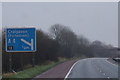
A standing stone listed as 'prehistoric standing stone' on the Northern Ireland Environment Agency website. Located just off, and visible from, the M1 motorway about 1km past junction 12
You may be viewing yesterday's version of this page. To see the most up to date information please register for a free account.
Do not use the above information on other web sites or publications without permission of the contributor.
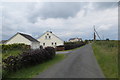
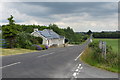
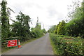
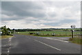
Nearby Images from Geograph Britain and Ireland:
©2015(licence)
©2015(licence)
©2015(licence)
©2015(licence)
©2016(licence)
The above images may not be of the site on this page, they are loaded from Geograph.
Please Submit an Image of this site or go out and take one for us!
Click here to see more info for this site
Nearby sites
Click here to view sites on an interactive map of the areaKey: Red: member's photo, Blue: 3rd party photo, Yellow: other image, Green: no photo - please go there and take one, Grey: site destroyed
Download sites to:
KML (Google Earth)
GPX (GPS waypoints)
CSV (Garmin/Navman)
CSV (Excel)
To unlock full downloads you need to sign up as a Contributory Member. Otherwise downloads are limited to 50 sites.
Turn off the page maps and other distractions
Nearby sites listing. In the following links * = Image available
16.4km SSW 213° Ballybrolly Stone Circle (H840460)
16.8km SSW 210° Navan Fort* Henge (H847452)
16.8km SSW 210° Navan Site B Timber Circle (H848451)
17.3km SSW 210° Navan Centre Museum
18.1km NNW 329° Grange Stones Standing Stones (H830752)
20.2km S 185° Vicar's Cairn* Passage Grave
21.7km S 191° Bull's Stone (Ballymacnab)* Ancient Cross (H89033855)
25.0km NW 320° Carnanbane* Court Tomb (H762786)
25.4km SE 138° The Three Sisters* Stone Row / Alignment
25.7km WNW 294° Turnabarson SE Stone Circle (H6894069770)
25.9km SE 136° Drumnahare* Standing Stone (Menhir) (J111415)
26.0km WNW 293° Cornamaddy B Stone Circle (H686697)
26.1km WNW 293° Cornamaddy Stone Row / Alignment (H6858069720)
26.1km NW 305° Moymore Circles Stone Circle (H7106074510)
26.1km WNW 294° Turnabarson NW Stone Circle (H6856069870)
26.2km WNW 293° Cornamaddy A Stone Circle (H685698)
26.4km NW 306° Edentoit Standing Stones (H7103074990)
27.0km NW 305° Moymore Barrow Round Barrow(s) (H7035075080)
27.6km WNW 292° Altmore Court Tomb Court Tomb (H6687569578)
28.6km NNW 337° Letteran Stone Circle (H810860)
29.3km NW 304° Murnell's Dolmen* Portal Tomb
29.4km W 266° Armaghlughey Ancient Village or Settlement
29.7km NNW 332° Mobuy Stone Circle (H783859)
30.3km NW 314° Tulnacross* Stone Circle (H7048080430)
30.3km WNW 298° Tremoge NE Stone Row / Alignment (H657736)
View more nearby sites and additional images


 We would like to know more about this location. Please feel free to add a brief description and any relevant information in your own language.
 Wir möchten mehr über diese Stätte erfahren. Bitte zögern Sie nicht, eine kurze Beschreibung und relevante Informationen in Deutsch hinzuzufügen.
 Nous aimerions en savoir encore un peu sur les lieux. S'il vous plaît n'hesitez pas à ajouter une courte description et tous les renseignements pertinents dans votre propre langue.
 Quisieramos informarnos un poco más de las lugares. No dude en añadir una breve descripción y otros datos relevantes en su propio idioma.