<< Image Pages >> Loch Dhu Crannog - Crannog in Scotland in Isle of Bute
Submitted by durhamnature on Monday, 17 September 2012 Page Views: 3287
Iron Age and Later PrehistorySite Name: Loch Dhu CrannogCountry: Scotland
NOTE: This site is 0.815 km away from the location you searched for.
County: Isle of Bute Type: Crannog
Map Ref: NS06646176
Latitude: 55.810287N Longitude: 5.087249W
Condition:
| 5 | Perfect |
| 4 | Almost Perfect |
| 3 | Reasonable but with some damage |
| 2 | Ruined but still recognisable as an ancient site |
| 1 | Pretty much destroyed, possibly visible as crop marks |
| 0 | No data. |
| -1 | Completely destroyed |
| 5 | Superb |
| 4 | Good |
| 3 | Ordinary |
| 2 | Not Good |
| 1 | Awful |
| 0 | No data. |
| 5 | Can be driven to, probably with disabled access |
| 4 | Short walk on a footpath |
| 3 | Requiring a bit more of a walk |
| 2 | A long walk |
| 1 | In the middle of nowhere, a nightmare to find |
| 0 | No data. |
| 5 | co-ordinates taken by GPS or official recorded co-ordinates |
| 4 | co-ordinates scaled from a detailed map |
| 3 | co-ordinates scaled from a bad map |
| 2 | co-ordinates of the nearest village |
| 1 | co-ordinates of the nearest town |
| 0 | no data |
Internal Links:
External Links:
")
Canmore site 40380
Dhu Loch Crannog
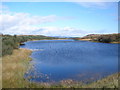
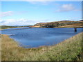
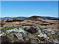
The remains of a crannog could once be seen on the Dhu Loch (Black Lake). Constructed of wooden piles and beams, it was drawn by Mackinlay in 1812 and 1826 when the water level was exceptionally low.
The remains of the crannog were completely submerged when the Dhu Loch valley was dammed to form a reservoir in the early 20th century. The water level was again raised in 1932 when the dam was heightened and nothing can now be seen.
Text summarised from Canmore and other sources.
You may be viewing yesterday's version of this page. To see the most up to date information please register for a free account.
Do not use the above information on other web sites or publications without permission of the contributor.
Nearby Images from Geograph Britain and Ireland:
©2009(licence)
©2009(licence)
©2018(licence)
©2018(licence)
©2018(licence)
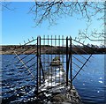
The above images may not be of the site on this page, they are loaded from Geograph.
Please Submit an Image of this site or go out and take one for us!
Click here to see more info for this site
Nearby sites
Key: Red: member's photo, Blue: 3rd party photo, Yellow: other image, Green: no photo - please go there and take one, Grey: site destroyed
Download sites to:
KML (Google Earth)
GPX (GPS waypoints)
CSV (Garmin/Navman)
CSV (Excel)
To unlock full downloads you need to sign up as a Contributory Member. Otherwise downloads are limited to 50 sites.
Turn off the page maps and other distractions
Nearby sites listing. In the following links * = Image available
1.2km SSW 198° Bicker's Houses* Chambered Cairn (NS062606)
2.1km NNE 21° Craigberoch* Standing Stone (Menhir) (NS0745263652)
2.2km S 174° Ambrisbeg Hill Cairn* Cairn (NS0677459579)
2.5km S 188° Loch Quien Crannog* Crannog (NS06185929)
2.6km NE 46° Townhead Neolithic Settlement Ancient Village or Settlement (NS086635)
2.8km NE 43° St Mary's Well (Rothsay)* Holy Well or Sacred Spring (NS0866763750)
2.9km W 266° St. Ninian's Bay* Standing Stones (NS037617)
3.1km S 190° Scalpsie Barrow* Round Cairn (NS05955873)
3.3km SSW 198° Scalpsie Dun* Stone Fort or Dun (NS05485866)
3.9km NW 305° Castle Cree* Hillfort (NS0356464133)
3.9km E 100° Mountstuart* Cist (NS1048360922)
4.3km N 353° Dun Burgidale* Stone Fort or Dun (NS0627766051)
4.7km W 261° Inchmarnock Cists Cist (NS0199361233)
5.0km NW 326° St Colmac's A Stone Circle (NS040660)
5.3km NNW 345° Acholter* Standing Stone (Menhir) (NS0546466961)
5.5km NNW 334° St Colmac Cottages Stone Circle* Stone Circle (NS044668)
5.7km NNW 340° Colmac Bridge* Standing Stone (Menhir) (NS0491367160)
5.9km NNW 336° St Colmac's Cross Standing Stone (Menhir) (NS0452167263)
6.6km SSE 155° Blackpark* Stone Circle (NS0916455666)
6.6km SSE 162° Stravanan Bay* Stone Row / Alignment (NS0846555361)
7.9km WNW 287° Ardlamont Point* Rock Art (NR99146439)
8.7km SSE 165° Dunagoil* Burial Chamber or Dolmen (NS08595322)
8.8km NW 315° Glecknabae* Chambered Cairn (NS0074568263)
8.8km SSE 159° St Blane's Well* Ancient Cross (NS0944253442)
8.8km SSE 159° St Blane's Broch* Broch or Nuraghe (NS094534)
View more nearby sites and additional images


 We would like to know more about this location. Please feel free to add a brief description and any relevant information in your own language.
 Wir möchten mehr über diese Stätte erfahren. Bitte zögern Sie nicht, eine kurze Beschreibung und relevante Informationen in Deutsch hinzuzufügen.
 Nous aimerions en savoir encore un peu sur les lieux. S'il vous plaît n'hesitez pas à ajouter une courte description et tous les renseignements pertinents dans votre propre langue.
 Quisieramos informarnos un poco más de las lugares. No dude en añadir una breve descripción y otros datos relevantes en su propio idioma.