<< Our Photo Pages >> Glecknabae - Chambered Cairn in Scotland in Isle of Bute
Submitted by durhamnature on Saturday, 12 January 2013 Page Views: 11403
Neolithic and Bronze AgeSite Name: GlecknabaeCountry: Scotland County: Isle of Bute Type: Chambered Cairn
Map Ref: NS0074568263 Landranger Map Number: 63
Latitude: 55.866230N Longitude: 5.185934W
Condition:
| 5 | Perfect |
| 4 | Almost Perfect |
| 3 | Reasonable but with some damage |
| 2 | Ruined but still recognisable as an ancient site |
| 1 | Pretty much destroyed, possibly visible as crop marks |
| 0 | No data. |
| -1 | Completely destroyed |
| 5 | Superb |
| 4 | Good |
| 3 | Ordinary |
| 2 | Not Good |
| 1 | Awful |
| 0 | No data. |
| 5 | Can be driven to, probably with disabled access |
| 4 | Short walk on a footpath |
| 3 | Requiring a bit more of a walk |
| 2 | A long walk |
| 1 | In the middle of nowhere, a nightmare to find |
| 0 | No data. |
| 5 | co-ordinates taken by GPS or official recorded co-ordinates |
| 4 | co-ordinates scaled from a detailed map |
| 3 | co-ordinates scaled from a bad map |
| 2 | co-ordinates of the nearest village |
| 1 | co-ordinates of the nearest town |
| 0 | no data |
Internal Links:
External Links:
")
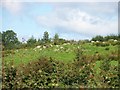
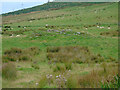
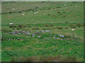
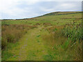
It now appears as a roughly oval, grass-grown stony mound, about 60ft by 30ft and about 4ft high, with the tops of a few constructional stones just visible.
More at Canmore site no. 40371.
Note: Research ancient sites from your armchair on the Megalithic Portal! John Durkin (DurhamNature) combs for images on archive.org (now shown in yellow on our maps) and David Morgan is hunting for ancient sites captured on Google Street View in Scotland, France, Italy and elsewhere. These are shown in blue on our maps where we only have Street View images, or in red where our contributors have visited.
You may be viewing yesterday's version of this page. To see the most up to date information please register for a free account.
")
")
Do not use the above information on other web sites or publications without permission of the contributor.
davidmorgan has found this location on Google Street View:
Nearby Images from Geograph Britain and Ireland:
©2017(licence)
©2017(licence)
©2023(licence)
©2023(licence)
©2023(licence)
The above images may not be of the site on this page, they are loaded from Geograph.
Please Submit an Image of this site or go out and take one for us!
Click here to see more info for this site
Nearby sites
Key: Red: member's photo, Blue: 3rd party photo, Yellow: other image, Green: no photo - please go there and take one, Grey: site destroyed
Download sites to:
KML (Google Earth)
GPX (GPS waypoints)
CSV (Garmin/Navman)
CSV (Excel)
To unlock full downloads you need to sign up as a Contributory Member. Otherwise downloads are limited to 50 sites.
Turn off the page maps and other distractions
Nearby sites listing. In the following links * = Image available
1.1km N 351° Carnbaan* Chambered Cairn (NS0063269316)
2.4km NW 326° St Michael's Grave* Chambered Cairn (NR9947070314)
2.5km NNW 333° Glenvoidean* Chambered Cairn (NR9970870570)
3.3km NNW 334° Aultmore Burn Fort* Hillfort (NR9946871279)
3.9km ESE 102° St Colmac's Cross Standing Stone (Menhir) (NS0452167263)
3.9km ESE 109° St Colmac Cottages Stone Circle* Stone Circle (NS044668)
4.0km ESE 122° St Colmac's A Stone Circle (NS040660)
4.2km SSW 200° Ardlamont Point* Rock Art (NR99146439)
4.3km ESE 102° Colmac Bridge* Standing Stone (Menhir) (NS0491367160)
4.7km NW 308° Kames* Standing Stones (NR97177137)
4.9km ESE 103° Acholter* Standing Stone (Menhir) (NS0546466961)
5.0km SE 143° Castle Cree* Hillfort (NS0356464133)
5.3km W 268° Colachla* Stone Fort or Dun (NR95456832)
5.9km ESE 109° Dun Burgidale* Stone Fort or Dun (NS0627766051)
7.1km SSE 167° Inchmarnock Cists Cist (NS0199361233)
7.1km N 6° Eilean Buidhe* Stone Fort or Dun (NS01867532)
7.2km SSE 153° St. Ninian's Bay* Standing Stones (NS037617)
7.2km W 264° Creag Loisgte* Standing Stone (Menhir) (NR93506779)
7.5km W 262° Port Leathan* Cairn (NR93226754)
7.6km W 268° Cnoc Pollphail* Standing Stones (NR93166835)
7.6km W 265° Low Stillaig* Rock Art (NR93146798)
8.1km ESE 122° Craigberoch* Standing Stone (Menhir) (NS0745263652)
8.8km SE 135° Loch Dhu Crannog* Crannog (NS06646176)
9.1km ESE 117° St Mary's Well (Rothsay)* Holy Well or Sacred Spring (NS0866763750)
9.2km ESE 119° Townhead Neolithic Settlement Ancient Village or Settlement (NS086635)
View more nearby sites and additional images


 We would like to know more about this location. Please feel free to add a brief description and any relevant information in your own language.
 Wir möchten mehr über diese Stätte erfahren. Bitte zögern Sie nicht, eine kurze Beschreibung und relevante Informationen in Deutsch hinzuzufügen.
 Nous aimerions en savoir encore un peu sur les lieux. S'il vous plaît n'hesitez pas à ajouter une courte description et tous les renseignements pertinents dans votre propre langue.
 Quisieramos informarnos un poco más de las lugares. No dude en añadir una breve descripción y otros datos relevantes en su propio idioma.