<< Text Pages >> St Catherine's Well (Eldrickhill) - Holy Well or Sacred Spring in Scotland in Dumfries and Galloway
Submitted by Anne T on Monday, 27 June 2022 Page Views: 466
Springs and Holy WellsSite Name: St Catherine's Well (Eldrickhill)Country: Scotland
NOTE: This site is 2.845 km away from the location you searched for.
County: Dumfries and Galloway Type: Holy Well or Sacred Spring
Nearest Town: Portpatrick Nearest Village: Lochans
Map Ref: NX06125442
Latitude: 54.846932N Longitude: 5.02129W
Condition:
| 5 | Perfect |
| 4 | Almost Perfect |
| 3 | Reasonable but with some damage |
| 2 | Ruined but still recognisable as an ancient site |
| 1 | Pretty much destroyed, possibly visible as crop marks |
| 0 | No data. |
| -1 | Completely destroyed |
| 5 | Superb |
| 4 | Good |
| 3 | Ordinary |
| 2 | Not Good |
| 1 | Awful |
| 0 | No data. |
| 5 | Can be driven to, probably with disabled access |
| 4 | Short walk on a footpath |
| 3 | Requiring a bit more of a walk |
| 2 | A long walk |
| 1 | In the middle of nowhere, a nightmare to find |
| 0 | No data. |
| 5 | co-ordinates taken by GPS or official recorded co-ordinates |
| 4 | co-ordinates scaled from a detailed map |
| 3 | co-ordinates scaled from a bad map |
| 2 | co-ordinates of the nearest village |
| 1 | co-ordinates of the nearest town |
| 0 | no data |
Be the first person to rate this site - see the 'Contribute!' box in the right hand menu.
Internal Links:
External Links:
Holy Well or Sacred Spring in Dumfries and Galloway
This holy well was 'traditionally the site of baptisms' according to Canmore Site ID 60575. Eldrickhill, St Catherine's Well. The 1847 Ordnance Survey name book adds: "this shallow spring well. A small distance away where the threshing mill of Elsrig now stands, when digging to a considerable depth, old graves were found containing pieces of blackened wood and bones. It is probable that a church, dedicated to St Catherine, and burial ground occupied this site."
The Ordnance Survey name book of 1882 tells us: "A church dedicated to St Catherine is said to have stood in the vicinity of St Catherine's Well (NX 0612 5442) 80m NE of Eldrickhill farmhouse".
The Canmore entry was updated in 1970 to add: "The well, which has been piped, is now covered by flagstones which are overgrown with turf. Name confirmed. No evidence of a church could be found."
Has anyone visited the site of this well? Do you have any photographs to add? Do you have any information about this well, and whether the baptisms took place within the well pool, or within the church? Does anyone know if the water from this well had any healing or restorative properties? If so, please upload any photographs or add a comment to this site page - thank you!
You may be viewing yesterday's version of this page. To see the most up to date information please register for a free account.
Do not use the above information on other web sites or publications without permission of the contributor.
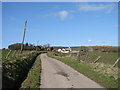
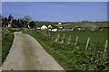
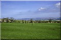
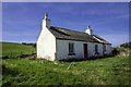
Nearby Images from Geograph Britain and Ireland:
©2008(licence)
©2014(licence)
©2014(licence)
©2014(licence)
©2014(licence)
The above images may not be of the site on this page, they are loaded from Geograph.
Please Submit an Image of this site or go out and take one for us!
Click here to see more info for this site
Nearby sites
Key: Red: member's photo, Blue: 3rd party photo, Yellow: other image, Green: no photo - please go there and take one, Grey: site destroyed
Download sites to:
KML (Google Earth)
GPX (GPS waypoints)
CSV (Garmin/Navman)
CSV (Excel)
To unlock full downloads you need to sign up as a Contributory Member. Otherwise downloads are limited to 50 sites.
Turn off the page maps and other distractions
Nearby sites listing. In the following links * = Image available
2.5km NW 316° Cairn Pat* Hillfort (NX04425632)
4.0km WSW 237° Knockinaam Standing Stone* Standing Stone (Menhir) (NX02695242)
4.6km NW 306° Craigenlee Fell E* Cairn (NX02495728)
4.8km WNW 302° Craigenlee Fell W* Cairn (NX02155717)
5.5km S 172° Whirlpool* Standing Stone (Menhir) (NX06624898)
5.9km NNE 29° Galla Hill* Misc. Earthwork (NX09205941)
5.9km S 171° Mid Float E* Standing Stone (Menhir) (NX06804851)
6.0km S 173° Mid Float W* Natural Stone / Erratic / Other Natural Feature (NX06584844)
6.0km ENE 61° Inch Cursus Cursus (NX11505710)
6.0km W 265° St Patrick's Well (Portpatrick) Holy Well or Sacred Spring (NX00105411)
6.1km ENE 61° Inch Cursus Cursus (NX11555716)
6.3km SSE 160° Kirkmadrine Church Stones* Early Christian Sculptured Stone (NX0801448389)
6.4km SSE 154° Cairnweil standing stone* Standing Stone (Menhir) (NX0863748556)
6.4km N 356° Stranraer Museum* Museum (NX0594960839)
6.5km W 280° St Kain's Well (Dunskey Glen) Holy Well or Sacred Spring (NW997558)
6.6km WNW 290° Balmannoch Stone Circle (NX0057)
6.6km N 353° St John's Well (Stranraer) Holy Well or Sacred Spring (NX05646106)
7.2km WNW 296° Knock and Maize* Standing Stone (Menhir) (NW9983057873)
7.4km S 170° Craigencroy* Cairn (NX07064711)
8.2km WNW 287° Killantringan Bay* Stone Fort or Dun (NW98365719)
8.5km NE 42° Cults Loch* Crannog (NX12066047)
8.6km NE 35° Black Loch Crannog* Crannog (NX11396118)
9.0km ENE 72° Droughduil Mote* Timber Circle (NX14825687)
9.2km WNW 302° Culdees Holy Well (Knockaldie) Holy Well or Sacred Spring (NW985597)
9.3km ENE 69° Dunragit Cursus* Cursus (NX14975745)
View more nearby sites and additional images


 We would like to know more about this location. Please feel free to add a brief description and any relevant information in your own language.
 Wir möchten mehr über diese Stätte erfahren. Bitte zögern Sie nicht, eine kurze Beschreibung und relevante Informationen in Deutsch hinzuzufügen.
 Nous aimerions en savoir encore un peu sur les lieux. S'il vous plaît n'hesitez pas à ajouter une courte description et tous les renseignements pertinents dans votre propre langue.
 Quisieramos informarnos un poco más de las lugares. No dude en añadir una breve descripción y otros datos relevantes en su propio idioma.