<< Text Pages >> St Kain's Well (Dunskey Glen) - Holy Well or Sacred Spring in Scotland in Dumfries and Galloway
Submitted by Anne T on Tuesday, 05 July 2022 Page Views: 430
Springs and Holy WellsSite Name: St Kain's Well (Dunskey Glen) Alternative Name: St Cainneach's Well; St Canigus's Well; St Kenneth's WellCountry: Scotland County: Dumfries and Galloway Type: Holy Well or Sacred Spring
Nearest Town: Portpatrick
Map Ref: NW997558
Latitude: 54.856787N Longitude: 5.122078W
Condition:
| 5 | Perfect |
| 4 | Almost Perfect |
| 3 | Reasonable but with some damage |
| 2 | Ruined but still recognisable as an ancient site |
| 1 | Pretty much destroyed, possibly visible as crop marks |
| 0 | No data. |
| -1 | Completely destroyed |
| 5 | Superb |
| 4 | Good |
| 3 | Ordinary |
| 2 | Not Good |
| 1 | Awful |
| 0 | No data. |
| 5 | Can be driven to, probably with disabled access |
| 4 | Short walk on a footpath |
| 3 | Requiring a bit more of a walk |
| 2 | A long walk |
| 1 | In the middle of nowhere, a nightmare to find |
| 0 | No data. |
| 5 | co-ordinates taken by GPS or official recorded co-ordinates |
| 4 | co-ordinates scaled from a detailed map |
| 3 | co-ordinates scaled from a bad map |
| 2 | co-ordinates of the nearest village |
| 1 | co-ordinates of the nearest town |
| 0 | no data |
Be the first person to rate this site - see the 'Contribute!' box in the right hand menu.
Internal Links:
External Links:
Holy Well or Sacred Spring in Dumfries and Galloway
A. Agnew, in his 1893 publication "The Hereditary Sheriffs of Galloway", 2nd edition, volume 1, page 413, identifies that "St Kain's Well is in Dunskey Glen (name: NW 997 558). The dedication is to St Cainneach or Canigus".
This is the only reference given in Canmore Site ID 60319, 'St Kain's Well, Dunskey Glen'.
I have scoured the National Library of Scotland Maps: 1894 25-inch OS map, and the 1849 6-inch OS map of Dunskey Glen. There are several wells identified, but none of them named. NLS links shared under the terms of their Creative Commons CC-BY licence.
According to Wikipedia, "Cainnech of Aghaboe (515/16–600), also known as Saint Canice in Ireland, Saint Kenneth in Scotland, Saint Kenny and in Latin Sanctus Canicus, was an Irish abbot, monastic founder, priest and missionary during the early medieval period."
Does anyone have any information about this well, and able to confirm whether or not it used to exist, and was a holy well? Do you have any historical documents and/or drawings? If it was a holy well, it would be nice to be able to identify what the waters of the well were used for - baptism, healing and/or restorative purposes. If you know anything, please leave a comment on this site page. Many thanks!
You may be viewing yesterday's version of this page. To see the most up to date information please register for a free account.
Do not use the above information on other web sites or publications without permission of the contributor.
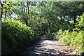
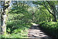
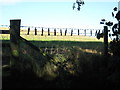
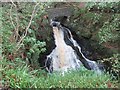
Nearby Images from Geograph Britain and Ireland:
©2017(licence)
©2017(licence)
©2010(licence)
©2017(licence)
©2010(licence)
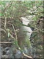
The above images may not be of the site on this page, they are loaded from Geograph.
Please Submit an Image of this site or go out and take one for us!
Click here to see more info for this site
Nearby sites
Key: Red: member's photo, Blue: 3rd party photo, Yellow: other image, Green: no photo - please go there and take one, Grey: site destroyed
Download sites to:
KML (Google Earth)
GPX (GPS waypoints)
CSV (Garmin/Navman)
CSV (Excel)
To unlock full downloads you need to sign up as a Contributory Member. Otherwise downloads are limited to 50 sites.
Turn off the page maps and other distractions
Nearby sites listing. In the following links * = Image available
1.2km NNE 11° Balmannoch Stone Circle (NX0057)
1.7km SSE 164° St Patrick's Well (Portpatrick) Holy Well or Sacred Spring (NX00105411)
1.9km NW 314° Killantringan Bay* Stone Fort or Dun (NW98365719)
2.1km N 1° Knock and Maize* Standing Stone (Menhir) (NW9983057873)
2.8km ENE 58° Craigenlee Fell W* Cairn (NX02155717)
3.1km ENE 59° Craigenlee Fell E* Cairn (NX02495728)
4.1km NNW 340° Culdees Holy Well (Knockaldie) Holy Well or Sacred Spring (NW985597)
4.5km SE 136° Knockinaam Standing Stone* Standing Stone (Menhir) (NX02695242)
4.7km E 81° Cairn Pat* Hillfort (NX04425632)
6.5km E 100° St Catherine's Well (Eldrickhill) Holy Well or Sacred Spring (NX06125442)
7.9km NE 46° St John's Well (Stranraer) Holy Well or Sacred Spring (NX05646106)
8.0km NE 49° Stranraer Museum* Museum (NX0594960839)
8.9km N 5° Tor of Craigoch* Hillfort (NX00856464)
9.7km SE 132° Whirlpool* Standing Stone (Menhir) (NX06624898)
10.1km SE 134° Mid Float W* Natural Stone / Erratic / Other Natural Feature (NX06584844)
10.1km ENE 67° Galla Hill* Misc. Earthwork (NX09205941)
10.2km SE 133° Mid Float E* Standing Stone (Menhir) (NX06804851)
10.6km NNE 17° St Mary's Well (Kilmorie Chapel) Holy Well or Sacred Spring (NX03286578)
11.1km SE 129° Kirkmadrine Church Stones* Early Christian Sculptured Stone (NX0801448389)
11.4km SE 137° Craigencroy* Cairn (NX07064711)
11.5km SE 127° Cairnweil standing stone* Standing Stone (Menhir) (NX0863748556)
11.8km E 81° Inch Cursus Cursus (NX11505710)
11.9km E 81° Inch Cursus Cursus (NX11555716)
12.8km ENE 63° Black Loch Crannog* Crannog (NX11396118)
13.1km SE 145° Doon Castle (Broch)* Broch or Nuraghe (NX0670244683)
View more nearby sites and additional images


 We would like to know more about this location. Please feel free to add a brief description and any relevant information in your own language.
 Wir möchten mehr über diese Stätte erfahren. Bitte zögern Sie nicht, eine kurze Beschreibung und relevante Informationen in Deutsch hinzuzufügen.
 Nous aimerions en savoir encore un peu sur les lieux. S'il vous plaît n'hesitez pas à ajouter une courte description et tous les renseignements pertinents dans votre propre langue.
 Quisieramos informarnos un poco más de las lugares. No dude en añadir una breve descripción y otros datos relevantes en su propio idioma.