<< Our Photo Pages >> Wester Livilands - Broch or Nuraghe in Scotland in Stirling
Submitted by peigimccann on Thursday, 22 September 2016 Page Views: 5020
DigsSite Name: Wester LivilandsCountry: Scotland
NOTE: This site is 1.296 km away from the location you searched for.
County: Stirling Type: Broch or Nuraghe
Nearest Town: Stirling
Map Ref: NS7979692369
Latitude: 56.108906N Longitude: 3.934444W
Condition:
| 5 | Perfect |
| 4 | Almost Perfect |
| 3 | Reasonable but with some damage |
| 2 | Ruined but still recognisable as an ancient site |
| 1 | Pretty much destroyed, possibly visible as crop marks |
| 0 | No data. |
| -1 | Completely destroyed |
| 5 | Superb |
| 4 | Good |
| 3 | Ordinary |
| 2 | Not Good |
| 1 | Awful |
| 0 | No data. |
| 5 | Can be driven to, probably with disabled access |
| 4 | Short walk on a footpath |
| 3 | Requiring a bit more of a walk |
| 2 | A long walk |
| 1 | In the middle of nowhere, a nightmare to find |
| 0 | No data. |
| 5 | co-ordinates taken by GPS or official recorded co-ordinates |
| 4 | co-ordinates scaled from a detailed map |
| 3 | co-ordinates scaled from a bad map |
| 2 | co-ordinates of the nearest village |
| 1 | co-ordinates of the nearest town |
| 0 | no data |
Internal Links:
External Links:
")
Some tantalising possible fragments have been found (see the photos for more details). If confirmed, this broch will join the few known brochs such as Coldoch, Leckie and Tappoch south of the Highland Line.
First discovered and described in 1872 by archaeologist Christian Maclagan, Scotland’s first female archaeologist, the broch has been ignored and left unexcavated for nearly 150 years. Because women were not allowed to become members of the Society of Antiquaries of Scotland, Maclagan had to remain content to be a Lady Associate: of the society - her paper only accepted because it was transcribed by a man.
Thought to be one of the later brochs in Central Scotland along with Leckie, Tabboch and Coldoch, Maclagan described the broch’s location as Livilands. There are two Livilands in Stirling, Easter and Wester, however the discovery of an unfinished rotary quern has led archaeologists to believe the broch’s location is at Wester Livilands where “ a review of the historic mapping indicates that Wester Livilands had a designed landscape comprising two circular banks that resemble ramparts. A site inspection identified the presence of substantial horizontal masonry…
From Maclagan’s 1872 paper: “there has stood another of the round houses, which seems to have had three circular walls with probably 20 feet of space between each of them. The stones of these walls are all gone, but the mark where their foundations had been is sufficiently distinct. The area of the central chamber had apparently been about 50 feet in diameter. It is situated on a part of that terrace or ancient sea-beach which is found around almost the whole valley of the Forth, and on which elevation many of those round houses are built. Its height is about 40 feet.’
Scotland’s Lost Broch website: Christian Maclagan and Stirling’s Lost Broch
Scotland’s Lost Broch facebook page: Stirling’s Lost Broch
DigVentures crowdfunding site: Lost Broch 2016
Canmore site for the rotary quern: Canmore ID 2221116
BBC article: Search for Stirling's lost Iron Age roundhouse
You may be viewing yesterday's version of this page. To see the most up to date information please register for a free account.
")
")
")
")
Do not use the above information on other web sites or publications without permission of the contributor.
Nearby Images from Geograph Britain and Ireland:
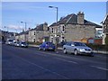
©2006(licence)
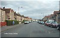
©2009(licence)
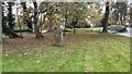
©2019(licence)
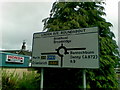
©2011(licence)
©2012(licence)
The above images may not be of the site on this page, they are loaded from Geograph.
Please Submit an Image of this site or go out and take one for us!
Click here to see more info for this site
Nearby sites
Key: Red: member's photo, Blue: 3rd party photo, Yellow: other image, Green: no photo - please go there and take one, Grey: site destroyed
Download sites to:
KML (Google Earth)
GPX (GPS waypoints)
CSV (Garmin/Navman)
CSV (Excel)
To unlock full downloads you need to sign up as a Contributory Member. Otherwise downloads are limited to 50 sites.
Turn off the page maps and other distractions
Nearby sites listing. In the following links * = Image available
362m W 280° Randolphfield Stones* Standing Stones (NS79449244)
651m N 349° St Ninian's Well (Stirling)* Holy Well or Sacred Spring (NS7969093012)
1.4km W 279° Coneypark Nursery (Cambusbarron)* Cairn (NS78409263)
1.5km WNW 292° King's Park Cup and Rings* Rock Art (NS7837892998)
1.7km WNW 287° Douglas Terrace (Cambusbarron) Cairn (NS782929)
1.7km NNW 329° Butt Well* Holy Well or Sacred Spring (NS78949389)
1.8km W 276° Birkill House Cairn (NS780926)
2.0km W 272° Chapel Well (Cambusbarron)* Holy Well or Sacred Spring (NS77819251)
2.0km WNW 288° St Thomas's Well (Cambusbarron)* Holy Well or Sacred Spring (NS7788493056)
2.2km NNW 346° Our Lady's Well (Stirling) Holy Well or Sacred Spring (NS79329454)
2.2km WSW 238° Boiling Springs (Cambusbarron) Holy Well or Sacred Spring (NS77879124)
2.8km SW 236° Wallstale Dun* Stone Fort or Dun (NS77449085)
2.8km SE 139° St Ninians Cursus Cursus (NS81599016)
2.9km SE 139° St Ninians Cursus Cursus (NS81679012)
3.0km WSW 257° Gillies Hill* Hillfort (NS76879176)
3.5km NNE 18° Abbey Craig Vitrified Fort* Hillfort (NS80949565)
3.5km WSW 238° Wester Craigend Dun* Stone Fort or Dun (NS7677790621)
3.5km N 10° Bel Stane (Causewayhead) Standing Stone (Menhir) (NS805958)
3.5km WSW 243° Castlehill Dun* Stone Fort or Dun (NS76619084)
4.4km NNE 20° Airthrey Stone* Standing Stone (Menhir) (NS81409650)
4.5km NNE 19° The Victoria Stone* Marker Stone (NS8141296608)
4.6km N 9° Pathfoot Stone* Standing Stone (Menhir) (NS8060496871)
4.8km N 1° Lentran (Bridge of Allan) Cist (NS80039720)
4.9km NNE 19° Logie Old Kirk (Stirling)* Early Christian Sculptured Stone (NS81549696)
4.9km WSW 251° Castlehill Wood Dun* Stone Fort or Dun (NS75089090)
View more nearby sites and additional images


 We would like to know more about this location. Please feel free to add a brief description and any relevant information in your own language.
 Wir möchten mehr über diese Stätte erfahren. Bitte zögern Sie nicht, eine kurze Beschreibung und relevante Informationen in Deutsch hinzuzufügen.
 Nous aimerions en savoir encore un peu sur les lieux. S'il vous plaît n'hesitez pas à ajouter une courte description et tous les renseignements pertinents dans votre propre langue.
 Quisieramos informarnos un poco más de las lugares. No dude en añadir una breve descripción y otros datos relevantes en su propio idioma.