<< Text Pages >> Cranmore Castle - Hillfort in England in Devon
Submitted by AngieLake on Sunday, 10 January 2016 Page Views: 5275
Iron Age and Later PrehistorySite Name: Cranmore CastleCountry: England County: Devon Type: Hillfort
Nearest Town: Tiverton
Map Ref: SS959119
Latitude: 50.897165N Longitude: 3.48164W
Condition:
| 5 | Perfect |
| 4 | Almost Perfect |
| 3 | Reasonable but with some damage |
| 2 | Ruined but still recognisable as an ancient site |
| 1 | Pretty much destroyed, possibly visible as crop marks |
| 0 | No data. |
| -1 | Completely destroyed |
| 5 | Superb |
| 4 | Good |
| 3 | Ordinary |
| 2 | Not Good |
| 1 | Awful |
| 0 | No data. |
| 5 | Can be driven to, probably with disabled access |
| 4 | Short walk on a footpath |
| 3 | Requiring a bit more of a walk |
| 2 | A long walk |
| 1 | In the middle of nowhere, a nightmare to find |
| 0 | No data. |
| 5 | co-ordinates taken by GPS or official recorded co-ordinates |
| 4 | co-ordinates scaled from a detailed map |
| 3 | co-ordinates scaled from a bad map |
| 2 | co-ordinates of the nearest village |
| 1 | co-ordinates of the nearest town |
| 0 | no data |
Internal Links:
External Links:
Hillfort in Devon
Cranmore Castle is an Iron Age earthwork[1] situated on a hillside above the Devon town of Tiverton in south-west England. Its National Grid reference is SS958118. It is an English Heritage scheduled monument, and has been given a National Monument number of 34256.
[Angie: NB: When checking : http://www.ancientmonuments.info/en34256-cranmore-castle grid refs given were for 'SN' sites in Wales.]
The earthwork is widely described in guidebooks and histories as an Iron Age hill fort[1] though more recent archaeological evaluations and histories, such as Mike Sampson's recently published work,[2] point out that it seems inefficient as a fortification, since it is overlooked from the south by the higher slope of Exeter Hill/Newtes Hill.
The earthwork is also unusual in that the area it encloses slopes from 120 metres (390 ft) to 170 metres (560 ft) above sea level. This arrangement does however offer clear lines of sight to Cadbury Castle, Castle Close below Stoodleigh up the Exe Valley, Huntsham castle, Hembury fort and other significant hills and earthworks, suggesting that all were contemporary. It also manages to overlook the confluence of the rivers Lowman and Exe and the forded crossings on those rivers, which a higher position would not allow.
The hillside that Cranmore Castle stands above is called Skrink Hills or Shrink Hills in various early histories of the area.[3][4] and it is from there that Thomas Fairfax's artillery laid siege to Tiverton Castle. The promontory of land that links Cranmore to the edge of Newtes Hill is traversed by the old Exeter Road, which travels past the earthwork on its way from Tiverton to Exeter. The hill and road have latterly been known as Exeter Hill, and this road almost certainly follows the path of a prehistoric trackway.
Current theories about the nature of the earthwork suggest that it might have been a winter enclosure for livestock or a market site, though the earthworks are very substantial for such applications and could even point to a tribal oppidum. Certainly the area would be large enough.
The Ordnance Survey Map of Southern Britain in the Iron Age [5] shows Cranmore as the largest enclosure in Devon (along with Hillsborough) at over 15 acres (61,000 m2).
During the Prayer Book Rebellion of 1549 Cranmore Castle became the site of a fierce battle fought between the two sides over whether a child should be baptised according to the 'new' religion or the 'old'. The battle took place near a small chapel that stood at one corner of the site, near the road. The chapel was demolished in the 17th century, and in 1687 bones and musket shot thought to be from the battle were discovered.[6]
The etymology of the name Cranmore Castle is unclear. Cranmore is not a local name and does not fit with any local placenames. No record of Cranmore seems to exist in any early records. It is possible that the name is derived from the battle described above. The archbishop at the time of the Prayer Book Rebellion was Thomas Cranmer so it is possible it derives from a variation of 'Cranmer Castle' in reference to the battle fought there.
[Source = Wikipedia]
History of Tiverton [From: http://exploretiverton.co.uk/tiverton-history.php]
Set in the curvaceous hills between Dartmoor and Exmoor, the ancient market town of Tiverton sits in a delightful setting on the banks of the River Exe. Few people realise, however, just how ancient the settlement. Human occupation actually dates back to the Stone Age.
It is believed that the name is actually derived from ‘Twyfordton’ or ‘Twyverton’ as the town stands not only the Exe but also the River Lowman. Historically it was referred to as Twyford and at some point that morphed into the name it carries today.
Clearly it was an ideal site for occupation. Many flint tools from the Stone Age were found in the area and an Iron Age hill fort – Cranmore Castle – stands on top of Exeter Hill which looks down on today’s town and the point where the rivers Exe and Lowman merge at Collipriest.
Another website gave SS959119 as OS ref. It's a large enough area to be either perhaps?
You may be viewing yesterday's version of this page. To see the most up to date information please register for a free account.
Do not use the above information on other web sites or publications without permission of the contributor.
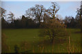
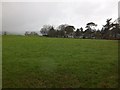
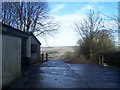
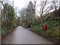
Nearby Images from Geograph Britain and Ireland:
©2016(licence)
©2012(licence)
©2009(licence)
©2012(licence)
©2009(licence)
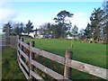
The above images may not be of the site on this page, they are loaded from Geograph.
Please Submit an Image of this site or go out and take one for us!
Click here to see more info for this site
Nearby sites
Key: Red: member's photo, Blue: 3rd party photo, Yellow: other image, Green: no photo - please go there and take one, Grey: site destroyed
Download sites to:
KML (Google Earth)
GPX (GPS waypoints)
CSV (Garmin/Navman)
CSV (Excel)
To unlock full downloads you need to sign up as a Contributory Member. Otherwise downloads are limited to 50 sites.
Turn off the page maps and other distractions
Nearby sites listing. In the following links * = Image available
3.4km NE 51° Craze Lowman Mound* Round Barrow(s) (SS98611399)
6.7km NNW 340° Castle Close* Misc. Earthwork (SS937182)
6.7km NNE 27° Huntsham Castle* Misc. Earthwork (SS99111784)
8.0km SSW 214° Cadbury Castle (Devon)* Hillfort (SS913053)
11.1km WNW 286° Witheridge Moor Barrows* Barrow Cemetery (SS853152)
11.4km SSE 162° Holy Well (Broadclyst)* Holy Well or Sacred Spring (SS9914700962)
11.5km SW 219° Raddon Hill* Causewayed Enclosure (SS885031)
11.9km S 172° Dolbury Hillfort* Hillfort (SS974001)
12.1km S 188° Nether Exe Cursus* Cursus (SX94079995)
12.6km WNW 299° Holy Trinity Well (Rackenford)* Holy Well or Sacred Spring (SS85001825)
12.7km SSW 201° No Mans Chapel tumulus* Barrow Cemetery (SS912001)
13.3km SSW 197° Long Plantation Bowl Barrows* Barrow Cemetery (SX9182199200)
13.4km WNW 292° Berry Castle (Devon)* Hillfort (SS835171)
13.5km SSW 198° Three Barrows (Devon)* Barrow Cemetery (SX915991)
14.3km SW 221° Shobrooke Holy Well* Holy Well or Sacred Spring (SS8632301236)
14.4km SW 220° Shobrooke Church Preaching Cross Ancient Cross (SS863011)
15.9km NE 37° Castles Camp Hillfort (ST057244)
15.9km W 259° Berry Castle (Black Dog)* Hillfort (SS802093)
15.9km NW 308° Knowstone Inner Moor Round Barrow(s) (SS8346021869)
16.0km S 181° Mincimore Copse Tumulus* Round Barrow(s) (SX953959)
16.6km NW 305° Beaples Hill* Standing Stone (Menhir) (SS8248621693)
17.0km SW 226° Libbett's Well* Holy Well or Sacred Spring (SS835003)
17.0km SW 226° St Boniface's Well (Crediton)* Holy Well or Sacred Spring (SS834003)
17.0km NNW 342° Oldberry Castle Hillfort (SS90932820)
17.7km ESE 119° Hembury Fort* Hillfort (ST113031)
View more nearby sites and additional images


 We would like to know more about this location. Please feel free to add a brief description and any relevant information in your own language.
 Wir möchten mehr über diese Stätte erfahren. Bitte zögern Sie nicht, eine kurze Beschreibung und relevante Informationen in Deutsch hinzuzufügen.
 Nous aimerions en savoir encore un peu sur les lieux. S'il vous plaît n'hesitez pas à ajouter une courte description et tous les renseignements pertinents dans votre propre langue.
 Quisieramos informarnos un poco más de las lugares. No dude en añadir una breve descripción y otros datos relevantes en su propio idioma.