


<< Our Photo Pages >> The Fairy Knowe - Misc. Earthwork in Scotland in Moray
Submitted by wiccaman9 on Tuesday, 27 November 2007 Page Views: 12685
Multi-periodSite Name: The Fairy Knowe Alternative Name: Fairy Hill, Faery KnollCountry: Scotland
NOTE: This site is 0.499 km away from the location you searched for.
County: Moray Type: Misc. Earthwork
Nearest Town: Elgin Nearest Village: Aberlour
Map Ref: NJ267422
Latitude: 57.464130N Longitude: 3.223533W
Condition:
| 5 | Perfect |
| 4 | Almost Perfect |
| 3 | Reasonable but with some damage |
| 2 | Ruined but still recognisable as an ancient site |
| 1 | Pretty much destroyed, possibly visible as crop marks |
| 0 | No data. |
| -1 | Completely destroyed |
| 5 | Superb |
| 4 | Good |
| 3 | Ordinary |
| 2 | Not Good |
| 1 | Awful |
| 0 | No data. |
| 5 | Can be driven to, probably with disabled access |
| 4 | Short walk on a footpath |
| 3 | Requiring a bit more of a walk |
| 2 | A long walk |
| 1 | In the middle of nowhere, a nightmare to find |
| 0 | No data. |
| 5 | co-ordinates taken by GPS or official recorded co-ordinates |
| 4 | co-ordinates scaled from a detailed map |
| 3 | co-ordinates scaled from a bad map |
| 2 | co-ordinates of the nearest village |
| 1 | co-ordinates of the nearest town |
| 0 | no data |
Internal Links:
External Links:
")
Clearly a man-made earthwork. Seen on OS maps clearly enough. Lying next to a small dirt-road, behind the distillery of Charlestown of ABERLOUR (Aberlour), - consisting of a rather conical mound, jutting skywards from the sloping hills overlooking Aberlour. Rather overgrown with small trees and with several stones at its' summit - likely a burial cairn, the stones now being largely overgrown with grasses and vegetation.
Close by is the Hatton burial Cairn
Aron Bowers
"Originally known as Fairy Knowe, this small hill behind the Aberlour Distillery has a number of standing stones on it - evidence of an ancient Pictish settlement. In pre-Christian times, it was thought to be the haunt of spirits from the Faery kingdom"
"Fairy Knowe"
"The old name for the small hill behind the Aberlour Distillery ("Fairy Hill"), on which there are a number of standing stones - evidence of an ancient Pictish settlement. Fairy Knowe, as its name suggests, was also thought to be the haunt of spirits from the Faery Kingdom in pre-Christian times. The Celtic fairies were a far cry from the friendly Victorian image of the "little spirits", with their wands and tutus. They could be fierce and vindictive and frequently fought amongst themselves. Mortals were not safe from them either: they kidnapped unbaptised children and snatched young mothers to wet nurse their own offspring. Many a man was lured to his death by the hypnotic sound of their music. Fairies lived underground, favouring small green hills like Fairy Knowe - and who is to say they are not still there...!"
You may be viewing yesterday's version of this page. To see the most up to date information please register for a free account.
Do not use the above information on other web sites or publications without permission of the contributor.
coldrum has found this location on Google Street View:
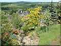
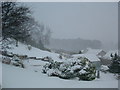
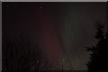
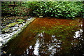
Nearby Images from Geograph Britain and Ireland:
©2006(licence)
©2006(licence)
©2014(licence)
©2006(licence)
©2014(licence)
The above images may not be of the site on this page, they are loaded from Geograph.
Please Submit an Image of this site or go out and take one for us!
Click here to see more info for this site
Nearby sites
Key: Red: member's photo, Blue: 3rd party photo, Yellow: other image, Green: no photo - please go there and take one, Grey: site destroyed
Download sites to:
KML (Google Earth)
GPX (GPS waypoints)
CSV (Garmin/Navman)
CSV (Excel)
To unlock full downloads you need to sign up as a Contributory Member. Otherwise downloads are limited to 50 sites.
Turn off the page maps and other distractions
Nearby sites listing. In the following links * = Image available
499m SE 142° Hatton Circle (Moray)* Stone Circle (NJ270418)
5.4km NNE 25° Arndilly* Class I Pictish Symbol Stone (NJ29064707)
6.3km SE 130° Nether Cluny* Stone Circle (NJ315381)
6.3km ESE 117° Mortlach 2* Class I Pictish Symbol Stone (NJ323392)
6.4km ESE 116° Mortlach 1* Class II Pictish Symbol Stone (NJ32413924)
7.5km W 276° Drum Divan* Stone Circle (NJ192431)
8.1km W 273° Knockando 2* Class I Pictish Symbol Stone (NJ186428)
8.1km W 273° Knockando 1* Class I Pictish Symbol Stone (NJ186428)
9.5km WSW 253° Mains of Kirdells* Round Cairn (NJ175396)
9.6km WSW 240° Inveravon (1)* Class I Pictish Symbol Stone (NJ1828737599)
9.6km WSW 240° Inveravon (2)* Class I Pictish Symbol Stone (NJ1828737599)
9.6km WSW 240° Inveravon (3)* Class I Pictish Symbol Stone (NJ1828737599)
9.6km WSW 240° Inveravon (4)* Class I Pictish Symbol Stone (NJ1828737599)
9.6km WSW 240° Inveravon* Class I Pictish Symbol Stone (NJ1828737599)
9.7km WSW 245° Pitchroy* Stone Circle (NJ17823826)
10.2km SW 234° Marionburgh* Stone Circle (NJ183364)
10.3km W 268° Leakin* Round Cairn (NJ164420)
10.7km SW 233° Lower Lagmore* Stone Circle (NJ180359)
11.1km ENE 78° St Fumac's Well* Holy Well or Sacred Spring (NJ376443)
11.1km SW 234° Upper Lagmore* Stone Circle (NJ176358)
12.6km SSW 207° Tom Na Heron Class I Pictish Symbol Stone (NJ208310)
12.8km NNW 348° Netherglen* Standing Stone (Menhir) (NJ24315476)
14.0km SW 215° Doune Of Dalmore* Stone Circle (NJ185308)
14.1km NNE 22° St Mary's Well (Inchberry)* Holy Well or Sacred Spring (NJ323552)
14.3km SSW 208° Glenlivet Standing Stone* Standing Stone (Menhir) (NJ19732963)
View more nearby sites and additional images


 We would like to know more about this location. Please feel free to add a brief description and any relevant information in your own language.
 Wir möchten mehr über diese Stätte erfahren. Bitte zögern Sie nicht, eine kurze Beschreibung und relevante Informationen in Deutsch hinzuzufügen.
 Nous aimerions en savoir encore un peu sur les lieux. S'il vous plaît n'hesitez pas à ajouter une courte description et tous les renseignements pertinents dans votre propre langue.
 Quisieramos informarnos un poco más de las lugares. No dude en añadir una breve descripción y otros datos relevantes en su propio idioma.